Observation: Geyser Pass

Observation Date
4/11/2016
Observer Name
Zimmerman-Wall
Region
Moab » Geyser Pass
Location Name or Route
Geyser Pass/Gates to the North
Weather
Sky
Scattered
Precipitation
Light Snowfall
Wind Direction
West
Wind Speed
Light
Weather Comments
This report encapsulates three days spent in the La Sals from 4/9-4/11. The surge of pacific moisture resulted in cloudy skies and light precip. Mostly graupel but some stellars. Winds trended from light to moderate out of the southwest, back to light out of the west, back to southwest. Cloud cover was totally socked in on the 9th, but by the morning of the 11th, we were on top of Haystack without a trace of wind or clouds. That quickly changed by the afternoon when the clouds rolled back in and snowfall began. Temps hovered around freezing, with one clear cold night on the 10th. Some greenhousing was noticed on the 9th and again on the 11th.
Snow Characteristics
New Snow Depth
2"
New Snow Density
High
Snow Surface Conditions
Dense Loose
Wind Crust
Melt-Freeze Crust
Damp
Snow Characteristics Comments
Variety of snow conditions. Most were skiable. Despite the totally obscured skies at the beginning of the weekend, the Solars skied quite well due to a lack of total refreeze the first night. Then once the sun came out Sunday, the 1-2" of new graupel that had insulated the old snow surface was creamy and edgable (Creamed Corn?) Norths were a mixed bag, but on the exposed slopes of Mellenthin there was some scoured wind crust that made turning sporty. Snow in the trees was primarily an isothermic cesspool that made skinong difficult at times. Although the one solid refreeze on the night of the 10th did help with that somewhat.
Red Flags
Red Flags Comments
No apparent red flags. Just spring MF cycle and a touch of new high density snow on top. Windloading was virtually non-existent. One test profile on a southwest facing slope at treeline revealed some stout crust/facet sandwiches with CTM PC-Q2 down 20cms. We found no other interesting layers and this particular crust was over 1cm thick. There was also an apparent dust layer on the old snow surface from the prefrontal winds ahead of the last major storm.
Avalanche Problem #1
Problem
Normal Caution
Trend
Same
Problem #1 Comments
We saw no significant activity and planned our travels according to cloud cover and slope exposure Travelled as far south as Mellenthin and as far north as Manns. Haystack and Tomasaki were our east/west boundary. Of note was one old crown below the east facing cliffband of Burro Ridge. It looked like this could have been from wind loading during the last major storm (3/30?) and we could hardly see the debris pile as it had been covered/smoothed out. The crown appeared to be about 12-18" deep and several hundred feet wide. Other than that, we couldn't even get a pushalanche going on steep solars and the norths were welded in place. We did find a large swath of aspens that had been destroyed by the slide on SE Haystack during the end of December.
Comments
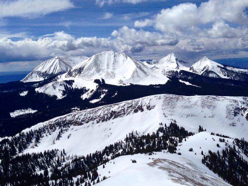
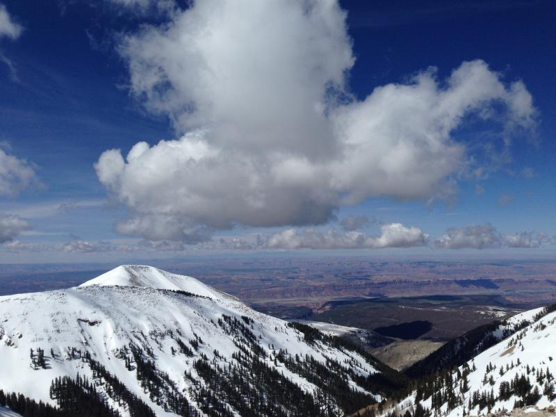
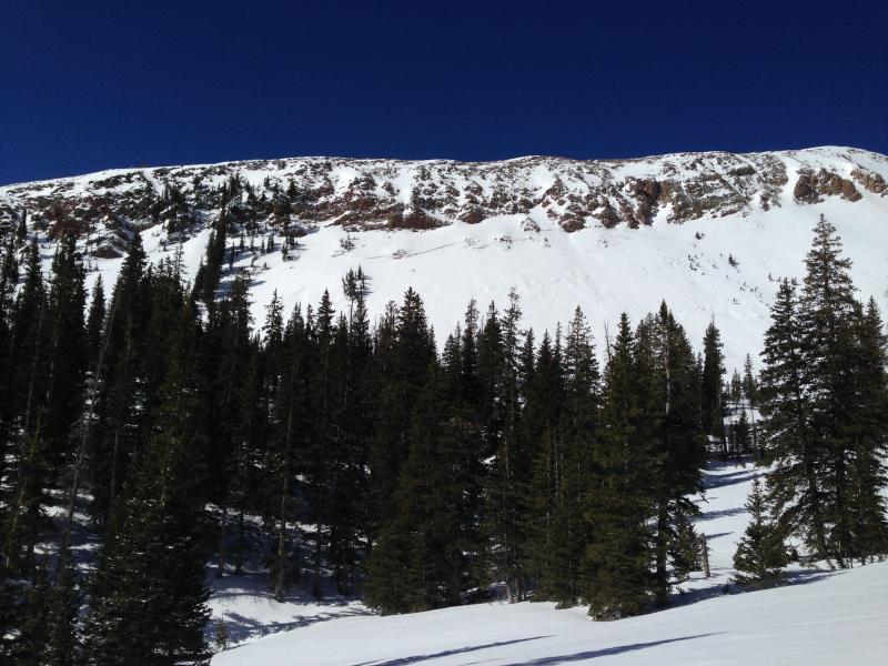
Below are photos of coverage of the Central and North Group, as well as the slide on Burro Ridge.
Today's Observed Danger Rating
Low
Tomorrows Estimated Danger Rating
Low
Coordinates