Both layers of graupel noted as "weak layers" within the upper meter of the snowpack; though I have found little correlation between their evidence/reactivity in the snowpit with actual avalanching in the backcountry. Not none, but little, and this is to mean a week or so after the event and subsequent loading. This is personal observation, agreed upon by a few others, but perhaps "more research is needed". Having said this, at least one avalanche fatality in Utah (1993) has been associated with graupel-pooling
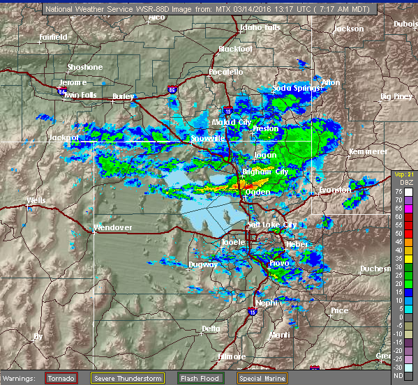
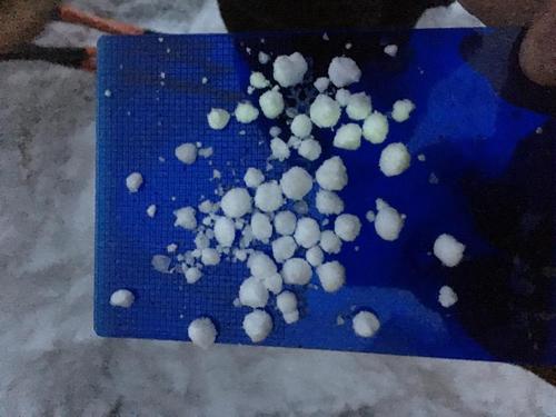
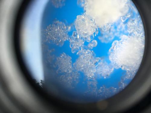
Graupel of course common with highly convective, turbulent events with snowflakes picking up super-cooled water droplets within the cloud while the original snow crystal is maytagged through the event. Photos below of the radar image from last Monday, the evidence on the ground (courtesy of Powder Mtn snow safety Brian Pollick), and graupel under the microscope.
Imagine that the new snow may bond well in some areas as it comes in warm...and perhaps bond poorly on many of the slick underlying crusts. See below as the sunscreen bottle experiences "slide for life" conditions.


