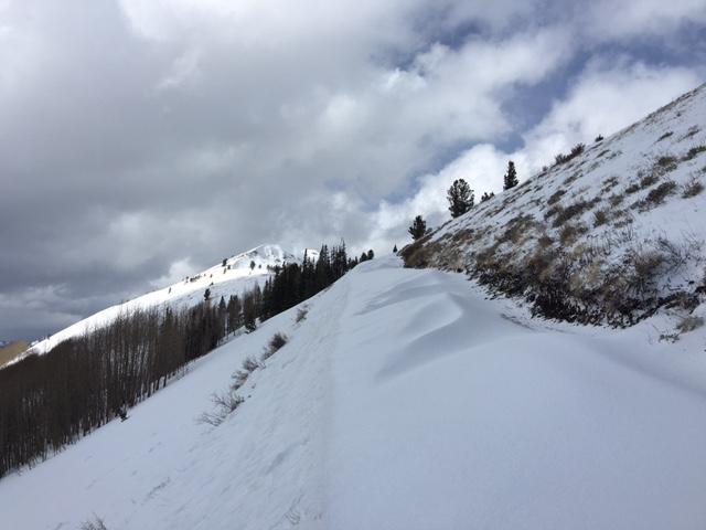
Wind drifts likely for tomorrow, especially if wind keeps up with hi snow intensity into the night. On south facing road today areas of uniform drift 2 feet deep neighbored totally scoured slopes. Cornices were building on ridges and looked as though some had already "calved" based on bits of debris on uphill sides of trunks. Releasing one chunk with a cornice rope failed to initiate slide on empty slope below; snow beneath not particularly loose.
So here’s a classic head-scratcher. Yesterday two friends and I skied two runs in South Monitor, one in No-Name and exited via USA bowl on shockingly good corn without thinking much about hazard. On Friday I had dug into north facing Reynolds (albeit under canopy) and found damp and unreactive basal facets. More importantly, Was Angelos has been skied wantonly for two weeks without incident. In no-name yesterday we outstayed our solar welcome and watched a leisurely wet loose slide pursue the first skier and we didn’t even yell a warning: the snow was moving too slowly. Certainly none of us felt concerned that the 450’ slide could step into a lower facet layer, and we were right. Right?
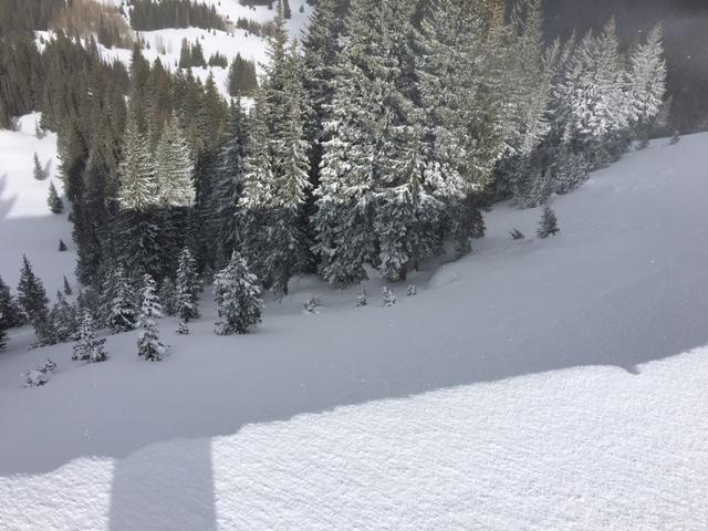
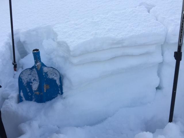
I returned with Drew to No Name around frontal passage today to see—with the security of a rope—if an old repeater could potentially awaken under the 2 inches of predicted storm water. No Name Bowl slid 6” down on the old/new interface nearly 3 weeks ago, and on facets near the ground many times previously, so we thought weak snow would be here if anywhere. True to form, under several inches of graupel, a light melt crust with facets below, and a slab of mixed forms, we found facets from the ground to roughly 30 cm. At their weakest the facets were dry and shakable, 3mm in size, and had some striping visible to the naked eye. They propagated a failure down 80 cm in a 95 cm snowpack on ECTP27, Q3.
So what? I don’t know. Birkeland and Simenois looked at over 600 total pits and concluded in 2009 that “In comparison to the PST, our data suggest that the ECT has a lower false-stability rate, but a higher false instability rate" and maybe that's all that this pit revealed. Or maybe a big storm (not sure if this willl get there) or a sudden load could still tickle a repeat out of No Name Bowl.


Forecaster Comments: Mostly because this forecaster was part of the tour - most suspect snow seemed to be in repeater terrain where the snow surface is graupel over a thin mf crust with surface facets below.
Moderate plus might be a better hazard rating?


