Observation: Eyrie Peak

Observation Date
2/21/2016
Observer Name
Evelyn
Region
Ogden » North Ogden Canyon » North Ogden Divide » Eyrie Peak
Location Name or Route
Ogden Divide south to Eyrie Peak
Weather
Sky
Scattered
Wind Direction
West
Wind Speed
Light
Weather Comments
Steady west nothwesterly winds along the ridge, just enough to make it feel cold and shorten the summit stay. Early high level clouds cleared by around 1 pm.
Snow Characteristics
Snow Surface Conditions
Dense Loose
Melt-Freeze Crust
Rain-Rime Crust
Damp
Snow Characteristics Comments

Nice to have ski crampons in the morning going up a steep westerly facing slope. Decent turning in places off the ridge line on the way down - shallow dense powder over smooth supportable crusts on northerly facing slopes; smooth sunny slopes softened nicely, skiing like shallow corn on supportable crusts.

All that glitters is ice - crazy cool clear ice along the ridge line. Wondering if I was going to want a mouth guard for the ski down, but it wasn't that bad. Rain/snow line was reported around 8,000' at this week (putting this whole tour below the rain line), followed with a few inches of nice dense powder as the storm cooled (though blown off the exposed ridges).

Avalanche Problem #1
Problem
Normal Caution
Problem #1 Comments

Mostly stable snow. Stayed cool today, observed no issues with heating. Still suspect at higher elevation there could be a few old wind drifts that could be triggered.

Snow Profile
Aspect
North
Elevation
7,600'
Slope Angle
33°
Comments

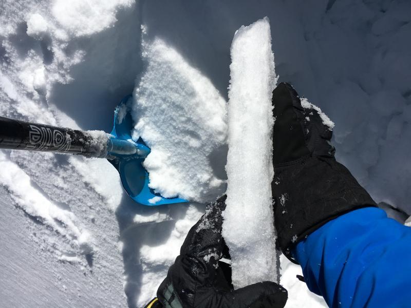
Photo of pit. (Pit profiler not working for me, I'll add the pit later.) 7,600', north facing. Total depth 160 cm, but pack depth was variable across slope. Did not dig to the ground.

3 layers of interest, upper two with red arrows in photo.

  • Upper most rain crust varied in thickness, as thick as 4-5 cm, with about 4 cm of snow above it.
  • Lower crust in photo was a double crust in places, about 35 cm down.
  • A third, clean shear was found around 60 cm down, on a thin layer of facets.

Both crusts had clean shears below them, but no results with either ECT or CT tests, nor on the layer 60 cm down. Worth keeping track of these layers over time, but nothing in the current weather forecast makes me think they will get over loaded anytime soon. I'm guessing the upper crust would be more interesting where it is thinner, due to aspect or elevation.

Lower photo is of upper rain crust.

Cool wave clouds seen on the drive home.

Today's Observed Danger Rating
Low
Tomorrows Estimated Danger Rating
Low