Route today was Thaynes Canyon (Millcreek), West Porter Fork, and exiting Main Porter Fork. (ala the Porter Fork Supertour.) I have been in Main Porter a handful of times this season, but this was the first trip to Thaynes and West Porter. Overall a very stable snowpack where we were looking. Used an inverted ski pole to check depths and was finding about 150 cms (5') with several locations approaching 2 meters. Snowpack throughout went from F-hard at the surface, to 4F and then 1F. Difficult to identify the persistent weaknesses in the top meter of snow.
Although we were exiting Main Porter at about 1300, temps were cool and snow surface remained dry and cold outside of the sun. Did not see any issues with lower elevations warming up.
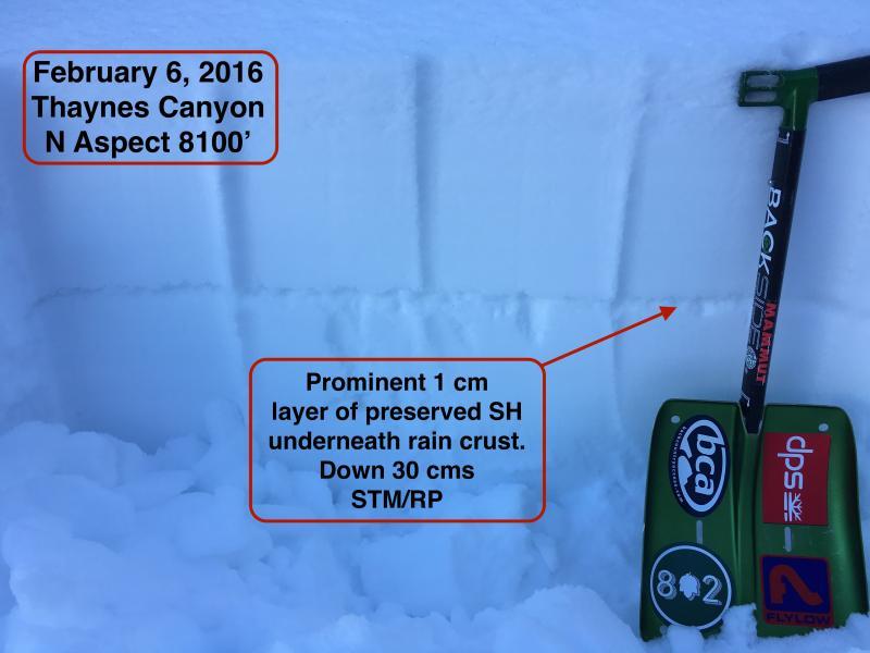
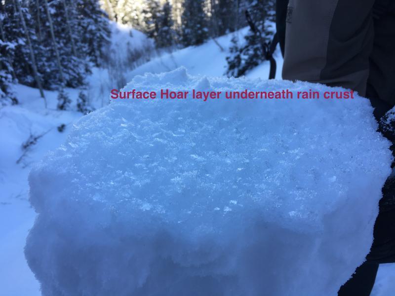
Have been interested to focus on the weak snow just below the rain crust from late last week. This is now buried 30 cms (12") below the snow surface. Although I was finding it only up to about 8100' in LCC, today was finding it to 8400'. On one slope at 8100' in Thaynes Canyon found a 1 cm layer of well-preserved SH just below the rain crust. This was producing clean shears with Moderate pressure (STM/RP). Also found preserved SH at 8400' on NW aspect in West Porter underneath a less prominent crust. This layer appears to be thinning however. Most everywhere else that I have seen this week there is faceted snow underneath this crust.
With a F/4F slab on top of the buried layer of SH, this is not a concern for now, but it is worth watching this layer going forward. It does appear the layer of preserved SH is spotty throughout the central Wasatch, and probably along a bathtub ring from 7800'-8200' on northerly aspects.
These are the kinds of things that can surprise you however. Last January I triggered a slide in Thaynes Canyon that failed on a preserved layer of surface hoar. This was exactly the type of terrain where I found the preserved SH layer today.
Photos of SH layer.
Video of my partner Mark Johnston performing shovel shear test on this layer as well.