Join us at our 2nd Annual Blizzard Ball

Observation: Skyline Summit

Observation Date
1/17/2016
Observer Name
Brett Kobernik - Lara Kendall
Region
Skyline » Huntington Canyon » Left Fork Huntington Canyon » Skyline Summit
Location Name or Route
Skyine Summit, Miller Flat, Electric Lake areas
Weather
Sky
Broken
Wind Direction
Northwest
Wind Speed
Moderate
Weather Comments
Wind was moderate to strong in the morning, decreasing as the day went on. Clouds continued to clear afternoon.
Snow Characteristics
New Snow Depth
5"
New Snow Density
Medium
Snow Surface Conditions
Dense Loose
Wind Crust
Snow Characteristics Comments

The north end of the Skyline got a nice shot of snow Saturday night. It was a bit higher density than Friday's new snow. This coupled with the wind made the snow feel slightly "upside down". Lots of wind damage along the higher elevations. The mid elevations also got stirred up and you'll find scalloped and wind crusted surfaces in the open areas.

Red Flags
Red Flags
Wind Loading
Red Flags Comments
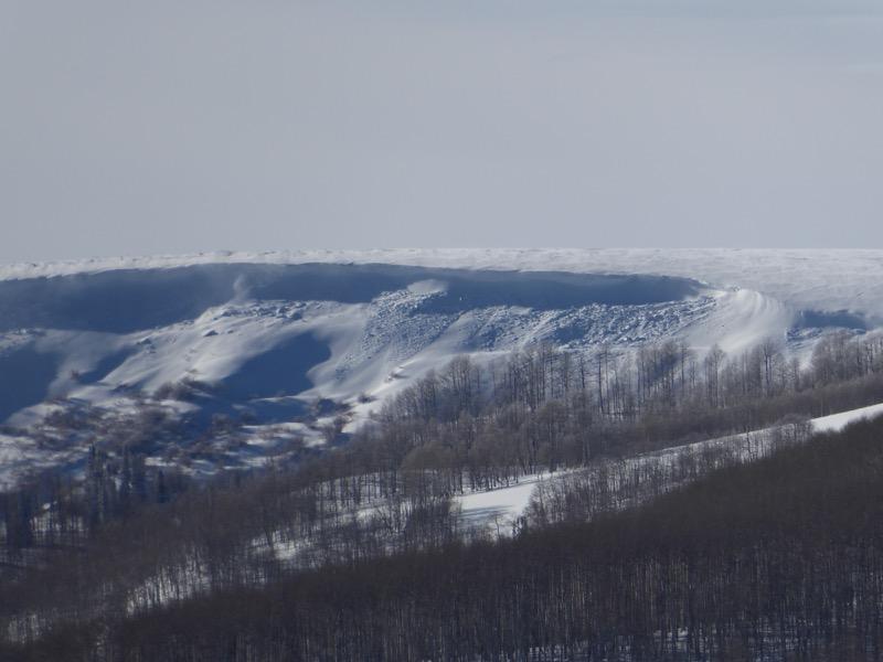
Obvious wind loading occurring during the day. We observed a number of natural cornice falls that released some small slabs below them.
Avalanche Problem #1
Problem
Wind Drifted Snow
Trend
Same
Problem #1 Comments

Upper elevation more east facing steep slopes should be avoided until the newly drifted snow has some time to adjust and stablize. The drifts seemed stubborn so you might not see any signs of instability until you get onto one of these drifts only to have it crack out. It looks like the wind will shift more to the southwest on Monday and it looks like it will be a bit gusty as the next storm approaches.

Comments

Below is photo of a cornice that broke off naturally during the wind loading. This is the type of slope you'll want to avoid again on Monday.

Video

Most terrain has a MODERATE avalanche danger but there are areas with a CONSIDERABLE avalanche danger on the higher more east facing steep slopes.

Today's Observed Danger Rating
Moderate
Tomorrows Estimated Danger Rating
Moderate