Video shows ECTP25 that failed in facets down near the ground. This was on a 35 degree slope on a NE aspect at 9800'. HS was 150 cms in this location, with 30 cms of facets down near the ground.
(Location was Bengal Tiger in Mineral Fork on Wasatch Backcountry Map.)
A good question is: How do we interpret these results?
There is 130 cms of snow over the weak layer, so I suspect a skier could not trigger a slide in an area with a deep snowpack such as this. But getting propagation with energy is still a sign avalanches are possible on this weak layer, though not likely. You would likely need to trigger one in a thinner snowpack area, which could propagate.
Bottom line was that we have a Moderate hazard in upper elevation northerly terrain, and it's not green light/ski-it-if-its-white conditions. Large, deep slab avalanches remain possible.
Also found the layer of basal facets interesting. In most areas I've been looking at this layer has compressed to 5-20 cms (2-8"), but this layer was 30-35 cms (12-14"). It was 4F hard, so is showing signs of strengthening.
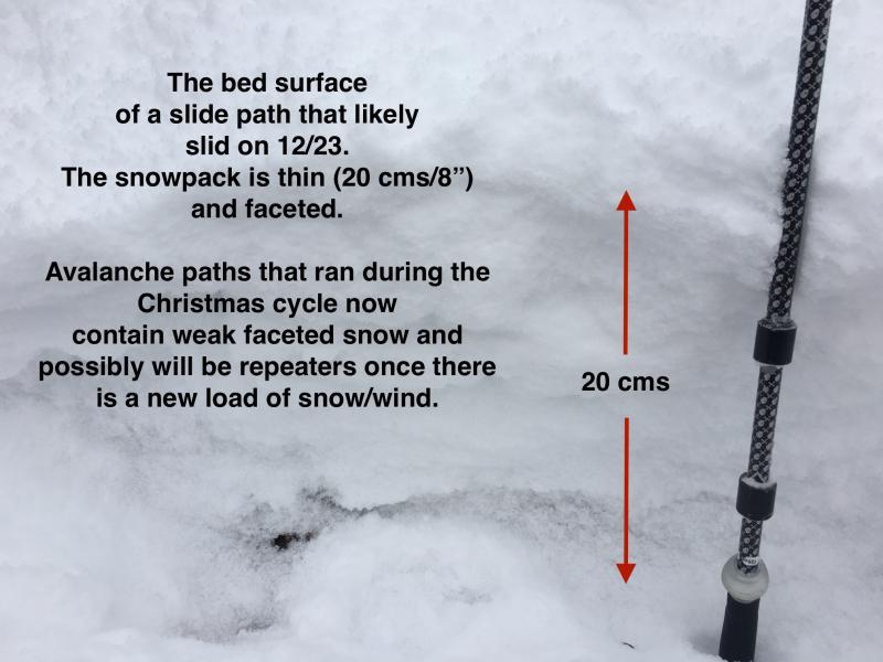
Much of the upper headwall of Bengal Tiger had slid during the Christmas cycle (likely sliding on 12/23.) The bed surface is similar to what I (and others) have been seeing. It feels very much like an early November snowpack: it is thin (15-30 cms) (6-12") and mostly faceted. Although skiing old bed surfaces was a wise choice following the Christmas storms, these paths are prime to be repeaters once they receive a new load of snow and/or wind.
I think most of the terrain is generally Low, with isolated pockets of Moderate on upper elevation West through East.


