
Now that we are dealing with a deep slab instability, was curious how test results appeared.
Storm snow instabilities have largely settled out, with only poor quality Q2/Q3 shears at storm or wind-loading interfaces.
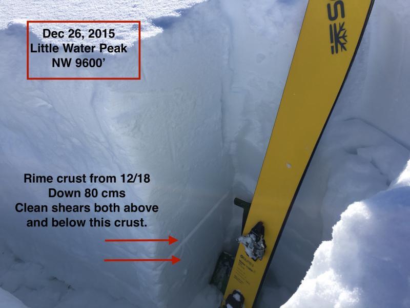
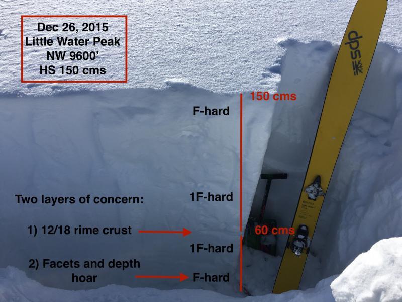
First pit was 150 cm (5') depth snowpack with 15-20 cms (6-8") of depth hoar at the ground. From the soft snow at the surface, the snowpack quickly goes to 1F hardness all the way down to the F-hard basal facets. Now finding the 12/18 rime crust now down about 80-90 cms. Extended column only got a poor Q2 shear down 20 cms. I later wrestled the 30 cm x 100 cm x 150 cm column and was able to get a clean Q1 shear just above the rime crust on a layer of faceted snow. "Wrestling" is not an official snow stability test, but it took a sustained effort to produce the shear. This layer does seem to be continuing to heal, and Drew's Christmas Day observation noticed similar results. In other pits in thinner snowpack areas I was finding faceted snow just below this rime crust. This is something worth paying attention to as we go forward.
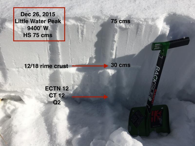
The tricky thing with deep slab instabilities is most of the snowpack may be stable, but it is possible to trigger an avalanche from a thinner snowpack area, where it could propagate the thicker areas. So I dug other pits in thinner snowpack areas, curious if I could get an ECT to propagate. Results were ECTN 12 and CT 12, both Q2, failing in depth hoar. No propagation.
(Probably should have also performed propagation saw test as well.)
Empirically, tests today are showing (1) effective bridging of the depth hoar in areas with a deeper snowpack, (2) no propagation on the slab in areas with a thinner snowpack, and (3) the rime layer continues to heal.
From what I observed today, I will stick my neck out and say that this past week has largely healed our persistent slab issue. But it's pretty easy for me to say this when I am not a forecaster having to forecast a danger rating for tomorrow. Also - I still don't trust the snowpack, especially given the consequences of triggering an avalanche. Our hazard is probably closer to Moderate than Considerable, but the stakes are pretty high if you do get caught in a slide. For me it's continued travel on slopes no steeper than the low 30's, and paying very careful attention to the type of terrain I am surrounded by.
(For those that do want to ski steeper lines, it is possible to get onto something that has already slid and has since filled in. Knowing snowpack history is crucial, as well as familiarity with terrain. Can't think of anyone better than Mark White who does this.)
FORECASTER COMMENTS: I AM CONTINUALLY BLOWN AWAY BY THESE AMAZING REPORTS AND OBSERVATIONS. GREG, A PROFESSOR IN TOWN, CERTAINLY CARRIES THAT LEVEL OF ACADEMIA, PROFESSIONALISM AND QUEST FOR KNOWLEDGE TO THE SNOW. THANKS GREG
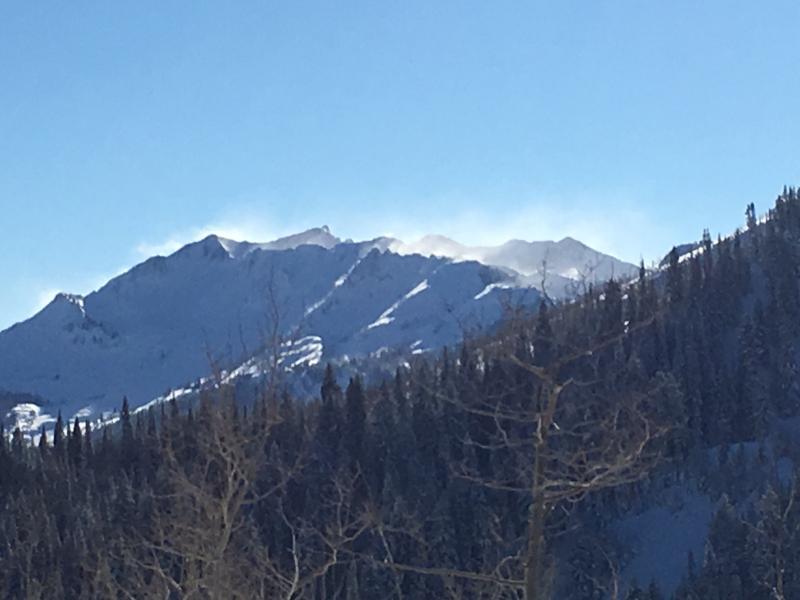
Video discussion of snowpack structure.


