Route today was East Bowl -> West Bowl -> Hideaway Park. Was expecting somewhat touchy snow conditions, but overall was finding less wind-drifted snow than I was expecting, and the wind drifts would only crack locally around my skis. The storm snow slab was cracking somewhat in the early morning, with the weakest snow being at the old/new snow interface. But I imagine any sensitivities within the storm snow will settle out rapidly. Ski cuts on steeper lines in north-facing Hideaway Park were getting sluffs to move and gouge down to the old/new snow interface. However, the slab would only propagate at most a meter.
Several people out today and apart from a few sluffs, was not finding any soft slab activity. Overall would call hazard Moderate, and very manageable as ski cuts are quite effective at mitigating storm snow and soft wind-drifts.
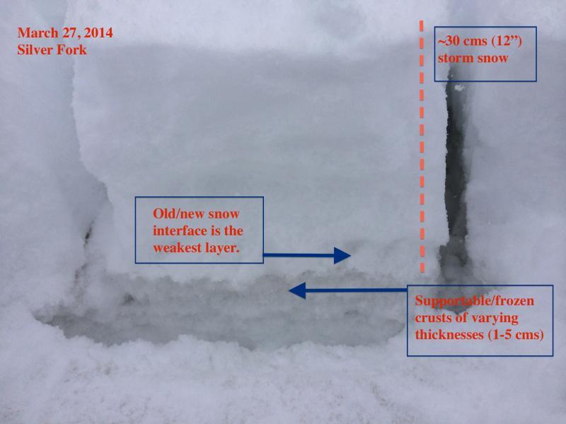
With the weakest snow found on top of frozen crusts on all but due north aspects, we have two of the necessary ingredients for avalanches - (1) bed surface, and (2) weak layer. Any increase in snowfall or wind loading could produce avalanching at this interface and there is a nice slick bed surface for them to run on.
Although I wish it was November, we unfortunately are heading into a warmer season at some point, and upper elevation north aspects will have their first warm up. Dug several quick hand pits down into the old snow on these aspects and was finding some layers of loose, small-grained crystals. Nothing of concern at the moment, but am starting to map the snowpack for the inevitable warm-up on these aspects.