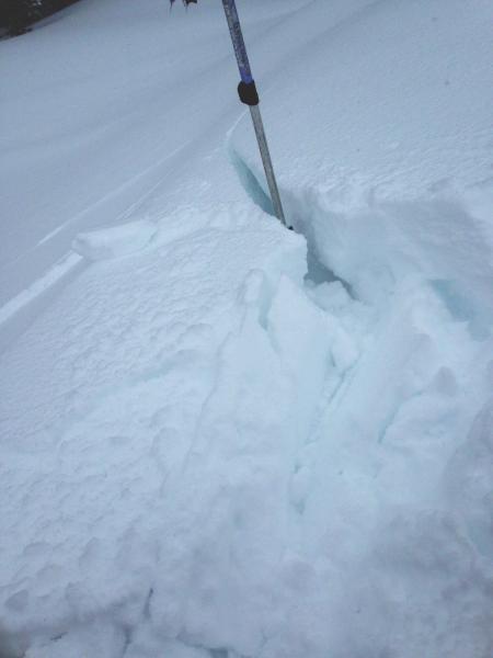
First stop was a look at a low elevation, northerly facing slope at 6,000'. Snowpack was about 60 cm deep, with the bottom half wet basal facets, fist hardness. Over that was a 4 finger slab of new snow on top. ECT results - full propagation, on 11 taps, on the top of the wet facets. Q1 shear. No sign of cooling or strengthening of the wet facets.
Would think with the forecast of additional rain and/or snow and warm temperatures, both wet sluffs and wet slabs will be possible over the next few days. Both natural and human triggered, with many of these gouging into the facets.
Photo below - low elevation snowpack, with obvious delineation between newer snow "slab" and wet facets.
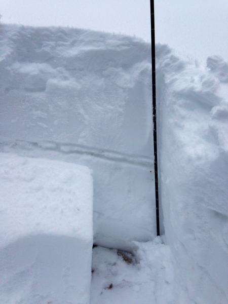
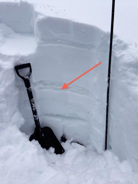
Snowpack on a mid elevation, northerly facing slope at 7,400'. ECTP 22, Q1 below the mid pack ice crust in the first photo. The lower photo is the same pit, with the red arrow the failure layer. It also has two other potential weak layers highlighted - an upper crust and weak, fist hardness facets comprising about the lower 1/3 of the snow pack. Here again, any new snow slide or wet snow sluff has the potential to step down to the mid pack or lower pack weak layers.
Upper elevation snow pit was on a northerly facing slope, 9,800', on the 10,420 ridge line. Total snow depth around 155 cm. Compression tests - Q1 failure on 17 and 22 taps on facets at 90 cm. (Arrow in photo) With multiple weak facet layers, slides may only take out the upper most facet layers, leaving plenty of weak snow on the bed surface below. Repeaters possible on slopes that slid last weekend if they get reloaded enough.

Winds were already loading snow along the ridge lines - easy cracking of the drifts - up to a foot deep by 10 to 15 feet long. Seems to be failing on a low density layer of snow. Shovel tap tests had an easy failure about 3 inches down, on 2 or 3 taps, again seeming to be between the newest snow/old snow interface. It seems this could be an active weak layer tomorrow with additional loading.