
Observation Date
12/19/2013
Observer Name
Greg Gagne
Region
Salt Lake » Little Cottonwood Canyon » Grizzly Gulch
Location Name or Route
Grizzly Gulch
Comments
Lunch patrol in upper LCC. Short 90 minute outing, but quite interested in how the weak faceted snow on shady aspects would react to the storm snow. My observations:
- This was not the in-your-face instability that I was expecting. Rather, upper LCC received 15-20 cms of storm snow and it didn't seem to be enough to create widespread avalanching. Looking at Collins Plot at Alta, it appears about .5" of water which probably kept our snowpack from widespread instability. [May be a totally different story in areas that received more snow than upper LCC.]
- Poor visibility, but I did not notice any natural avalanching at all.
- I did get several loud collapses on N and NE aspects, but not as much collapsing as I was expecting.
- New snow was not that sensitive ..... i.e. stepping above an existing skin track could not produce any cracking.
- Shovel tilt tests could get stubborn, Q2/RP shears at the new snow/old snow interface.
- CT3 - CT5 Q2/RP shears down 20 cms at the new snow/old snow interface.
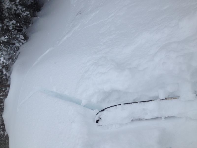
- Ski cuts on steeper slopes would mostly produce only sluffing in the top 5-10 cms of storm snow, however one ski cut on a steep N aspect propagated a crack 7 meter crack (close to 25') across the slope. This was failing on a faceted layer down 45 cms. (Photo.)
- From the several quick stability tests I performed, it did seem you needed to be on a steeper slope to get it to become reactive to stability tests.
- Didn't look at a lot of solar aspects, but it seemed the storm came in warm and bonded well to slopes that had a crust. Both Bruce and Evelyn had excellent observations from their previous field days, and they both raised the issue of how the warm snow would bond to the weak snow found at the surface on shady aspects. I had a difficult time assessing this, but overall it seems the old snow was so weak that even if the new snow bonded somewhat, it just meant failures a few cms deeper than the old snow surface.
Overall I would call the hazard Considerable on northerly aspects, and Moderate on southerly aspects. Am looking forward to reading what others report from today.
Today's Observed Danger Rating
Considerable
Tomorrows Estimated Danger Rating
Considerable


