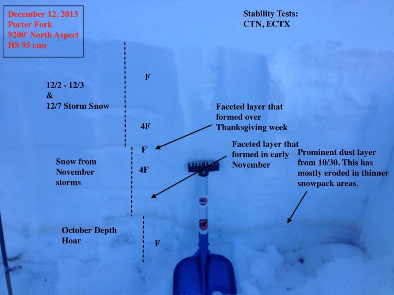
Have only traveled in BCC and LCC this season, so was curious what Millcreek looked like. Views into upper drainages in Millcreek have looked relatively snow-filled, and overall was finding a snowpack similar to what I've been seeing in the cottonwoods. HS in mid to upper reaches of drainages range from 50-100 cms, with greater amounts predictably in upper elevation north aspects. Lots of quick hand pits and pole probes to get a sense of the distribution of faceted layers, and they were found 30-45 cms down from the snow surface. (First photo shows relative layering.) Only did one formal stability test on a north aspect at 9200' and had CTN and ECTX. This did surprise me somewhat as I was getting easy full-propagation on ECTs Wednesday morning in upper LCC. Obviously only one data point, but perhaps evidence of buried persistent slab and weak layers adjusting to the load. Snow surface is weakening with widespread NSF and surface hoar.

Lots of settlement since the Saturday storm.

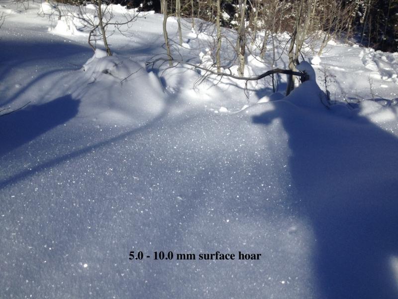
Surface hoar.

This video shows some radiation recrystallization (RR) I noted on a relatively gentle SW aspect between about 9000' and 9500'. I only find RR around this time of the year when the angle of the sun is low and we have had cold temperatures. Essentially, short-wave radiation penetrates the snow surface and warms the snow just underneath the snow surface, while the snow surface remains cold. This creates a super steep temperature gradient in the top cm or so of snow. What is left behind is a thin sun crust sitting about a cm (or less) underneath the snow surface, with faceted snow on top. (Tremper's book has a nice summary of this phenomenon.) This is wicked cool and makes skiing sun crusts fun.


