Get Your Ticket to the 32nd Annual Backcountry Benefit on September 11th! Support Forecasting, Awareness, and Education

Observation Date
1/17/2013
Observer Name
Bruce Tremper
Region
Salt Lake
Location Name or Route
Park City ridge line - West Monitor
Weather
Sky
Clear
Wind Speed
Light
Weather Comments
Wow, what a fabulous, warm, sunny day--up above the cold, choking layer of smog in SLC. I could ski around most of the day with a baseball hat, no gloves and a long underwear top.
Snow Characteristics
Snow Surface Conditions
Faceted Loose
Wind Crust
Damp
Snow Characteristics Comments
Mixed bag of snow conditions, lots of hard wind-damaged snow up high, many wet, loose snow slides on south facing slopes especially from the top of the smog layer (7,000') up to about 9,000'. There is still some soft, near-surface faceted snow with sparkly surface hoar on top on all the wind sheltered, mid and low elevation slopes. It rides well on very gentle terrain.
Red Flags
Red Flags Comments
Not many red flags in that area. The last snowstorm did not do much for the upper Cottonwoods and the Park City ridgeline. There is twice as much new snow at my house near the University as there is up there. I really should have gone into Mill Creek where there was much more new snow from the last storm but my field time was limited today.
Avalanche Problem #1
Problem
New Snow
Trend
Decreasing Danger
Problem #1 Comments

Although there was not much problem with the lingering persistent slabs in that area, several people have noted it's much worse in Mill Creek and the Session Mountains where most of the new snow fell from the last storm. People are still reporting some collapsing and propagating Extended Column tests in those areas. Many slopes in the central Wasatch now have lots of tracks on them without incident so we are probably near the Low-Moderate ballpark but closer to solid Moderate in the Mill Creek, Sessions and Bountiful-Farmington areas. Tricky pattern. I have included a snow profile below, which is representative for that area, it is probably not representative of the places where more new snow fell in the last storm.

Avalanche Problem #2
Problem
Wet Snow
Trend
Same
Problem #2 Comments

As temperatures have warmed dramatically over the past couple days, we continue to see lots of wet, loose sluffs on the steep southerly facing slopes especially at elevations from about 7,000' (top of the cold smog layer) up to about 10,000'. There are many sluffs lapping up against the edge of the road, which are coming off the warm rocks and steep embankments.

Snow Profile
Aspect
Northeast
Elevation
9,100'
Slope Angle
20°

Photos:

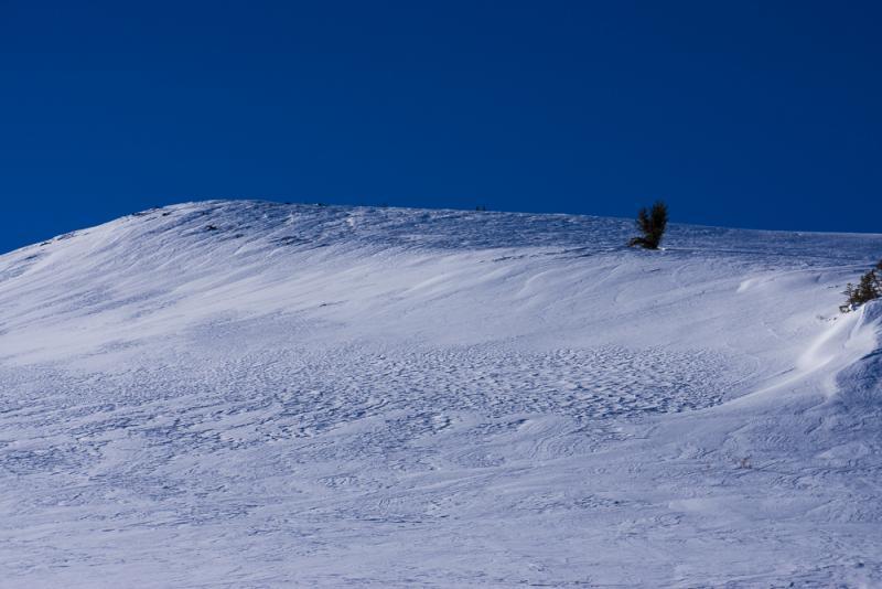
1) Wind damaged snow along in the high terrain. Can you spot the difference between wind eroded snow and wind deposited snow? The smooth, rounded snow is the dangerous kind.

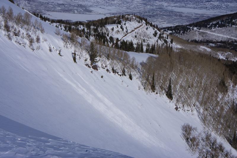
2) Wet, loose snow sluffs on steep south facing slopes. This slope was around 9,500'

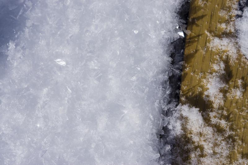
3) Thick surface hoar on all the sun and wind sheltered slopes.

Coordinates