Observation Date
1/13/2013
Observer Name
Michael Janulaitis
Region
Salt Lake
Location Name or Route
Mt. Raymond
Comments
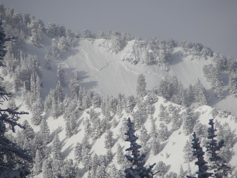
We headed out Butler Fork at 7:00 AM or so. It was cold but we were prepared. The clouds and snow that were forecasted were absent. The sun came out quickly. On our way to Raymond we observed a natural new snow slide (~40 feet wide by 300 in length and guessing ~1 foot deep) on the east face lookers left of the peak. I suspect the slope loaded when the south wind deposited snow using the east-west running ridge to the south as a snow fence. There was two other minor sluffs on the east face. I dug a shallow pit on the approach to the ridgeline and observed ECT 11 SP below the 3 cm thick melt-freeze layer on top 4F facets about 14 inches below the surface. The facets laid on top 1F rounds. A shovel shear easily pulled out the new snow failing on the facets below the melt-freeze layer and when isolating a CT column the melt-freeze layer failed when cutting. Given the layer was 3 cm thick that's not entirely surprising to me. Cornice drops produced no results.
I've included a pic of the Portor Fork Slide as viewed from Mt. Raymond.