


Observation Date
12/11/2012
Observer Name
Greg Gagne
Region
Salt Lake
Location Name or Route
Grizzly Gulch
Comments
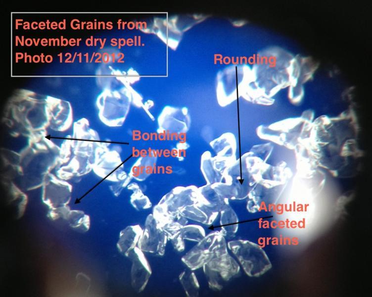
Traveled to an area where I have dug several pits already this season to look at November faceted layer. Stability tests only produced ECTN6/ECTN8 down about 20 cms (8"). No fractures in any of the weaker layering including the November facets now buried about 75 cms (2.5') below the snow surface. With a sizable load now on top of buried November facets and dozens (hundreds?) of slope testers out the past several days, the only activity I am aware of on this layer was the avalanche reported from Banana Days on 12/8. Photo highlights strengthening of this faceted layer. The thickness of this layer has also been reduced by over 50% due to compression. On 12/1 I was finding the November facets layer 15-20 cms (6-8") thick, in the same location it is now 5-10 cms (2-4").
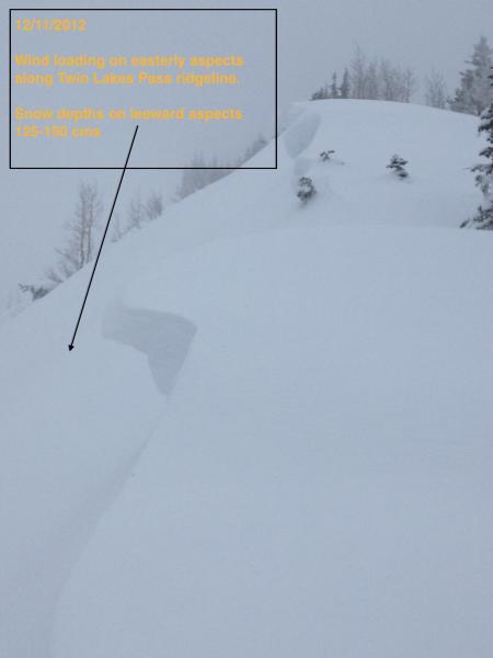
Did not travel enough to get an idea of wind loading, but overall I was finding fairly limited wind loading and where I was, the wind pockets were not sensitive, cracking at most just around my skis. Kicked several small cornices along Twin Lakes Pass ridgeline and could only produce minor sluffing. What is interesting to observe is that in the upper cottonwoods we are starting to develop a real snowpack with depths over a meter (3'+) above 9500'. On leeward aspects of Twin Lakes Pass I was finding some depths approaching 150 cms.
Coordinates