Observation Date
12/6/2012
Observer Name
Greg Gagne
Region
Salt Lake
Location Name or Route
Mt Wolverine
Comments
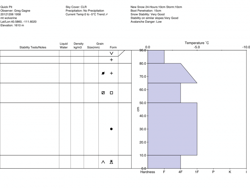
Not-quite-dawn-patrol today. Markedly different snow conditions and quality as you travel from 9000' to 10,500'+ Rain crusts below about 9500' of varying thicknesses (Jason covered this well in his obs from today.) No rain crusts observed above 10,000'. No detailed pits, yet lots of quick hand pits and ski pole penetration. Most problematic layer seems to be the November facets that form a layer anywhere from 10-20 cms (4.8") thick. This layer is now buried about 15-30 cms (6-12") where I was traveling, although obviously deeper in areas that received wind loading over the past 4-5 days. Quick stability tests today still showing not enough of a slab on top, yet from my observations over the past weekend and today, I am going to step out on a limb and suggest this layer won't be as much of a problem as we think. Small-grained facets with some rounding. I am thinking dribs and drabs of snow this week along with warm temps are colluding and helping this obvious weak layer adjust to the new load and gain strength. ( Though I did get two localized collapses at about 9500' today and I am suspecting they were failing on this layer. ) Obviously will continue to watch this layer over time.
Appreciated Evelyn's comment about the disparity in upper and mid-elevation snowpacks. Mid elevations (< 10,000) seems to have a lot more crusts, with several crusts forming facet sandwiches. I noted these this past Sunday on Figure 8 Hill, and also saw Mark White's observation today from Cardiac.
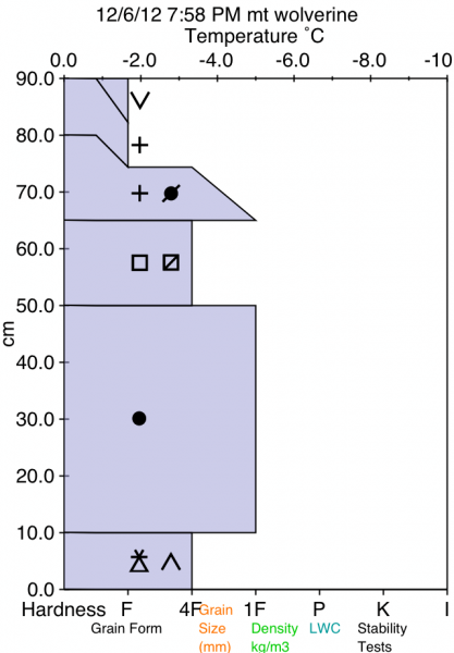
Am including composite snow pit representative of northerly aspects between 10,000' and 10,800' (Am experimenting with Avy Lab app which will produce two versions of the same pit structure.)
Am seeing a mostly Low avalanche danger.