Get Your Ticket to the 32nd Annual Backcountry Benefit on September 11th! Support Forecasting, Awareness, and Education

Observation Date
12/5/2012
Observer Name
Evelyn
Region
Salt Lake
Location Name or Route
Little Cottonwood
Weather
Sky
Obscured
Precipitation
Light Snowfall
Wind Direction
West
Wind Speed
Light
Weather Comments
Light rain at the lower elevtions, with rain snow line about 8,000' while I was out.
Snow Characteristics
New Snow Depth
2"
New Snow Density
High
Snow Surface Conditions
Dense Loose
Damp
Snow Characteristics Comments
Wet, saturated snow at and below the rain line, dense snow at the higher elevations.
Red Flags
Red Flags
Wind Loading
Cracking
Poor Snowpack Structure
Red Flags Comments
The wind loading was minor, but the newest snow was just a little wind affected up high, and cracky on steep slopes. Upper elevations still have poor snow pack structure where I was - dry, October facets near the ground, multiple layers of loose, dry faceted graupel.
Comments
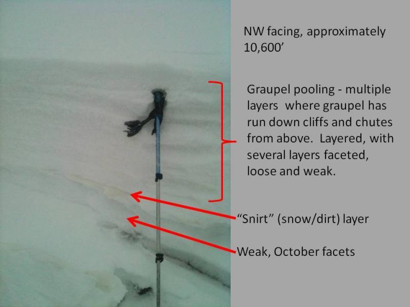
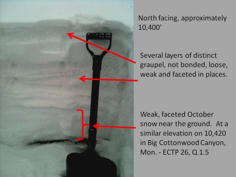
Today I traveled at higher elevations than I have been this winter. Somewhere above about 10,000 feet, the snowpack changes to one that has been consistantly cold, and is quite different from the mid elevations with the warmer snowpack. The October facets near the ground are still dry, loose and weak. There seem to be large amounts of graupel in the pack, with significant pooling beneath chutes and cliff bands. In general, it's a much more layered and weaker snowpack, significantly different than many other areas I have looked at. The rapid transition to this weaker snowpack over a short distance could be tricky for stability analysis as the winter goes on.