Forecast for the Skyline Area Mountains

Issued by Brett Kobernik on
Monday morning, December 9, 2019
Monday morning, December 9, 2019
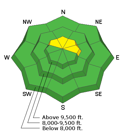
The overall avalanche danger is MODERATE. The danger is most pronounced in the highest terrain which received the most snow and most wind. Watch for fresh drifts along the upper east facing ridges. By far the biggest concern is on slopes approaching 40 degrees above about 9000 feet that face northwest, north, and northeast where an avalanche could break into old weak sugar snow near the ground.

Low
Moderate
Considerable
High
Extreme
Learn how to read the forecast here
Avalanche Problem #1
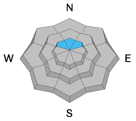
Persistent Weak Layer
Type
Location

Likelihood
Size
Description
The new snow from Sunday will most likely make things slightly more sensitive on the high northerly facing steep slopes where the old weak sugar snow from October is present. Continue to avoid slopes steeper than about 30 degrees on those slopes if you want to stay safe.
Additional Information
This forecast is from the U.S. Forest Service, which is solely responsible for its content. This forecast describes general avalanche conditions and local variations always occur.


