Forecast for the Skyline Area Mountains

Issued by Brett Kobernik on
Thursday morning, December 19, 2019
Thursday morning, December 19, 2019
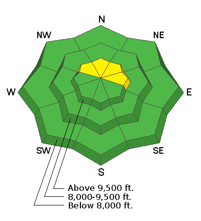
The majority of the terrain on the Skyline has a LOW avalanche danger. There is a MODERATE danger in the upper elevation northwest, north and northeast facing slopes that are holding weak snow from October. Gusty wind on Wednesday may have enhanced this danger by loading fresh drifts on top of an already weak snowpack.

Low
Moderate
Considerable
High
Extreme
Learn how to read the forecast here
Avalanche Problem #1
Persistent Weak Layer
Type
Location

Likelihood
Size
Description
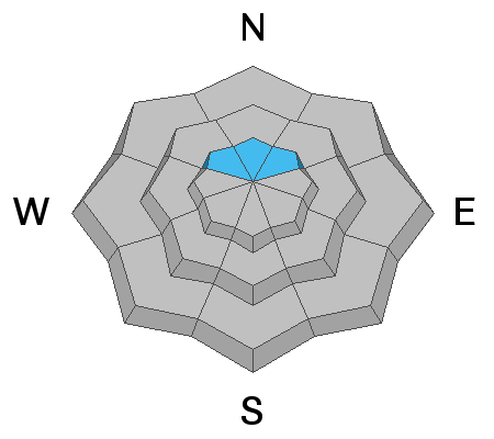
The east wind on Wednesday may have transported enough snow to increase the chance for an avalanche to break into the persistent weak layer of old sugar snow near the ground. This persistent weak layer is tricky to forecast for because in some high elevation northerly terrain, the snow near the ground is not all that weak but in others it is still very much a concern. The bottom line is that there is enough weak snow lingering around to be a concern and some fresh wind loading on top if it will make it more dangerous.
Additional Information
This forecast is from the U.S. Forest Service, which is solely responsible for its content. This forecast describes general avalanche conditions and local variations always occur.


