Observation Date
4/9/2025
Observer Name
Ryan Huels
Region
Moab » Gold Basin » El Pinche
Location Name or Route
El Pinche
Weather
Sky
Clear
Wind Direction
West
Wind Speed
Light
Weather Comments
Sunny skies and light/moderate westerly winds which were helping keep snow in upper elevations cold. It was 38 degrees in the winter lot at 0730 and up into the 50s at the winter lot by 1300. Beautiful spring day in the mountains. Temps remained relatively cool with the wind up until about 1130/1200 when things notably started to heat up. One more night of freezing temps tonight before a few days of high pressure and warm temps through the weekend. Looks like overnight below freezing temps may return in a few days after our warm up.
Snow Characteristics
New Snow Density
Medium
Snow Surface Conditions
Powder
Dense Loose
Wind Crust
Melt-Freeze Crust
Damp
Snow Characteristics Comments
I toured the Laurel Highway and boot packed the ridge to El Pinche getting a look at snow on a variety of aspects and elevations. At lower elevations and in areas exposed to the sun, the snow was frozen hard and made for fast moving in the morning. By noon in was soft but too sloppy in open areas and still hard in shaded areas. On NE-NW aspects at mid elevations in the trees and E-W upper elevations above treeline the snow was cold, soft, dense powder from our recent storm. Upper elevations facing W were more affected by the sun than aspects facing E. E facing terrain seemed to soften up around 10/1030. I did not ski any southerly facing aspects. At 1045 I descended a NW facing aspect that held cold snow into El Pinche which also held cold, soft snow. At the Apron the snow was sun affected and had not yet softned but still made for pleasant turning. Sharks still lurk in the snow in areas where you can tell the snowpack is shallow.
Red Flags
Red Flags
Wind Loading
Rapid Warming
Red Flags Comments
Previous skin tracks seemed to be slightly filled in from wind transport as there is still cold soft snow at upper elevations in areas sheltered from the sun. There are wind drifts along the ridge line from Laurel to Peal/Tuk from westerly winds. Evidence of loose/wet slides and rollerballs from previous days was all around on aspects with solar gain, greater on westerlies.
Avalanche Problem #1
Problem
Wet Snow
Trend
Increasing Danger
Problem #1 Comments
Wet snow from daytime warming. Watch out for sings of rapid warming which will be greater over the next few days as temps rise.
Avalanche Problem #2
Problem
Persistent Weak Layer
Problem #2 Comments
While many people have been getting out and on all kinds of aspects and various elevations, the PWL could still be lurking below in the right spots as we had a very poor snowpack structure all year. The warmup a few weeks ago followed by the cooling trend + snow helped lock things in, but that doesn't mean it does not exist.
Comments
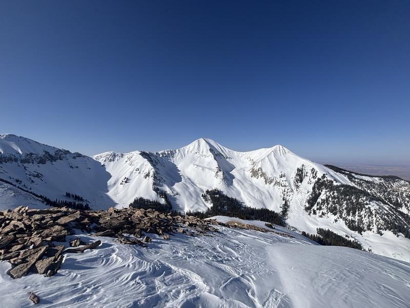
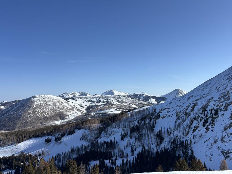
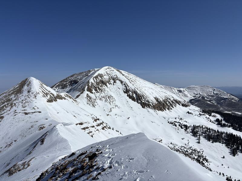
A look at Tuk No, Tuk and Talking Moutain Cirque from the Laurel Highway which have all been seeing plenty of action over the past handful of days.
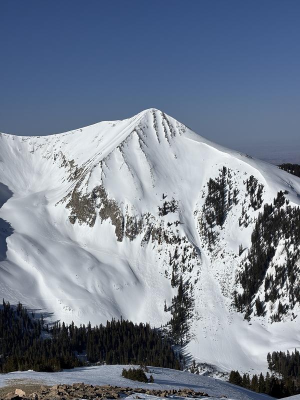
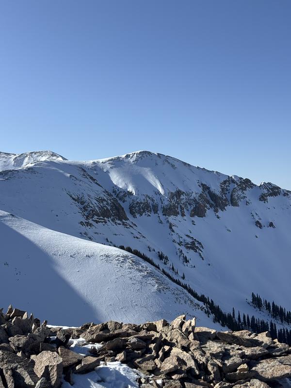
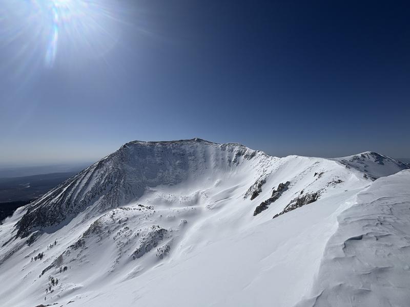
El Pinche from the Laurel Highway and Below. Things are thin in the gut and on the SW facing entrance, but the NW facing aspect is holding quality snow. Evidence of loose/wet activity in and around the coulior along with debris from the old wet slab that broke during our warm spell a few weeks ago.
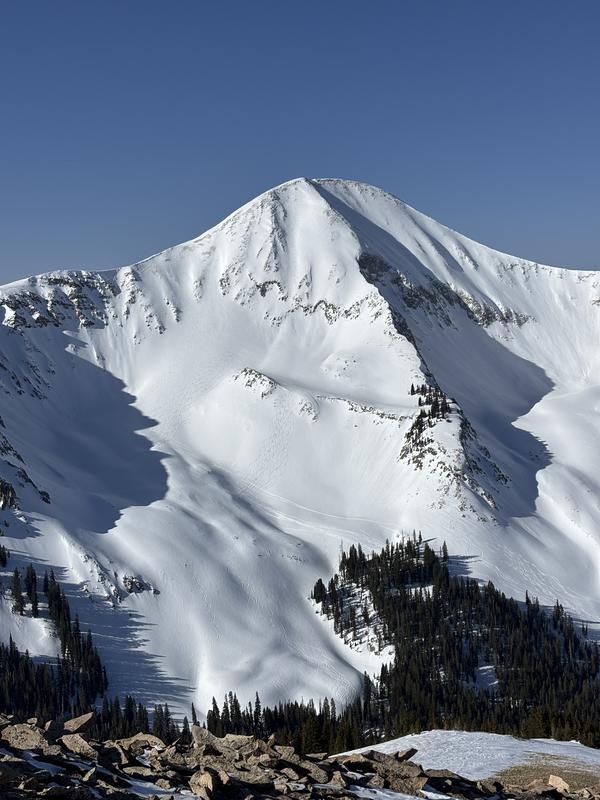
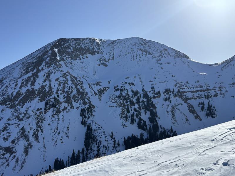
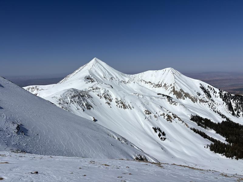
South facing aspects are getting cooked and becoming very thin as you can see with Mellenthin and the Nortern Group. And, a look at Mellenthin's SE face, Mt Peal and its snow filled basin, along with Tuk/Tuk No. from the top of El Pinche
Today's Observed Danger Rating
Low
Tomorrows Estimated Danger Rating
Low
Coordinates