Nikki Champion
Forecaster
Week in Review: Avalanche Conditions and Snowpack Developments (March 28- April 3, 2025)
Each week, we look back at the key snowfall, weather, and avalanche events from the previous week. For archived forecasts, visit the Salt Lake Mountains’ past updates.

As the season begins to wrap up and we finally eliminate the persistent weak layer, we will no longer examine the individual days throughout the week but rather just the overall summary and pattern. This week's week in review was summarized by Trent. Thanks Trent!
Overall Summary:
As the week came to a close on Friday, March 28th, temperatures finally started to cool down after a week of warm weather, strong sunshine, and CONSIDERABLE avalanche danger. Thursday night into Friday brought the first shallow overnight refreeze in several days, which led to an overall MODERATE danger for wet snow. A large glide avalanche was reported in Stairs Gulch of Big Cottonwood Canyon by UDOT, and a couple of additional wet slides were observed in Broads Fork by Mark White.

Saturday, March 29 was a transition day with colder temperatures leading to a solid refreeze of the snowpack. The weather forecast was overcast skies with a cold front for later in the day with a roughly 2-6 inches of new snow with winds from the west at 5-15 mph. The overall danger for the day was rated MODERATE at the mid and upper elevations for new snow and lingering wet snow instabilities.
Sunday, March 30 was an overall LOW danger because the storm did not deliver and only produced 1-3 inches of new snow throughout the range. Temperatures cooled off, and the snow was solidly frozen with just a skiff of snow on top leading to Normal Caution. One glide avalanche was reported from the Icebox in Upper Millcreek Canyon.

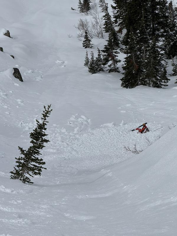
Good riding and stable snow followed on Monday, March 31st, with an overall LOW avalanche danger. The main concern was shallow sluffs and drifts from the 1–3 inches of new snow. One skier-triggered avalanche occurred in Mill B South. This small avalanche caught the skier off guard.

Tuesday, April 1st, was a different story (no joke). Dave Kelly wrote the following about overnight and morning conditions:
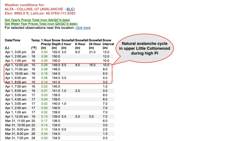
“Currently, under overcast skies, it is snowing lightly. Weather stations are reporting 4–9 inches of new snow and 0.40–0.96 inches of snow water equivalent (SWE). Trailhead temperatures are in the mid-20s °F, and the highest peaks are in the low teens °F. Winds are blowing from the west, 5 MPH gusting to 10 MPH at lower ridgelines, and from the west and northwest at the highest peaks in the 20s, gusting into the 30s mph, with some overnight gusts reaching the 60s and 70s MPH at the 11,000' peaks.”
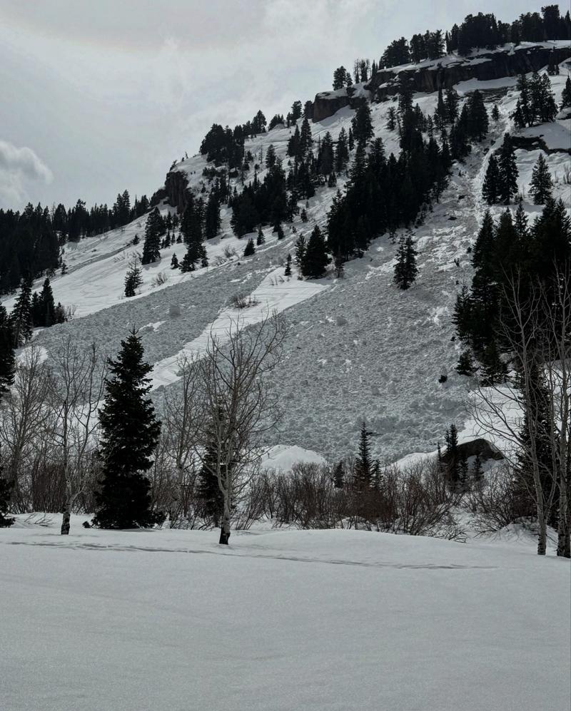
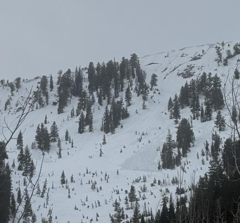
With new snow and wind across the upper elevations, the avalanche danger quickly rose to CONSIDERABLE for new snow and wind-drifted snow avalanches. Many backcountry observers reported shallow but widely propagating avalanches on all aspects and elevations. We likely went through a small natural avalanche cycle during the highest PI and wind for the day.

On Wednesday, April 2nd, 13 avalanches were reported to the UAC from Tuesday. Nikki wrote:
“Yesterday saw a widespread avalanche cycle across the Salt Lake area mountains, with at least 13 avalanches reported to the UAC so far—though the actual number is likely much higher. Slides ranged from 3 to 20 inches deep and up to 200 feet wide. Human-triggered avalanches were observed in Michigan City, Argenta, Silver Fork, Georges Bowl, and multiple locations in Days Fork, while natural avalanches occurred in Lanes Leap, Monitors, and Days Fork. Most avalanches failed on a density change within the recent snow, with many occurring during peak precipitation intensity between 8 a.m. and noon. Ski patrol observed widespread sensitivity, with soft slabs up to 16 inches deep reacting to ski cuts and explosives.”
For the day, the skies remained mostly cloudy with cold temperatures. Riding and turning conditions were fantastic, and the new snow rapidly stabilized. This led to an overall MODERATE avalanche danger for the day.


