Observation Date
3/6/2025
Observer Name
Champion, Collett
Region
Salt Lake » Park City Ridgeline » Scotts Backdoor
Location Name or Route
Scotts Backdoor
Weather
Sky
Overcast
Precipitation
Light Snowfall
Wind Direction
Southwest
Wind Speed
Light
Weather Comments
Consistent S1-S2 snowfall continued until 2 PM, when the skies began to break up. Winds were light out of the southwest, with minimal blowing snow observed in the area traveled. The sun even came out at times toward the end of the tour.
The big weather shift occurred while driving down the canyon around 3 PM. Winds ramped up significantly near Argenta, gusting strongly to extreme levels and blowing large powder clouds across the road. It also started to graupel. It was unclear whether this quick change in weather was isolated to mid-canyon or prefrontal.
Snow Characteristics
New Snow Depth
12"
New Snow Density
Medium
Snow Surface Conditions
Powder
Snow Characteristics Comments
There seemed to be about 30–35 cm of medium-density new snow in the Guardsman area. The new snow appeared to be bonding well with the old snow surface, and steep test slopes showed some sluffing in the upper few inches. On steeper terrain at upper elevations, the snow seemed to entrain a bit more and moved fairly quickly.
Tiny bit of sluffing in the surface while on steep test slopes and cutbacks.
Red Flags
Red Flags
Heavy Snowfall
Wind Loading
Red Flags Comments
12" of new snow and over 1" of SWE is definitely red flag-worthy, although the new snow seemed to be bonding well. We saw some light wind loading above 9,500 feet, which was creating a 4F wind slab. It seemed like you'd need to add wind to the equation to get an avalanche in this area.
Avalanche Problem #1
Problem
Wind Drifted Snow
Trend
Increasing Danger
Problem #1 Comments
With plenty of snow available for transport and some wind I'm sure you could find wind slab today. We traveled in mostly sheltered terrain but the snow in the wind zone was beginning to slab up. I'd anticipate this trend to increase as winds ramped up in the afternoon.
Avalanche Problem #2
Problem
New Snow
Trend
Same
Problem #2 Comments
As noted the new snow seemed to be bonding well although we did experience some sluffing in steep terrain. Trend staying the same as this storm continues.
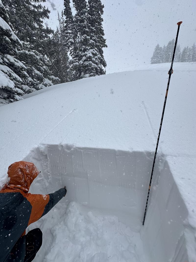
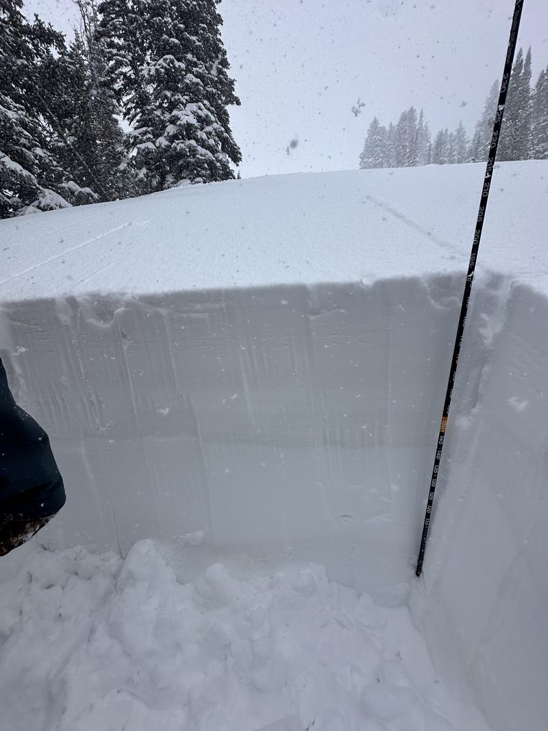
Snow Profile
Aspect
North
Elevation
9,600'
Slope Angle
22°
Comments
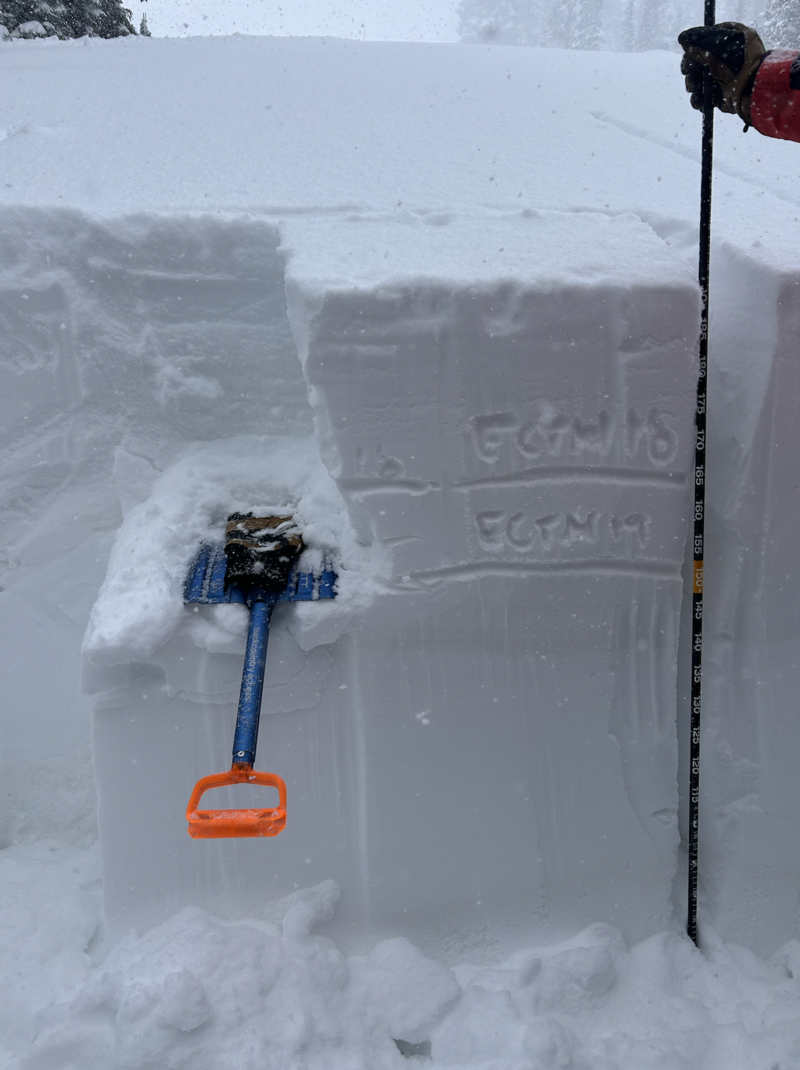
We dug a quick pit to assess new snow instabilties and to target a near surface facet layer (below the dust layer) 30-40 cm down that has been producing mixed ECTP and ECTN results for the last couple days. We got ECTN results on the old/new snow interface down 30 cm and ECTN within the old snow however we saw no failures within the facet layer. The facets were small grained and showed signs of rounding. Implications is that this facet layer is not a widespread problem but is something to keep on the radar. (See photo below)
Today's Observed Danger Rating
None
Tomorrows Estimated Danger Rating
None
Coordinates
Snow Pilot URL