
Observation Date
3/4/2025
Observer Name
Kelly, Thompson, DePalma
Region
Provo » Snake Creek » Ant Knolls
Location Name or Route
Ant Knolls
Comments
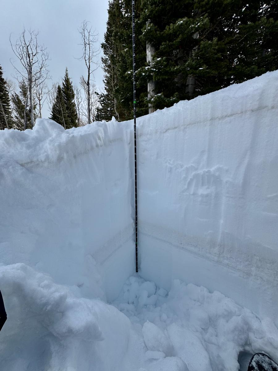
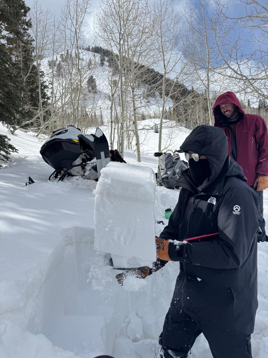
We dug a snowpit on a northerly facing slope at 8,420'. Total depth of the snowpack was 6 feet ( 187cm) and we had no propagation with an extended column test. We did a burp the baby shovel test (photo 2) looking for some sort of mid-pack surface hoar or decomposing precipitation particles (PP) and had no results. This is the layer that forecaster Drew Hardesty found in the Guardsman Pass area on Sunday. We did not find it today in this snowpit. We found an overall stable deep snowpack in this location. We discussed how this may not be representative of other locations particularly north-east facing aspects that have avalanched already this season, these repeater slopes may be thinner and have more facets (weak sugary snow) near the ground and are the places where you would be likely to trigger an avalanche with additional storm snow.
We also made it to the site of an avalanche accident that occurred on Saturday February 22, 2025 on Ant Knolls. We were able to get to the toe of the debris and found anywhere from 8-10 feet of debris (250-300cm). It appeared that the avalanche ran on facets near the ground, was likely a repeater avalanche. Talking to some snowmobilers in the area they mentioned that the snow the avalanche failed on had melted during last weeks warm temperatures and there was approximately 4" of new snow on the ground.
Photos of the avalanche:
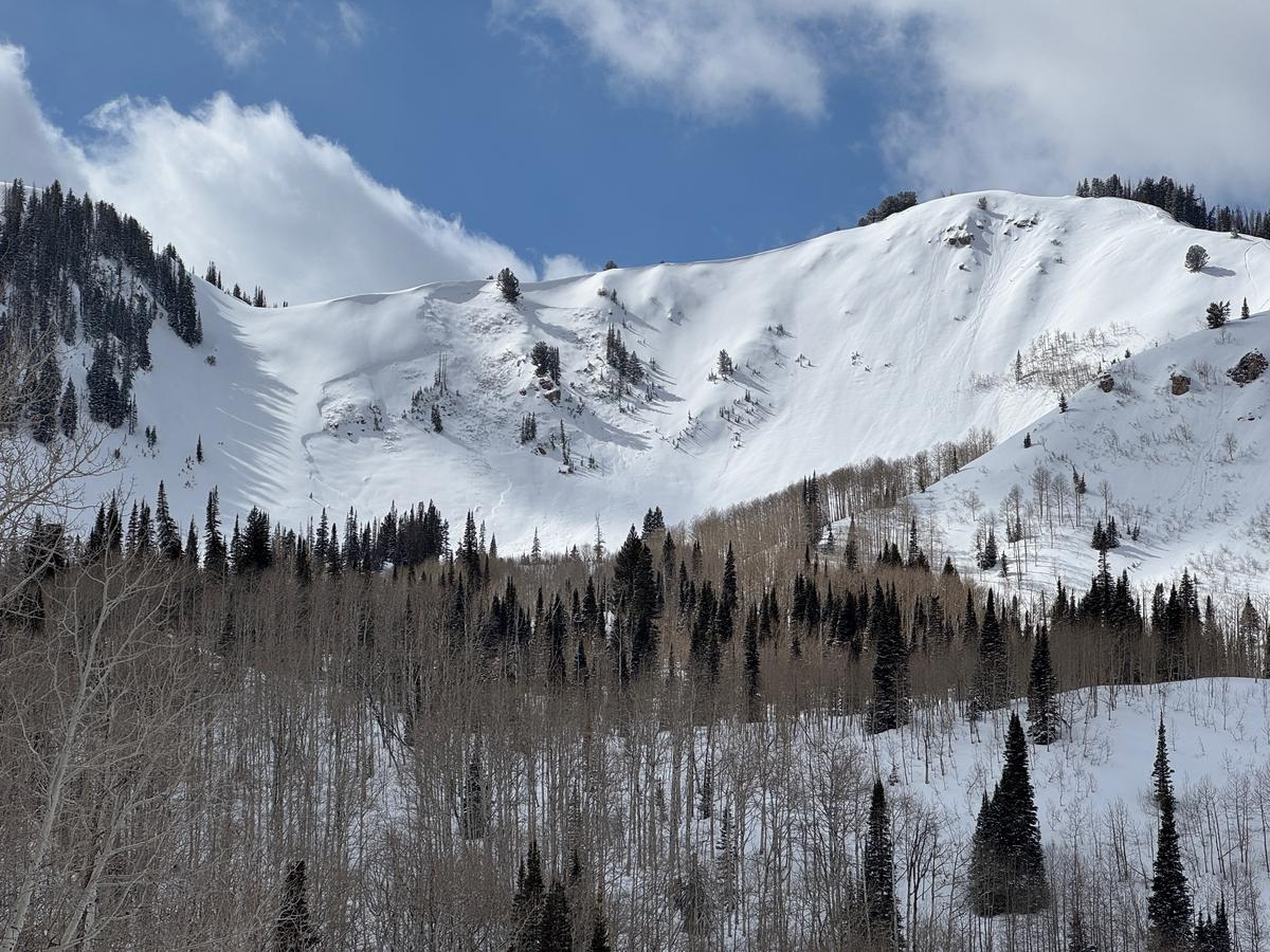
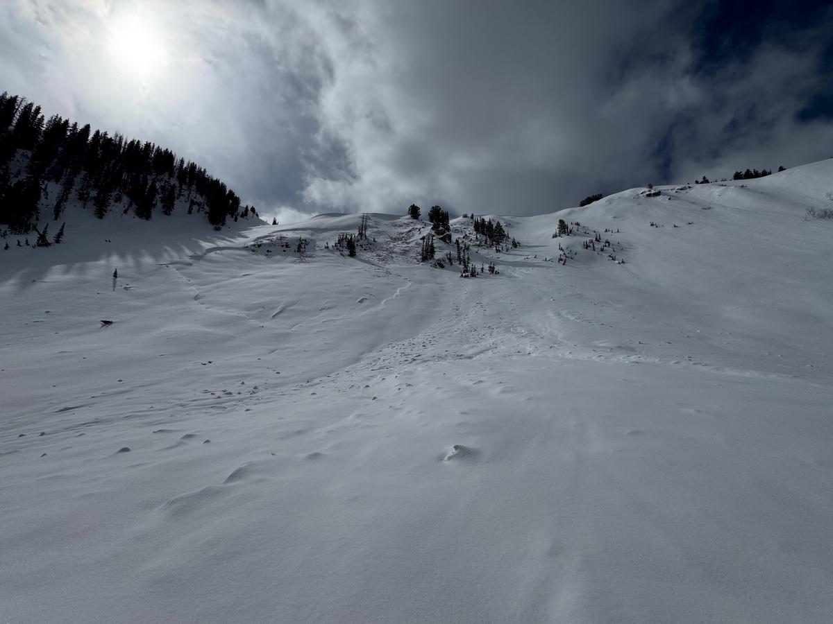
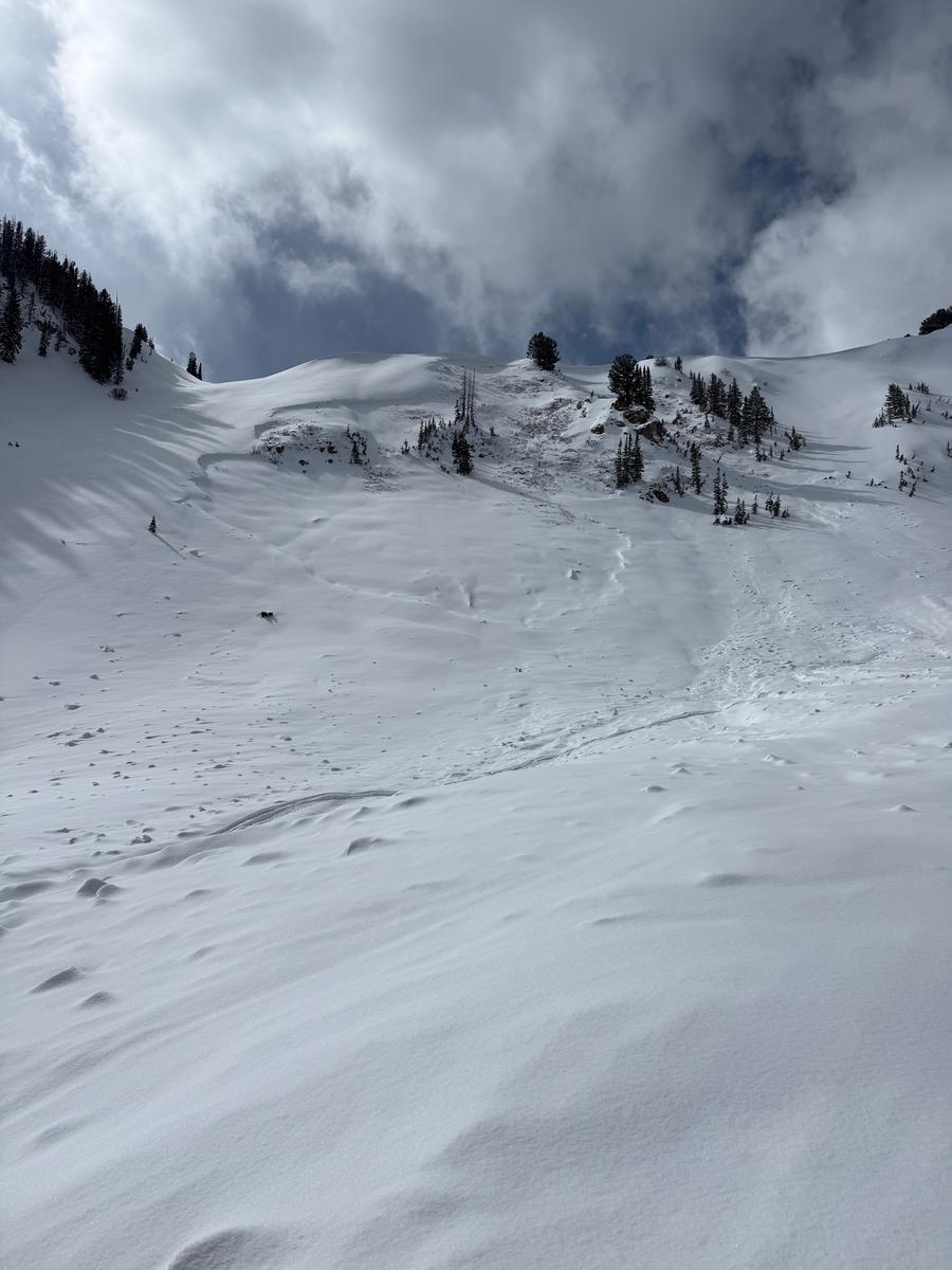
Photo of the burial sites (red arrows):

The avalanche danger where we traveled today was MODERATE. We started the day traveling as though it was CONSIDERABLE, did a couple of test pits, saw no new avalanche activity and one-at-a-time moved onto some steeper terrain after checking to see that total depths in that area were over 8' deep. We discussed how we still don't trust the buried persistent weak layer (PWL), particularly on steep slopes that may have previously avalanched this season. These slopes would be thinner snowpack areas and more likely to avalanche again. LOW or MODERATE danger with a PWL gets more attention than LOW or MODERATE with another avalanche problem. IF the storm comes in this weekend we discussed how we will be backing off of steep terrain.
Today's Observed Danger Rating
Moderate
Tomorrows Estimated Danger Rating
None
Coordinates


