

Observation Date
3/1/2025
Observer Name
Kelly, Evatt, Breen
Region
Salt Lake » Lone Peak
Location Name or Route
Lone Peak- Bighorn Peak
Comments
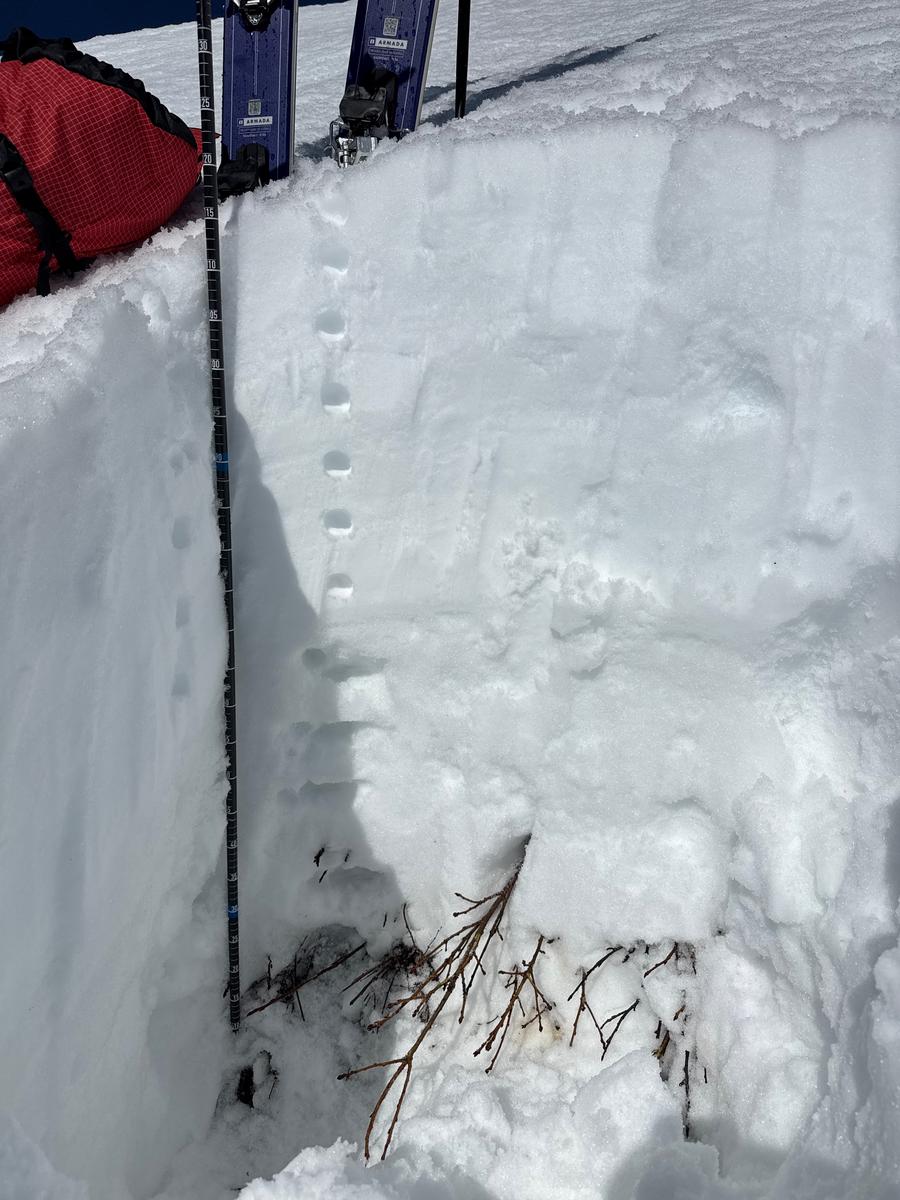
Snowpit on a southeast aspect at 8,800' showed moist grains throughout the snowpack. There was a melt freeze crust that was most likely an ice lens 18" (45cm) from the surface snow. There was lots of supportable snow in the morning, but as the day went on and we got closer to trees or rocks we would sink through these upper layers (including this crust) when bootpacking. The facets near the ground are starting to show signs of rounding and were damp. I think in order to see an avalanche in this location ( or a similar slope) you would need steep terrain isolated to rocky gully features. Height of snow on a southeast aspect at 10,400' was over 10' (300cm) deep.
Price of admission in this zone between the Salt Lake and Provo region is high.
We started very early in the morning to beat the heat and the sun warmed slopes. We played our aspects and started with east and southeast facing terrain, switched to southerlies and finished on southwest facing slopes. We found good supportable travel in most locations. Towards noon we were starting to sink through when boot-packing and knew it was time to move on. We traveled as though it was MODERATE danger, but found LOW danger on the slopes we chose. Wet problems particulary with a freeze (even superficial) can be managed by timing. Earlier starts make for better surface conditions. It also decreases the chances of being involved in an avalanche on sun warmed slopes.
Today's Observed Danger Rating
Low
Tomorrows Estimated Danger Rating
None
Coordinates