Observation: Gold Hill

Observation Date
2/28/2025
Observer Name
Brackelsberg/Davis
Region
Uintas » Gold Hill
Location Name or Route
Gold Hill
Weather
Sky
Clear
Wind Speed
Calm
Snow Characteristics
Snow Surface Conditions
Damp
Snow Characteristics Comments
The heat of the day had the snow surface saturated. From our snowpit, the top ~2" of snow was saturated. Even in the shaded trees the snow was damp.
Red Flags
Red Flags
Rapid Warming
Poor Snowpack Structure
Red Flags Comments
The observed avalanhces (see avalanche submissions) indicated to us that in places with shallow snow, it is still possible to trigger an avalanche that will break into old snow. Both of the avalanches ran on facets near the ground where the snow was shallow.
Avalanche Problem #1
Problem
Wet Snow
Trend
Same
Problem #1 Comments
While the avalanches we observed failed on a PWL, our main concern for today was the warmth and the wet snow.
Avalanche Problem #2
Problem
Persistent Weak Layer
Trend
Same
Problem #2 Comments
As noted above, we observed two avalanches that ran on the old snow facets. This is an indication that in places with a deep snowpack, the likelihood of triggering an avalanche has decreased, but in places with a shallow snowpack, there is still a chance of triggering a large avalanche that runs to the ground.
Snow Profile
Aspect
Northeast
Elevation
9,600'
Slope Angle
23°
Comments
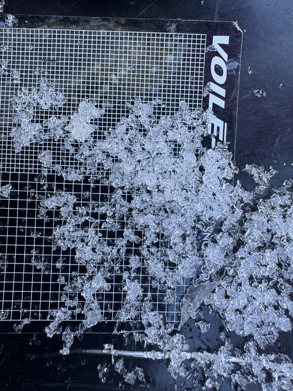
While our ECT did not produce any results. The facets on the ground and overall poor snowpack structure is still a concern and kept our travels off of and out from under steep slopes with shallow snow. You can see the quite large facets from the bottom of our snowpit in the photo below. The facets appeared to be started to either round or at least bond together.
Today's Observed Danger Rating
Moderate
Tomorrows Estimated Danger Rating
Moderate
Coordinates