


Observation Date
2/27/2025
Observer Name
T Diegel
Region
Salt Lake » Big Cottonwood Canyon » Raymond Peak
Location Name or Route
Mt Raymond
Comments
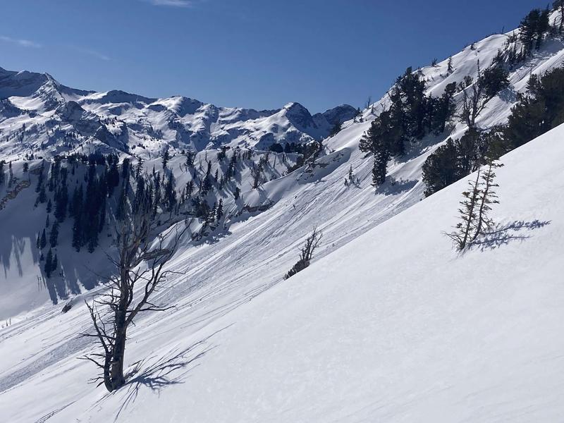
Bluebird day, as everyone knows. I went out to see if snowpack had locked up enough to indeed have supportable corn, and generally the answer was yes, though at lower elevations/lower slope angles I think there wasn't enough fluctuation in temps and solar radiation, so it was a bit breakable. But where it counted - on skiable slopes - it was indeed supportable corn. Which is not to necessarily describe ski conditions (since this is part of the "avalanche forecast center" and not the "ski conditions center!) but to say that at least there was a decent refreeze on the high-ish steep sunny slopes, so I wasn't too worried about wet slides, at least until late in the morning when I left. On the steeper slopes (ie the proud lines off the summit of Raymond) had rollerballed but there were no point-release slides....at least yet (see pic). Seems like the slightly-below freezing nighttime temps and clear skies over the next few days will maintain this status.
The north side had - as Drew predicted - some soft settled powder, at least in the protected trees. I didn't make it over to the more-open and thus windswept - and slightly sun-swept - main north face of Gobblers to see how windjacked/slabbed up that was. I didn't take the time to dig a pit; I kinda figured that doing a quick handy pit wouldn't get me to any of the anticipated buried PWLs that have been identified in many folks' pits, which I didn't feel exposed to in the terrain that I skied/skinned.
The thing that I did notice is that the surface snow on the north side is already starting to facet-up on top of a decent surface and the old tracks are starting to break down a little, so if/when the next storm hits in four-ish days, it might come down on faceted snow. Maybe there will be a prefrontal warm wind that will sweep the facets off....to other slopes.
Today's Observed Danger Rating
Moderate
Tomorrows Estimated Danger Rating
Low
Coordinates