

Observation Date
2/23/2025
Observer Name
Kelly, Manship
Region
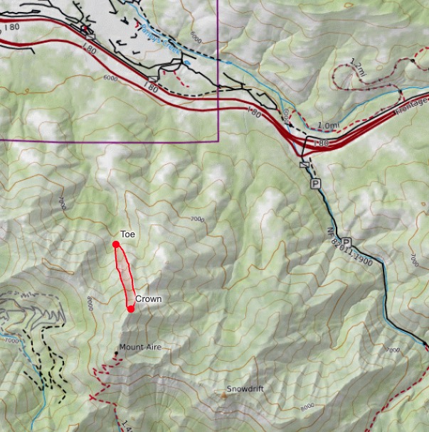
Salt Lake » Parleys Canyon » Mt Aire
Location Name or Route
Mt Aire
Comments
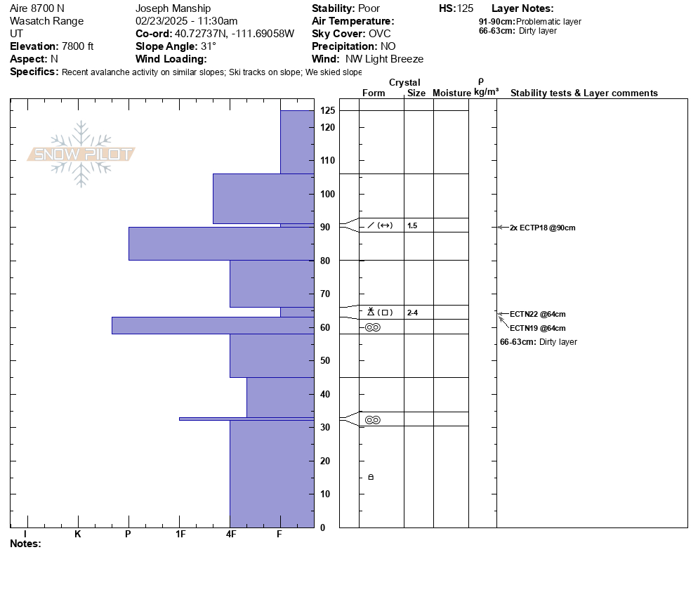
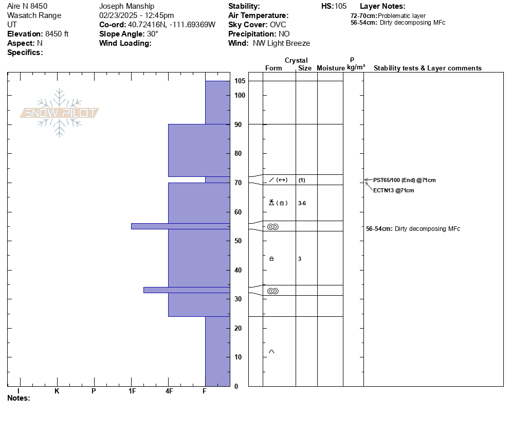
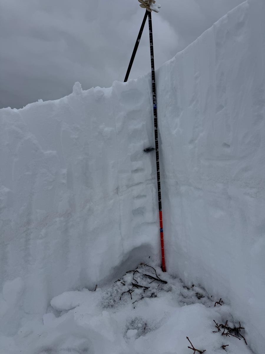
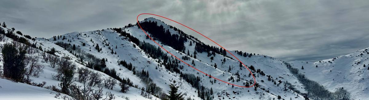
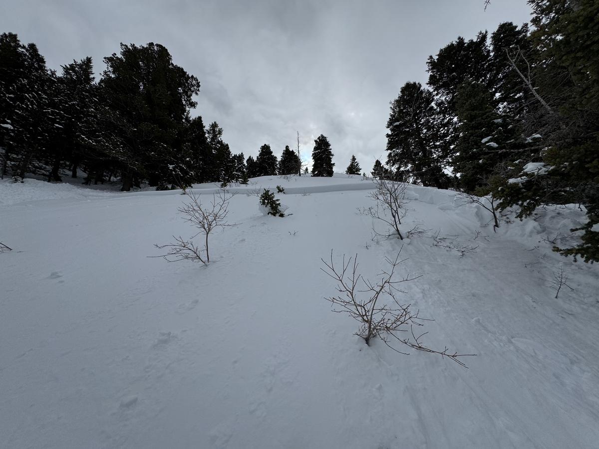
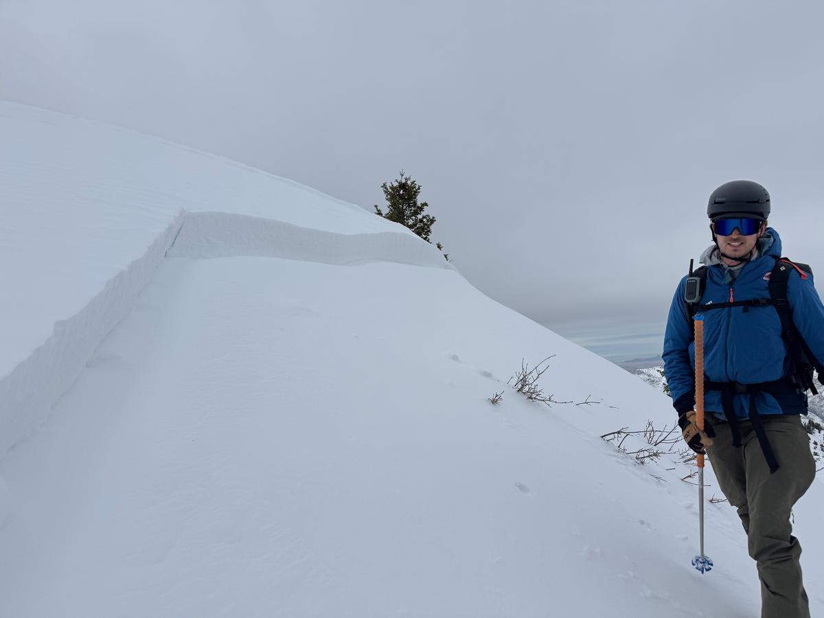
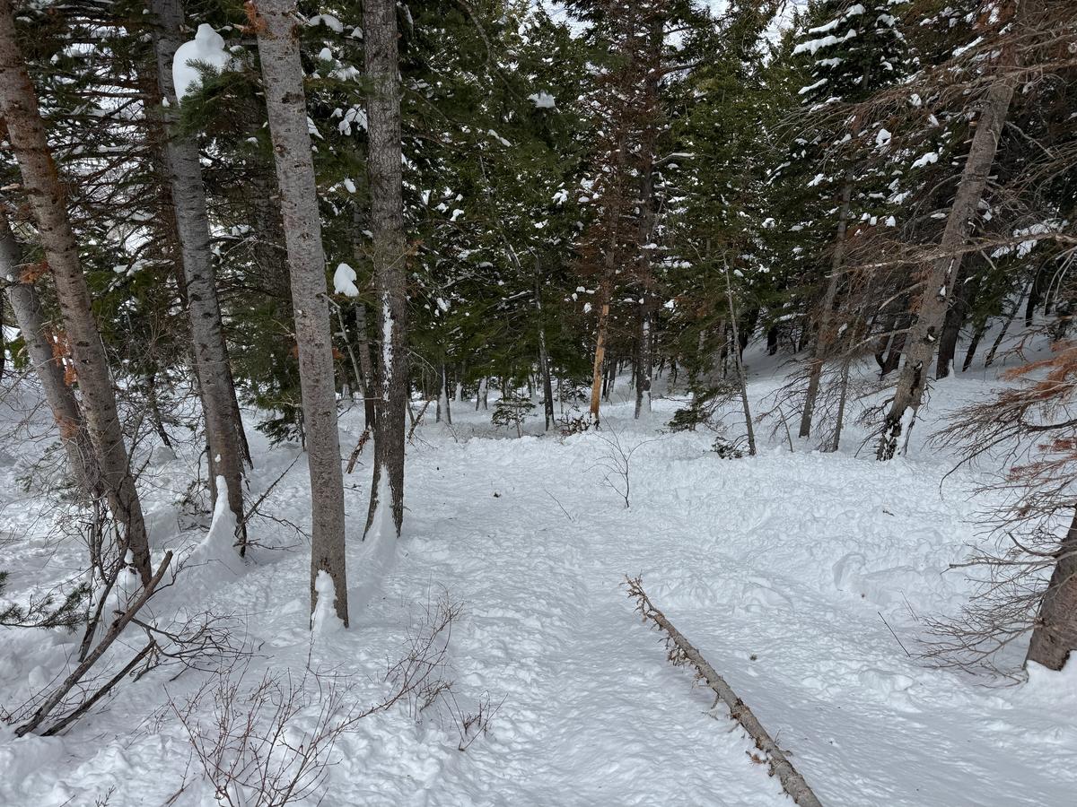
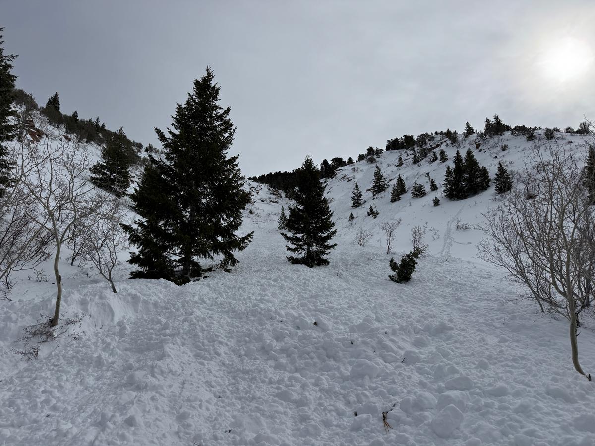
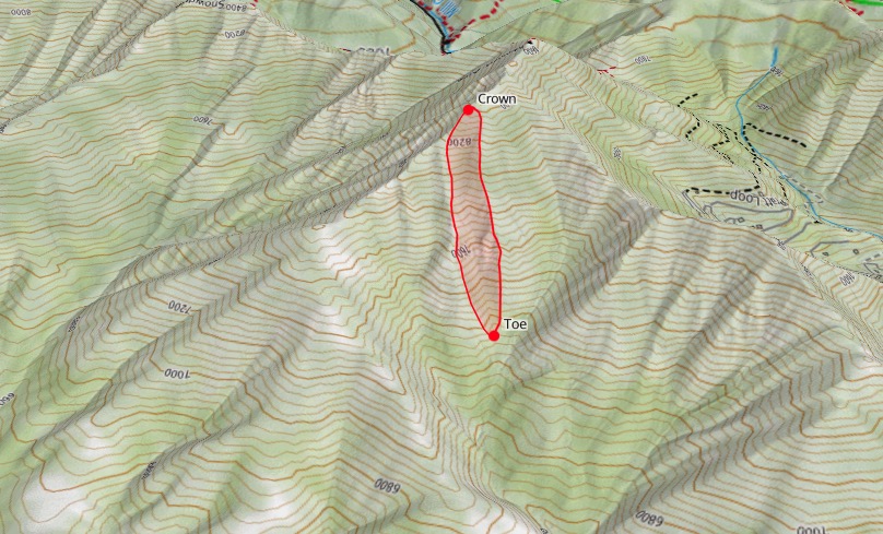
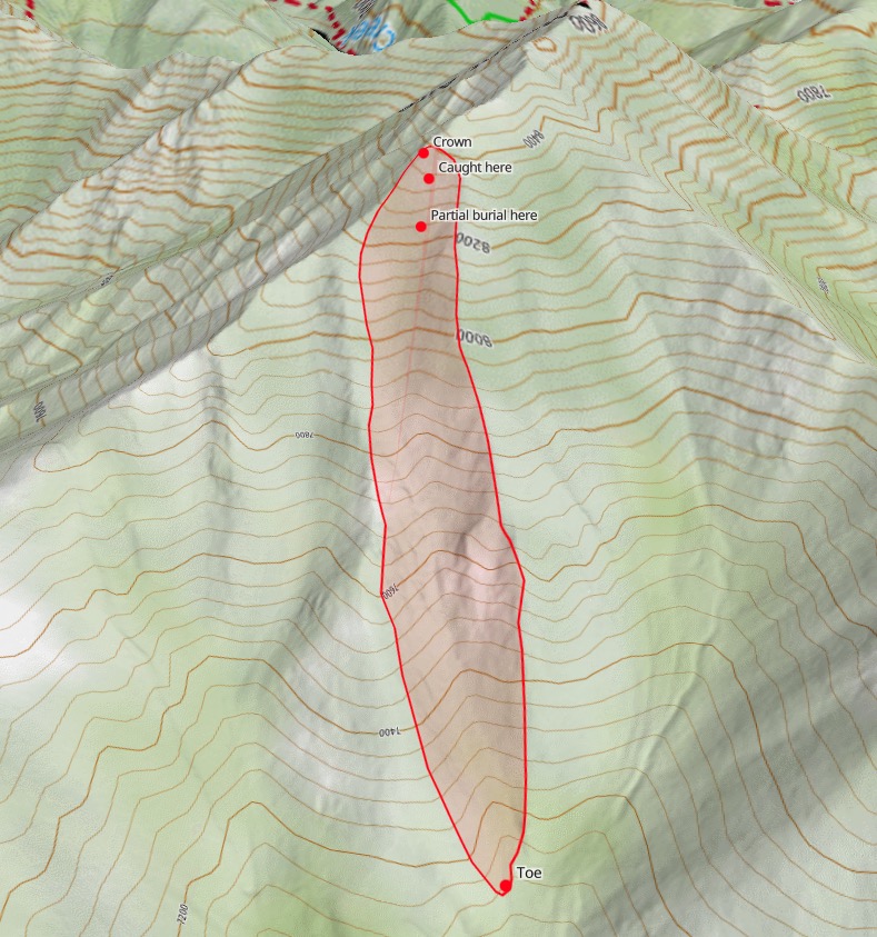
We went to look at the site of an avalanche accident from Saturday February 22nd involving one skier that was caught, carried, partially buried with minor injuries while ascending the slope. We found an avalanche that was 2' deep at the max and averaged 1' deep. It was 150' wide and ran 1400' vertical feet terminating in the aspens and scrub oak low on the slope. In the middle of the avalanche it was over 300' wide and entrained more snow eventually turning into wet debris at the toe. This individual was caught while ascending and was very lucky to have stopped higher on the avalanche path. The weak layer in this case was a soft (fist hard) layer of broken precipitation particles that was very thin. It was made up what we identified as needle grains that still had sharp edges.
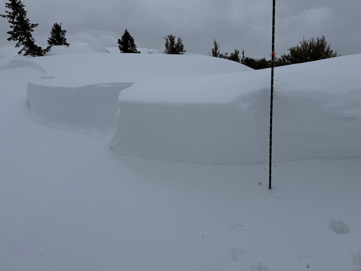
We dug 2 snowpits that both showed the weakness and propagation on a thin 1cm layer of broken precipitation particles (needles). Crystal card marks weak layer. We discussed it and do not believe it would have been easy to identify this layer with quick hand pits, probe or ski pole tests and that the only way to find this layer would have been a snowpit with some form of stability tests.

Today's Observed Danger Rating
None
Tomorrows Estimated Danger Rating
None
Coordinates