


Observation Date
2/4/2025
Observer Name
Hardesty
Region
Salt Lake » Big Cottonwood Canyon
Location Name or Route
BCC
Comments
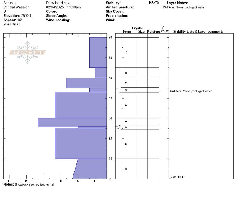
Travel was initially to Spruces and barely up Days Fork to assess low elevation structure. Snowpack on northerlies remain very structured but now isothermal. Some pooling found about a foot down in a dense to less dense structural interface. Expected some ability to trigger wet push-alanches but could not do so. Imagine any avalanche could gouge down into this isothermal layering making for a larger dense debris pile. Until it cools down, wet avalanches should be on the radar at low/mid elevation slopes.
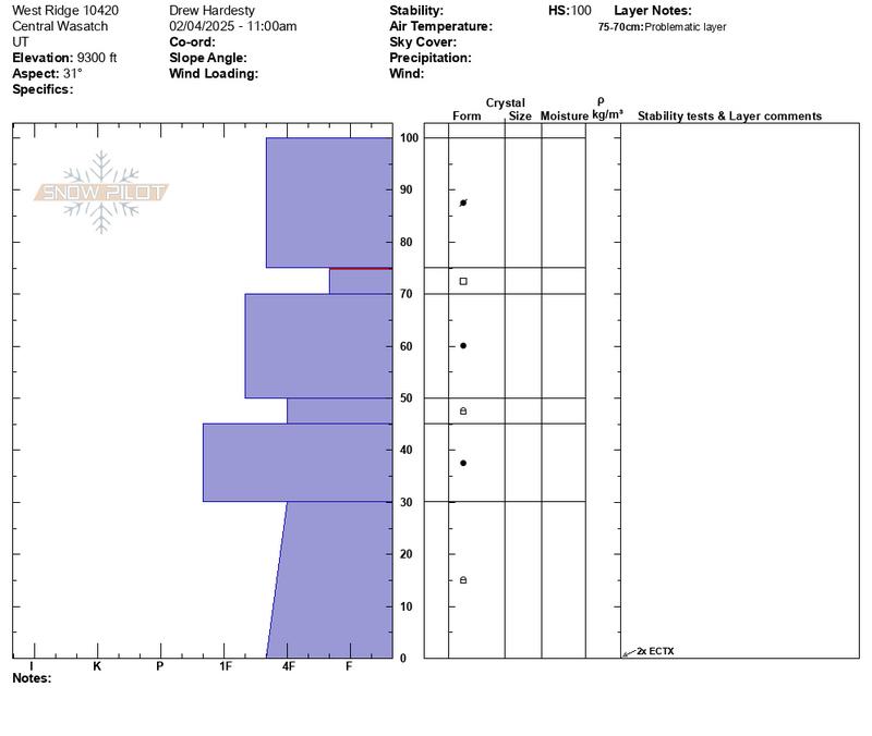
Continued up canyon to travel along the west ridge of 10420 to look at wind loading from southwest winds and to see if the classic areas facing north had avalanched again. Found alternating soft and hard wind slabs of snow that appeared welded in. 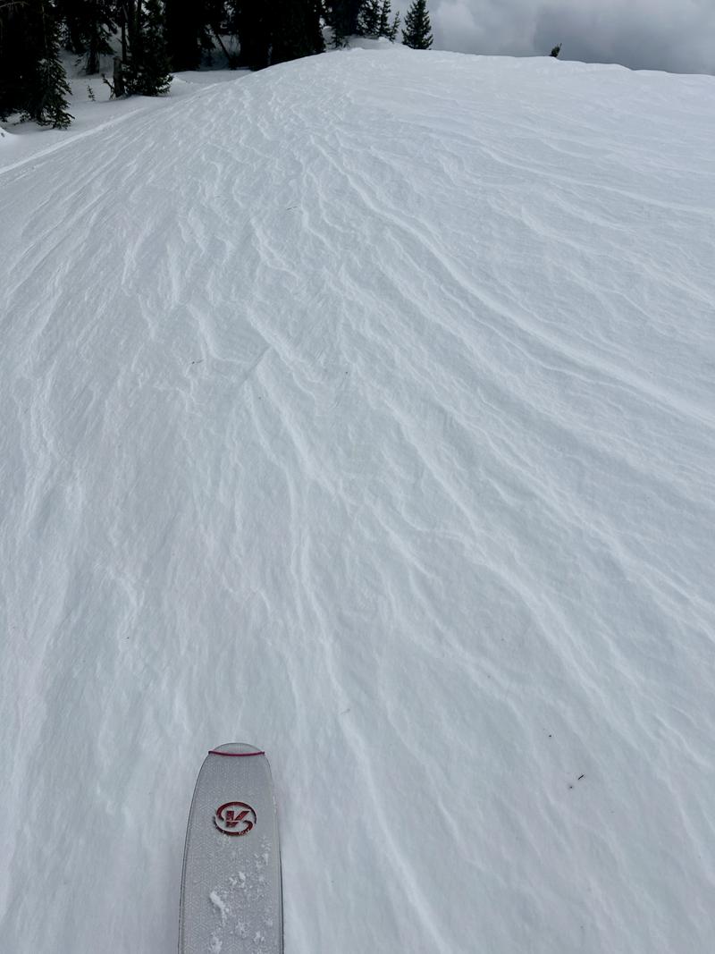
Profile at 9300' HS 100cm showed as expected a very layered snowpack that trending dormant/stable (non-windloaded).
Travel further up the ridge and remotely triggered a cornice which then triggered a repeater pocket to the ground 18" deep and 40' wide and also triggered a shallow new wind slab 10" deep and 35' wide that failed on last week's weak faceted surface snow.
Today's Observed Danger Rating
Considerable
Tomorrows Estimated Danger Rating
None
Coordinates