Join us at our 2nd Annual Blizzard Ball

Forecast for the Salt Lake Area Mountains

Drew Hardesty
Issued by Drew Hardesty on
Thursday morning, January 16, 2025
What are the odds?
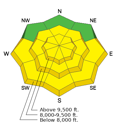
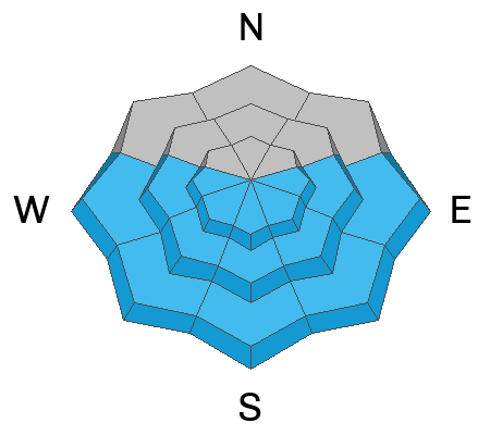
It's a MODERATE avalanche danger with a low-likelihood but high-consequence situation. There's a LOT of uncertainty and I don't like it. It's possible to trigger (even from a distance) a 2-4 foot thick slab avalanche failing on buried sugary faceted grains that may kill you. Those odds aren't good enough. This issue is on west to north to east facing terrain. Travel with extreme caution today.
With more sun and warming today, solar slopes will continue to shed wet sluffs with potentially deep debris piles.
Low
Moderate
Considerable
High
Extreme
Learn how to read the forecast here
Special Announcements
Join the UAC at Deer Valley on January 30th for the 2nd Annual Blizzard Ball Gala. The night will be full of fun including delicious cuisine, live music, an auction, and presentation by Bruce Tremper.
Weather and Snow
Skies are clear.
Mountain temperatures are in the low to mid-30s. Winds are light from the southwest. 11,000' anemometers are occasionally gusting into the 20s.
We'll have sunny skies today with temps rising into the upper 30s to low 40s. Winds will increase a touch from the southwest, with higher winds speeds expected north of I-80.
A quick-hitting storm punches through tomorrow afternoon through Saturday that could bring as much as 6-12" of cold smoke. It does appear that the DLE ('dreaded lake effect') will be in play on Saturday. Temps will drop rapidly behind the front, with the mercury on either side of zero degrees Fahrenheit. Ridging becomes the dominant feature for next week with some hints of a pattern change next weekend; we'll see.

Travel and riding conditions are excellent although a touch slow. Stray from true north and you'll find a breakable sun crust, particularly on the steeper terrain; although this crust will soon soften with today's sun and warming temps. Enjoy.
Recent Avalanches
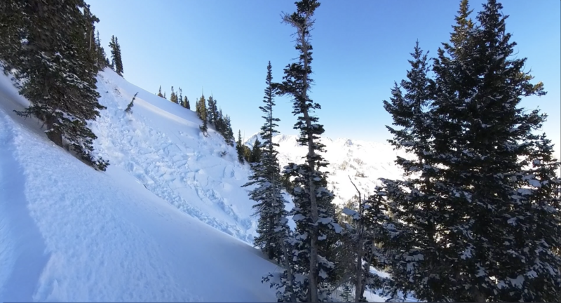
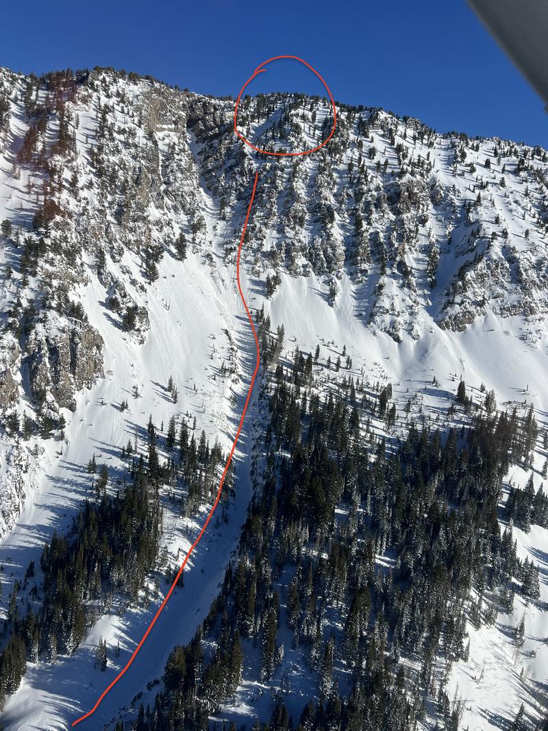
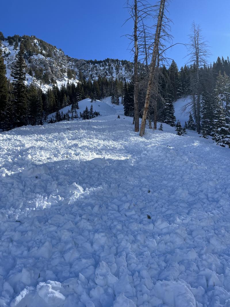
Yesterday a ski party headed for the Hallway couloir remotely triggered a significant avalanche 2-3 feet deep and 70 wide that failed on the old PWL. The starting zone is a steep northwest facing piece of terrain at 10,400'. It ran a LONG way down the couloir and down into the Tube (in Cardiff Fork of BCC). This is high optic terrain and I am glad no one was down below. I appreciate the report from the ski party as well as numerous photos (incl Powderbird) from others in the area.

Explosive control work along the south end of the PC ridgeline pulled out three avalanches into the old faceted snow on north facing slopes at 9700'.
A late report from Tuesday was of a party triggering one foot thick 'repeater' pockets in Days Draw in steep north facing terrain. More INFO.
Ad
Avalanche Problem #1
Persistent Weak Layer
Type
Location
Likelihood
Size
Description
The PWL of weak, faceted snow is Problem #1. It's what kills people in this business.
Avalanches on this layer are more likely in thin, rocky terrain or where avalanches have already occurred this season. I personally find these conditions to be more dangerous than HIGH avalanche danger days because we go along minding our business with no signs of instability and then BANG - we find the thin trigger point and it's off to the races. Stability tests can give misleading or dangerous info or not capture a thin trigger point only 100' away. Cracking and collapsing are increasingly rare and the avalanches are only trickling in. We may ride three slopes before the fourth one fails. Remember - tracks on a slope are zero indication of stability.
More info below. Compare this to the Wet Loose characteristics in the next box. For more information on Travel Advice for the Avalanche Problems, click HERE
Avalanche Problem #2
Wet Snow
Type
Location
Likelihood
Size
Description
With morning temps already in the low to mid-30s, it will not take long for the snow on the steep sunlit slopes to become wet and unstable. Both natural and human triggered wet loose avalanches are expected today. Fortunately, they are WAY WAY more predictable and manageable than avalanches involving a PWL. See below.
Additional Information
The Data Explorer for avalanches on the PWL since Christmas Eve -
General Announcements
This information does not apply to developed ski areas or highways where avalanche control is normally done. This forecast is from the U.S.D.A. Forest Service, which is solely responsible for its content. This forecast describes general avalanche conditions and local variations always occur.