Join us at our 2nd Annual Blizzard Ball

Observation: American Fork

Observation Date
1/10/2025
Observer Name
Zimmerman-Wall
Region
Provo » American Fork
Location Name or Route
Pagan Basin
Weather
Sky
Few
Wind Direction
West
Wind Speed
Moderate
Weather Comments
Started tour at 1030am. Few clouds and wind gusts along highest ridges were 20-25mph. Clouds increased throughout the day and winds stayed steady Westerly gusting to 40mph by afternoon. Snow moving off ridgelines. Temperatures stayed in check and it was -5C in the shade at 9000'. Finished by 1500 and the sky was nearly completely covered as the next storm makes its way in.
Snow Characteristics
Snow Surface Conditions
Powder
Wind Crust
Snow Characteristics Comments
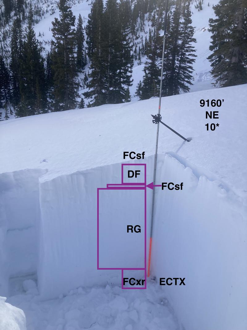
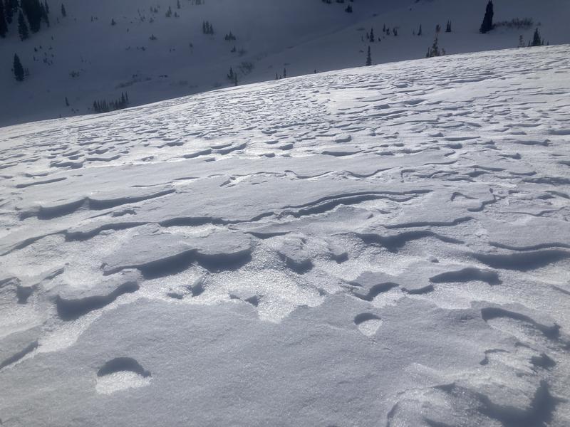
In the sheltered areas below the wind, the snow surface was creamy and even beginning to facet in some places. There was also a windskin and notable texture in many open slopes at mid and upper elevations. Along the ridgelines there was a lot of wind damage from the easterly winds earlier this week. No propagation in snowpack tests (ECTX and PST 100/100). CT5 SC at ground was inconclusive.
Red Flags
Red Flags
Wind Loading
Poor Snowpack Structure
Red Flags Comments
The wind loading was the primary red flag. Although I found strong over weak snow, the structure in the area visited was the best I have seen in a little while. Not getting my hopes up though. Want to see some more loading events stress this layering again. There were plenty of recent notable explosives triggered avalanches in the ski area just up drainage on similar aspects form this week.
Avalanche Problem #1
Problem
Persistent Weak Layer
Trend
Same
Problem #1 Comments
Still there. Although, in the Sinners Pass area I was surprised to see the layer thickness was less than 20cm (Ground to 20cm). These facets were also a bit damp and would clump in your hand.
Avalanche Problem #2
Problem
Wind Drifted Snow
Trend
Increasing Danger
Problem #2 Comments
Winds were moving snow along the highest ridges and channeling down through the terrain. Not a lot of drifting at mid elevation. Upper elevation it was pluming off ridges from time to time, but not much suspension. Some saltation of the surface snow noted in open terrain.
Snow Profile
Aspect
Northeast
Elevation
9,100'
Slope Angle
10°
Comments
Numerous snow machine tracks throughout the area and when I talked to the party, they indicated they had no collapsing or cracking, and had not seen any activity between Tibble Fork and Sinners Pass. They kept it chill in the trees and some open meadows, but were not interested in the larger slopes. However, they did get on some pieces of avalanche terrain (simple) and there was no sign of instability.
Photo:
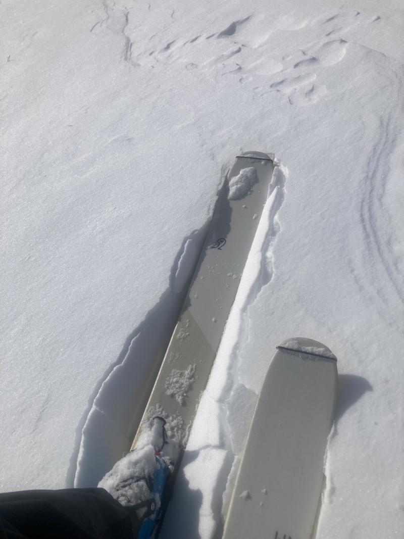
1. Texture *wind which way?
2. Wind skin was sometimes supportable under skis, and would sometimes break apart while skiing and skinning.
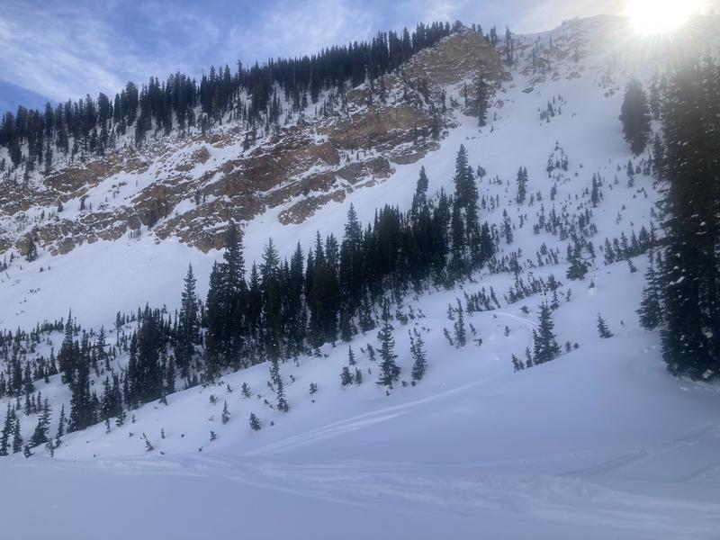
3. Pagan Basin. It looked like a subtle crown could be seen under the cliffs. And there were some brushy limbs sticking up here and there in the main bowl. This made me think it had run during one of the last storm cycles in December. However, there wasn't notable debris stacked up in the forest below.
4. Pagan Basin Profile photo to accompany formal graphical profile
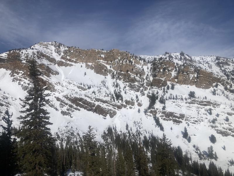
5. Wet loose out of Sugar cliffs, but looked to be from yesterday.
Today's Observed Danger Rating
Moderate
Tomorrows Estimated Danger Rating
None
Coordinates