

Observation Date
1/2/2025
Observer Name
Gagne/Covington
Region
Provo » Provo Canyon
Location Name or Route
Big Springs
Comments
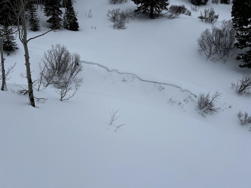
Propagation Saw Test on the above pit scoring 45/130 END. Although the ECT score (ECPT29) demonstrates it would be hard to trigger an avalanche, the PST demonstrated it is still possible. At mid elevations, the likely area where you could trigger an avalanche failing on the PWL would be in steeper and thinner snowpack areas, such as around rock outcrops.
Video
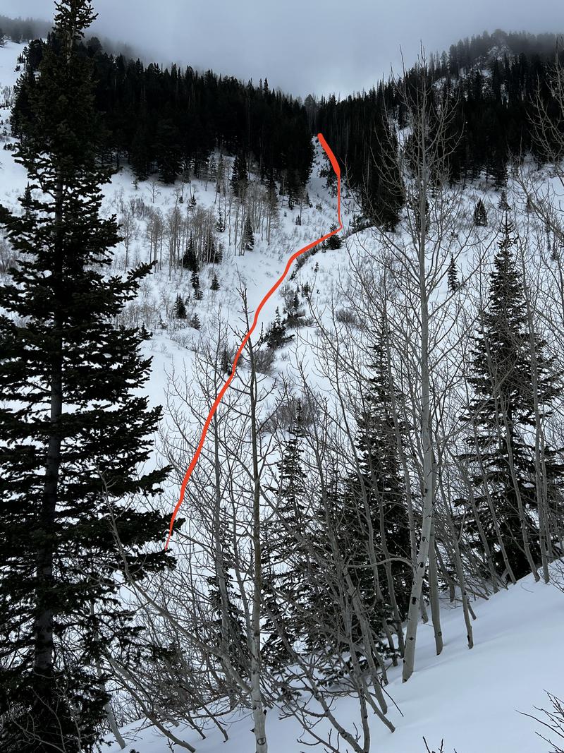
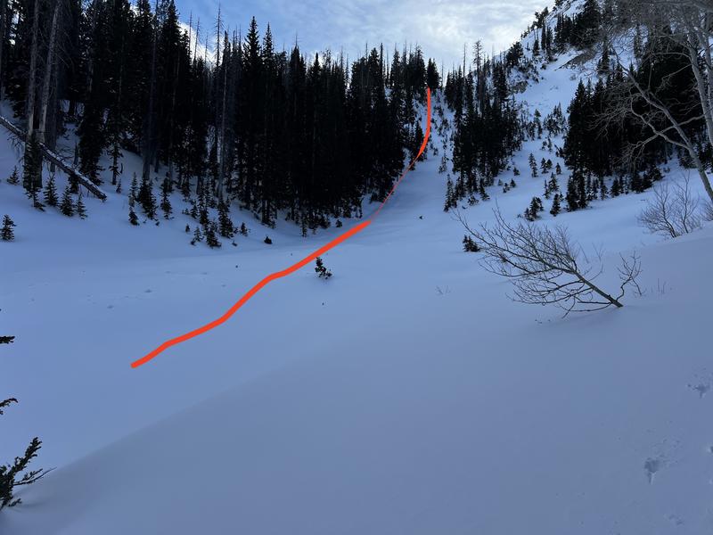
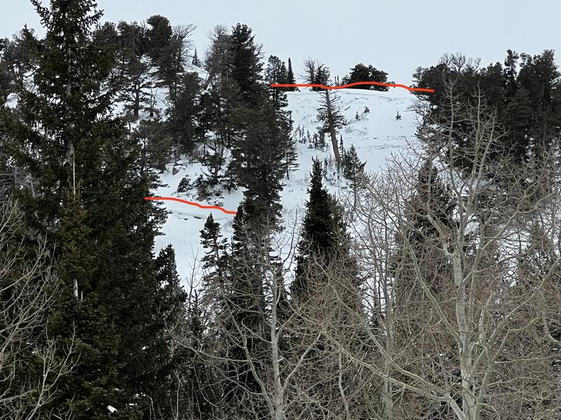
Photos of avalanches that ran naturally, likely during the Dec 27 avalanche cycle. These were all on northerly aspects above 8,000'. We are unsure if any ran on faceted layers.
Deeper snowpacks that are showing signs of strengthening - at least through the mid-elevations - are encouraging signs. We would still give the PWL more time before stepping into avalanche terrain on northerly aspects.
Today's Observed Danger Rating
Considerable
Tomorrows Estimated Danger Rating
Considerable
Coordinates