Forecast for the Logan Area Mountains

Toby Weed
Issued by Toby Weed on
Wednesday morning, January 1, 2025
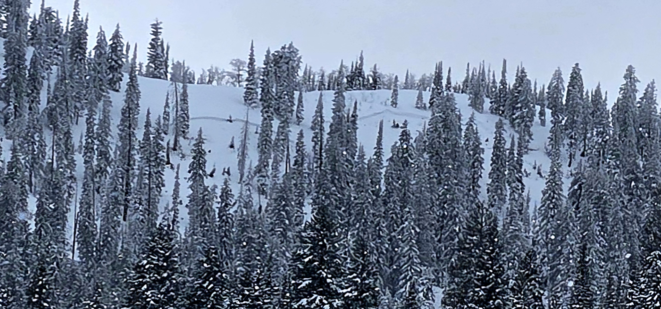
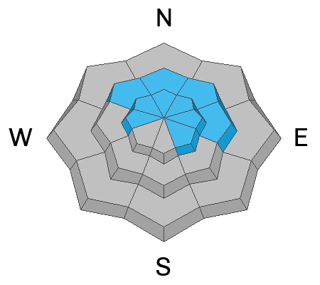
The avalanche danger is CONSIDERABLE in the Logan Zone, with dangerous avalanche conditions still on many slopes. People are likely to trigger large and destructive avalanches on slopes steeper than 30°, especially on drifted northerly-facing slopes at mid and upper elevations. Avalanches could be triggered remotely (from a distance) or from the flats below steep slopes. Heavy snowfall and drifting by strong winds will once again cause rising danger this afternoon and tonight.
Careful snowpack evaluation, cautious route-finding, and conservative decision-making are required. People should avoid being on or beneath drifted slopes steeper than 30°.
Low
Moderate
Considerable
High
Extreme
Learn how to read the forecast here
Special Announcements
Now is a great time to dial in your safety gear including putting fresh new batteries in your beacons! Local shops across the state will be handing out free Batteries for Beacons now until February 1, 2025. All you need to do is fill out a quick survey and grab the AAA or AA batteries you need to keep your beacon fresh this season. Find participating shops and more info HERE.
Weather and Snow
We've been staying out of avalanche terrain in the last few days of 2024, off of and out from under steep slopes. Cold temperatures have kept the snow nice, even in sunny terrain, and we found excellent powder riding conditions. The snow is supportable enough to float a sled in most places, but it's still pretty shallow. We did not hit any rocks, but there are still plenty of shallowly buried land mines out there.
About two feet of very heavy snow accumulated in upper elevation terrain across the Logan Zone, with much deeper drifts observed in upper elevation lee-slope deposition areas. The heavy snow has become a stout slab layer capping the widespread weak snow and poor snowpack structure formed earlier in the season. The mountain snowpack is gradually adjusting to the weight, but large, destructive avalanches remain possible. Southerly low-elevation slopes are bare of snow or have only minimal snow cover. Heavy snowfall and drifting by increasing winds blowing from the southwest will cause increasing danger this afternoon and especially tonight, with natural avalanches increasingly likely. Winter campers should set up camp well away from steep slopes.
We urge people to continue to stay off of and out from under drifted slopes steeper than 30°, as dangerous avalanches can be triggered remotely (from a distance) or from below.
-The 8400' Tony Grove Snotel reports 15° F, with 56 inches of total snow.
-Winds on Logan Peak increased overnight and are currently blowing from the southwest around 30 mph, with gusts around 45 mph, and it's 9° F. The wind chill value at 9700' is -13° F.
-It's 12° F at 8800 feet at our Card Canyon station, with 41 inches of total snow.
-On Paris Peak at 9500 feet in Bloomington Canyon, it is 6° F, and the winds blow 20 to 30 mph from the south-southwest. Wind chill value of -13° F as well.

Expect snowfall to commence around 11:00 in the mountains, and it will be heavy at times. 8500' high temperatures will be around 23° F, with 15 mph winds from the west-southwest with gusts into the 30s. Wind chill values are expected to be a few degrees below zero. Tonight, heavy snowfall is expected, with continuing elevated winds from the west and temperatures rising to around 24° F. Today and tonight, 13 to 21 inches of accumulation is possible in upper-elevation terrain!
The weather pattern will remain active through the weekend and into next week.

For more information, visit the UAC weather page here: Weather - Utah Avalanche Center
For Logan-specific weather, go here: Logan Mountain Weather - Utah Avalanche Center
Recent Avalanches
We are very sad to report that there were two confirmed fatalities due to two separate avalanches that happened in the Salt Lake area mountains over the last 3 days... Main Porter Fork and Davenport Hill
-Large natural avalanches were observed in the past few days across the zone, from the Wellsvilles to the Northern Bear River Range
- On Christmas Eve, two local riders (brothers) had a close call with a large avalanche in Steep Hollow. The 2-foot-deep and 700-foot-wide avalanche occurred on a northeast-facing slope at around 9000 feet in elevation. The accident report is HERE.
- On Saturday, we remotely triggered an avalanche of drifted storm snow from a lower-angled adjacent slope. Video HERE
- You can read all recent local observations HERE.

A crown from a recent natural avalanche in Egan Basin, ID, (Flygare, 12-31-24)
Ad
Avalanche Problem #1
Persistent Weak Layer
Type
Location
Likelihood
Size
Description
Very weak faceted snow exists near the ground on almost all northerly-facing slopes at upper and mid-elevations. Other persistent weak layers have also been observed higher in the snowpack. Large and dangerous avalanches failing on the persistent weak layer are likely in drifted terrain, and they are possible even in sheltered areas.
  • Recent avalanches, shooting cracks, and collapsing (whumpfs) are signs of unstable snow, but these obvious signs of instability will not always be present.
  • Avalanches today could be triggered remotely (from a distance) or from below steep slopes in the flats.
Avalanche Problem #2
Wind Drifted Snow
Type
Location
Likelihood
Size
Description
Winds out of the south and southwest increased overnight, and they will continue to strengthen today. Drifting will create new slabs of wind-drifted snow in exposed terrain. Freshly formed wind slabs will continue to overload slopes with poor snow structure.
  • Avalanches of wind-drifted snow are most likely on the lee side of major ridges.
  • Drifting will form new wind slabs in exposed terrain and in and around terrain features like cliff bands, sub-ridges, gullies, and scoops.
  • Stiff wind slabs may allow you to get out onto them before releasing.
Additional Information
Monday, we found great powder riding in the safe low-angle meadows in Franklin Basin north of the State Line, but the snowpack structure is pretty bad.

On Saturday we remotely triggered a large Avalanche above the Tony Grove Campground. The video is HERE
The crown of a remotely triggered avalanche near Tony Grove Lake.
General Announcements
-National Forest Winter Recreation Travel Maps show where it's open to ride: UWCNF Logan, Ogden LRD Tony Grove, Franklin Basin CTNF Montpelier
-Sign up for forecast region-specific text message alerts. You will receive messages about changing avalanche conditions, watches, and warnings...HERE.
-For all questions on forecasts, education, Know Before You Go, events, online purchases, or fundraising, call 801-365-5522.
-To report an avalanche or submit an observation from the backcountry, go HERE.
-Remember, even though the gate is still open, the Tony Grove Road is not maintained for winter driving.

This forecast is from the U.S.D.A. Forest Service, which is solely responsible for its content. This forecast describes general avalanche conditions, and local variations always occur.