UDOT PLANNED AVALANCHE CLOSURES!!

Observation: Pole Line Pass

Observation Date
12/28/2024
Observer Name
Champion & Andrews & Rizzo
Region
Provo » Snake Creek » Pole Line Pass
Location Name or Route
Pole Line Pass
Weather
Sky
Obscured
Precipitation
Moderate Snowfall
Wind Direction
West
Wind Speed
Moderate
Weather Comments
Storm day conditions persisted throughout. Precipitation ranged from light snowfall to periods of heavy snow, though it generally remained moderate over the course of the day. Winds were moderate to strong along ridge lines, but in the areas we traveled, wind speeds were lighter with occasional moderate gusts. Wind transport was evident across exposed terrain. Skies stayed mostly obscured, with a shifting cloud layer intermittently revealing and concealing the landscape, making it difficult to observe upper peaks and larger avalanche paths. Temperatures appeared to increase as the day progressed, raising the snowline and introducing rain at lower elevations.
Snow Characteristics
New Snow Depth
14"
New Snow Density
High
Snow Surface Conditions
Powder
Wind Crust
Damp
Snow Characteristics Comments
Precipitation totals were higher on the Snake Creek proper side, with depths of 16–18". Snowfall decreased as we moved over Pole Line Pass toward American Fork, where totals ranged closer to 12–14". Across both areas, the snow was high-density due to the warmer temperatures associated with this storm. The new snow consisted of a mix of broken precipitation particles, stellar crystals, and graupel, ranging from 1mm to 3mm in size.
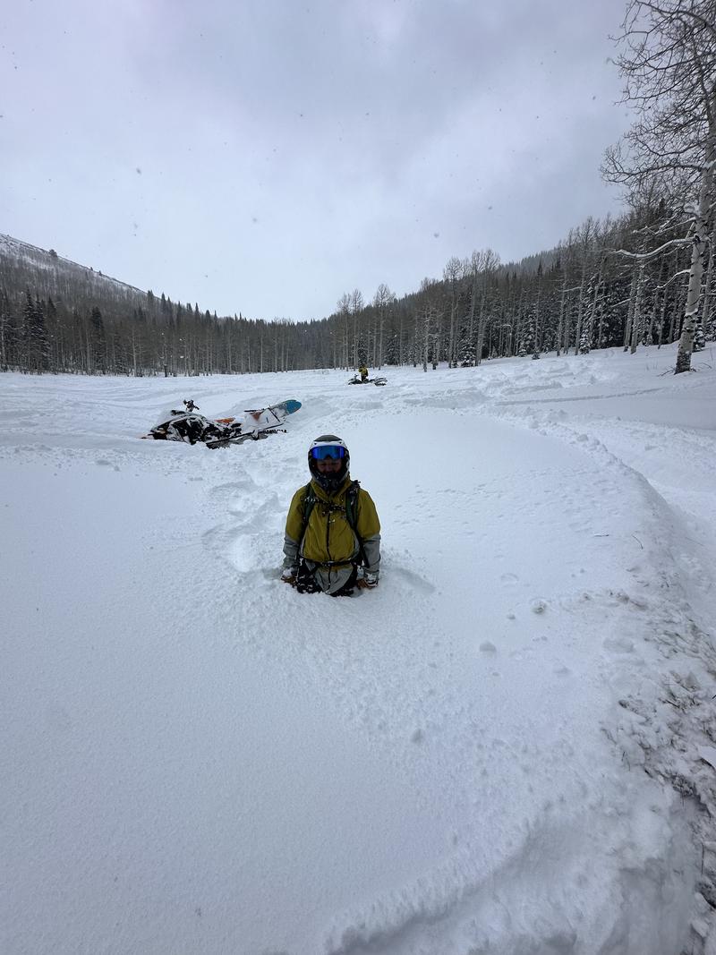
The high-density snow created challenging and at times humorous riding (sledding) conditions. The snowpack was upside in nature, with a more supportable surface layer that often gave way, allowing tracks to punch through into the underlying facets.
Red Flags
Red Flags
Recent Avalanches
Heavy Snowfall
Wind Loading
Cracking
Collapsing
Poor Snowpack Structure
Red Flags Comments
Every red flag in the book was out there today. We saw widespread cracking and collapsing while riding. Nearly every cutbank produced large, spanning cracks, and meadows easily collapsed and settled under our sleds. That said, in many of the mid-elevation areas we traveled, it seemed like the snowpack was still missing enough weight to really get things moving. Similar to what I observed with Dave yesterday, steep test slopes would crack and collapse, but we couldn’t get them to slide.
Avalanche Problem #1
Problem
Wind Drifted Snow
Trend
Increasing Danger
Problem #1 Comments
Wind was the key player again today in the Snake Creek zone. Wind-drifted snow is the primary issue, and when combined with the persistent weak layer, it’s setting up for large avalanches 1–3 feet deep. We noticed significant flagging along ridgelines and observed an avalanche near 9,400’ on a north aspect in the wind zone. It’s unclear whether the avalanche was skier-triggered or natural. Other parties skiing adjacent slopes reported large booming collapses.
Outside of the wind zones, we saw cracking and collapsing but no propagation in the pit we dug. That was just for the one area we traveled, though. In this region, wind seems to be the key factor adding weight to the snowpack. In other zones—like upper-elevation Snake Creek—the additional weight might come from straight snowfall and higher water totals.
Avalanche Problem #2
Problem
Persistent Weak Layer
Trend
Increasing Danger
Problem #2 Comments
The weak snowpack structure in the Provo area mountains is just as glaring as anywhere else in the Wasatch. It’s obvious when digging pits—or even just getting your sled stuck. Facets pour out of the pit walls, and when you step off your sled you posthole straight to the ground. It’s an eerie feeling when entire slopes or meadows settle on that weak layer. Personally, I’ll be steering clear of any slope connected to, below, or touching terrain steeper than 30° while the buried persistent weak layer (PWL) is active. Over the weekend, this layer will be impossible to ignore, with plenty of cracking, collapsing, and whumpfing. Once the storm clears and the sun comes out, managing this will become even trickier, and any slope that hasn’t already slid will stay highly suspect.
As I’ve mentioned before, weight is the driving factor here—and my uncertainty lies in whether it will be wind, snow, or skiers and riders that ultimately tip the scales.
Snow Profile
Aspect
Northeast
Elevation
8,800'
Slope Angle
32°
Comments
Total snow height measured 46" (115 cm).I wasn’t able to get any propagation in my pit at this location, which was dug next to a steep cutbank where we observed large cracking but no movement in the snow. The ECT just collapsed under the shovel blade. The snowpack here showed a very weak structure, but similar to yesterday, it didn’t seem like this slope had enough wind loading to create a meaningful load—or at least not enough to form a true slab.
It was an interesting day with widespread cracking and collapsing. On one large, steep cutbank near Bonner Hollow on a northeast aspect around 8,500', we were able to get the slope to collapse and shoot large cracks across its entirety—but it still didn’t slide, even though the slope angle exceeded 30°.
It feels like the mid-elevations in the Provo region—or at least the Snake Creek area—have been more sheltered from the winds compared to the Central Wasatch.
The large slope collapse below the road near Bonner Hollow - NE Aspect - 8500'
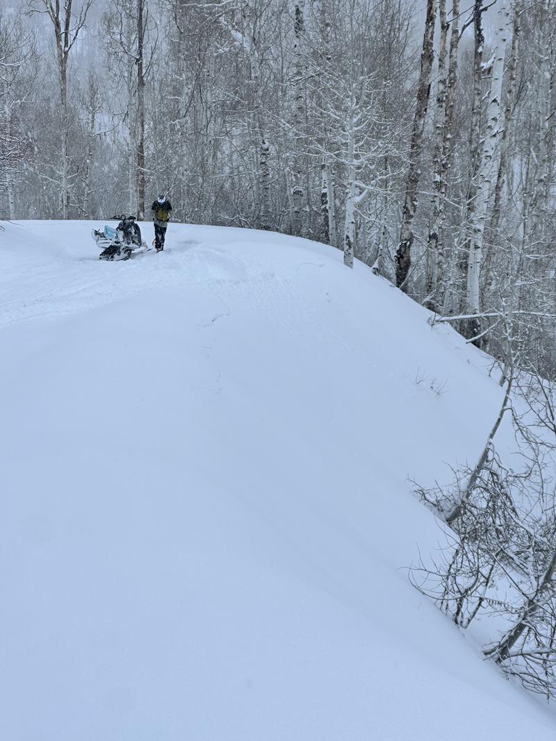
Upslope cracking caused by going slightly off the road - NE Aspect 8800'
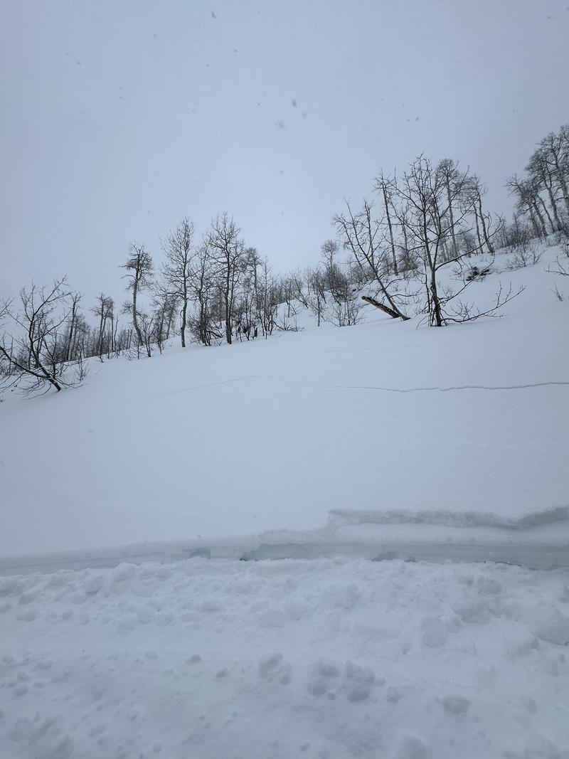
Additonal large cracking, and some new snow breaking upslope of the road - NE Aspect - 8600'
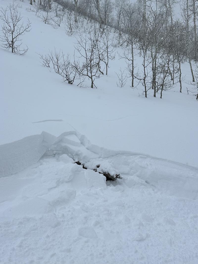
Additonal cracking from the same upslope cut as above - NE Aspect - 8600'
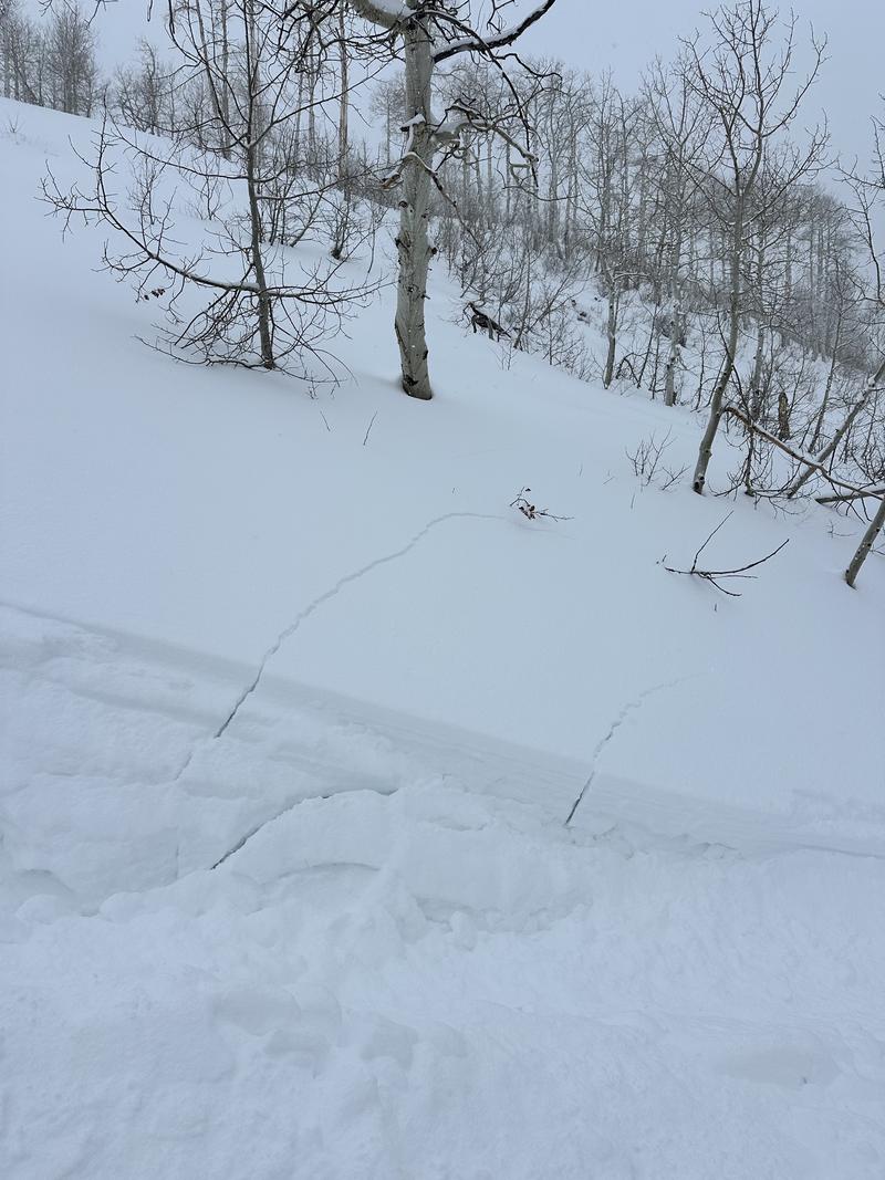
New snow depth/post-holing conditions in meadows
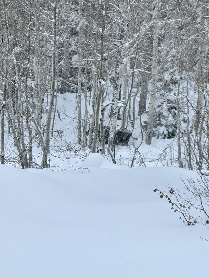
Bull Moose
Today's Observed Danger Rating
High
Tomorrows Estimated Danger Rating
High
Coordinates