Join us at our 2nd Annual Blizzard Ball

Forecast for the Provo Area Mountains

Drew Hardesty
Issued by Drew Hardesty on
Thursday morning, December 19, 2024
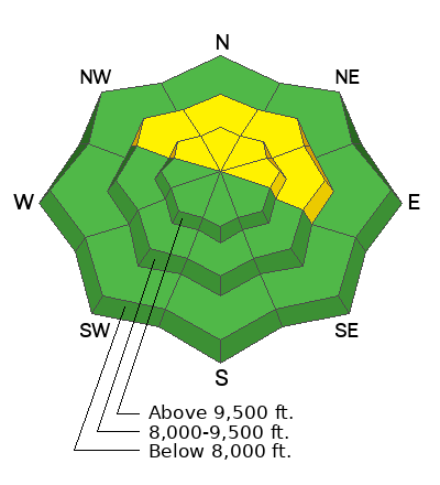
A MODERATE danger exists for triggering a 1-2 foot thick slab avalanche in steep northwest to easterly facing terrain of the mid and upper elevations. Heightened avalanche conditions exist on specific terrain features.
Pay attention to the warming temperatures as WET LOOSE AVALANCHES will become possible on steep solar terrain.
Low
Moderate
Considerable
High
Extreme
Learn how to read the forecast here
Special Announcements
Now is a great time to dial in your safety gear including putting fresh new batteries in your beacons! Local shops across the state will be handing out free Batteries for Beacons now until February 1, 2025. All you need to do is fill out a quick survey and grab the AAA or AA batteries you need to keep your beacon fresh this season. Find participating shops and more info here.

Join the UAC and DPS Skis for a fun night of Avalanche Jeopardy this Friday, December 20th from 6:00 - 8:30 PM at Industry SLC. More information for this FREE event is available here. See you there!
Weather and Snow
Skies are clear. Temperatures are in the low to mid-30s and mountain inversions are building. Winds are from the west, blowing 15mph with gusts to 20. The next couple days will bring sunny skies, light wind and temps soaring to near 50°F in the mountains. Skiing and riding conditions are best described as thin and variable with plenty of sun and wind damage.
I was in the Aspen Grove and Timp Divide area on Monday and my report is HERE.
Mike Rossberg was in the Ant Knolls area Monday and his report is HERE>
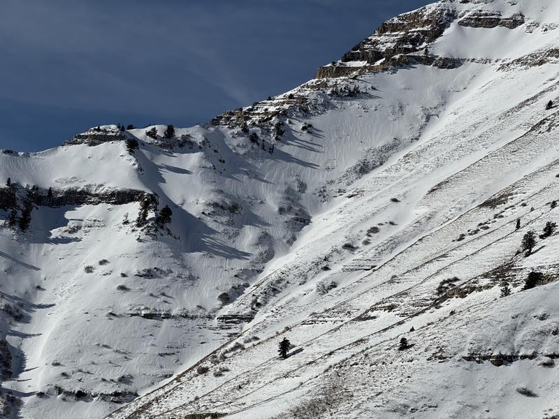
Trent Meisenheimer met up with the ski patrol at Sundance yesterday and his report is HERE. Photo below of Slide Canyon above Provo Canyon (thin coverage)
Recent Avalanches
No avalanches have been reported in the Provo mountains since last Friday.
Read all observations here.
Ad
Avalanche Problem #1
Persistent Weak Layer
Type
Location
Likelihood
Size
Description
It's been a dry early season and this naturally leads to a thin, weak snowpack and an overall poor structure. In wind loaded areas, it may be possible to trigger a soft or hard slab avalanche that fails on this early season weak faceted snow. This weak faceted snow is known as a PWL (persistent weak layer) for a reason - that it takes a very long time to heal. These avalanches may be 12-18 inches deep and up to 100 feet wide and most likely found in the mid and upper elevations.
Avalanche Problem #2
Wind Drifted Snow
Type
Location
Likelihood
Size
Description
Look for pockets of hard and soft wind slab around terrain features of the mid and upper elevations. While stubborn, these can crack out on you, even while you may be out on the teardrop of the plate of cohesive snow.
General Announcements
This information does not apply to developed ski areas or highways where avalanche control is normally done. This forecast is from the U.S.D.A. Forest Service, which is solely responsible for its content. This forecast describes general avalanche conditions and local variations always occur.