
Observation Date
12/15/2024
Observer Name
Kelly, Richards
Region
Salt Lake » Little Cottonwood Canyon » Cardiff Pass
Location Name or Route
Cardiff Pass
Comments
Total height of snow was 22" (55cm). The weakest snow we found was 9" (23cm) from the ground above a melt-freeze crust. The faceted snow in this layer was sensitive and we got propagation with 2 taps (ECTP2@ 23cm) and a shear with a compression test with 1 tap (CT1 @23 Sudden Collapse). We are starting to see more of a slab on top of the weak faceted snow. We did not ski this slope or any north or east facing terrain today.
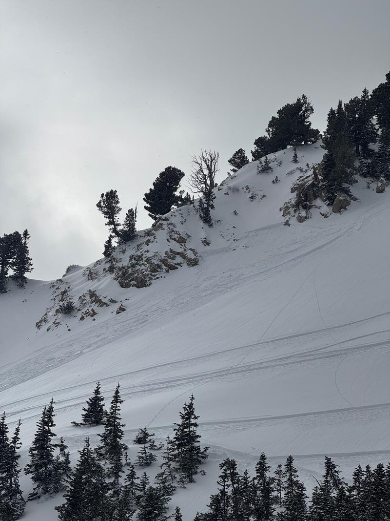
We watched a party trigger this avalanche on a northeast facing aspect at 9,800' in elevation. Read the full report HERE. They were able to call Alta Central and let them know everyone was ok. If you trigger an avalanche in the backcountry find out what you can do HERE.
Today's Observed Danger Rating
Considerable
Tomorrows Estimated Danger Rating
Considerable
Coordinates


