Join us at our 2nd Annual Blizzard Ball

Observation: Cutler Ridge

Observation Date
12/14/2024
Observer Name
Gagne/Brandt
Region
Ogden » Ben Lomond » Cutler Ridge
Location Name or Route
Ben Lomond - Cutler Ridge
Weather
Sky
Overcast
Wind Direction
Southwest
Wind Speed
Strong
Weather Comments
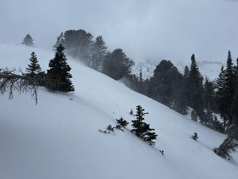
The morning began with a few snowflakes and we thought "here it comes!", but then it soon stopped with only a trace of new snow. Strong, sustained winds from the south and southwest above 7,000' drifting snow onto leeward northerly aspects.
Snow Characteristics
New Snow Depth
5"
New Snow Density
Medium
Snow Surface Conditions
Powder
Wind Crust
Damp
Snow Characteristics Comments
The Friday storm where the Ben Lomond weather station at 7,700' recorded 5" (13 cms) had settled to a damp 5 cms at the trailhead, although we also found up to 20 cms of dry new snow on a wind-sheltered slope just below 8,000'.
HS (Height of Snow or the depth of the snow) is 45 cms at the trailhead with 80 cms at 8,000'. Wind-drifted slopes at the upper elevations likely have well over a meter of snow.
Red Flags
Red Flags
Recent Avalanches
Wind Loading
Cracking
Poor Snowpack Structure
Red Flags Comments
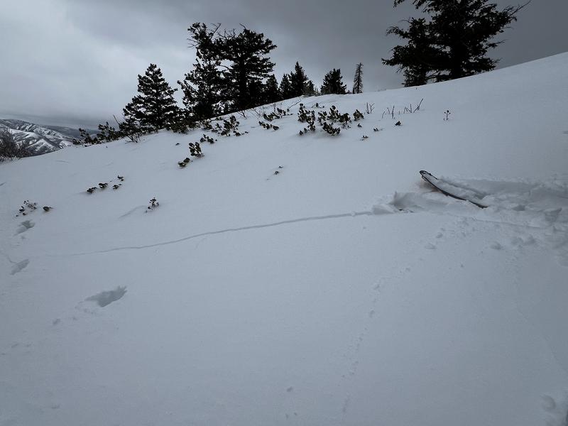
We found a poor snowpack structure on all slopes that held pre-existing snow. We only got one collapse, but had some cracking on wind-drifted slopes.
Avalanche Problem #1
Problem
Persistent Weak Layer
Trend
Increasing Danger
Problem #1 Comments
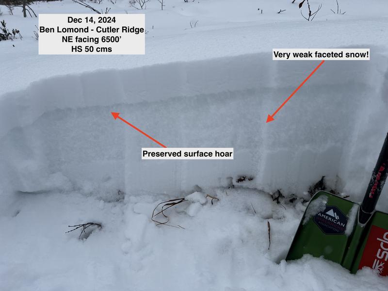
On slopes without wind-loading, the Thursday/Friday storm didn't create a slab on top of the facets and pit results were ECTX, with no real collapsing as the facets just smushed to the ground.
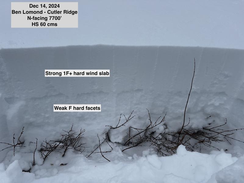
On slopes that were wind-loaded, our ECT scores were ECTV (collapse and propagation on isolation of the column), ECTP11, ECTP17, and ECTP21 - all full propagation failing in facets either mid-pack or down near the ground, indicating an unstable structure where you could likely trigger an avalanche on a wind-loaded slope.
Given winds are forecast to remain elevated, will identify the trend as Increasing Danger.
Snow Profile
Elevation
7,900'
Comments
On wind-loaded slopes facing northwest through east where the PWL exists, we traveled with a Considerable avalanche danger where human-triggered avalanches are likely. We avoided being on, adjacent to, or underneath wind-loaded slopes steeper than 30°. Several pit tests indicated an unstable structure with a strong slab on top of weak facets. Outside of wind-drifted terrain, the danger was Moderate where human-triggered avalanches are possible.
Photos:
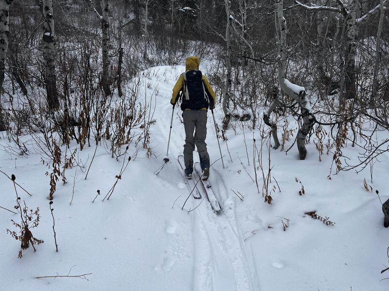
1. Scrubby, low-elevation conditions
2. Wind-drifting above 7500'
3. Cracking on wind-drifted slopes
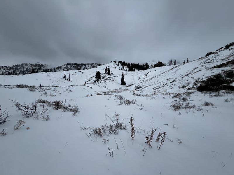
4. General snowpack coverage just below 8000' on Cutler Ridge (the slope had been wind-scoured somewhat)
5. The snowpack outside of wind-drifted terrain with a prominent weak layer just underneath the Thursday/Friday storm
6. The snowpack on a wind-drifted slope at 7700' where extended column tests all produced full propagation
7. Video of extended column test for the above snowpit where the score was ECTP11 indicating an unstable structure
Video
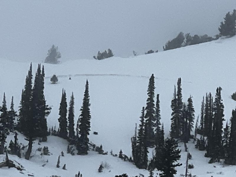
We noticed what may have been a crown on a NE-facing wind-loaded slope just below the Skyline Ridge. Given how weak the pre-existing snowpack is and the amount of wind-loading that was occurring, if there would have been a natural avalanche, this would have been a likely spot. The photo is poor quality as it was zoomed in.
Today's Observed Danger Rating
Moderate
Tomorrows Estimated Danger Rating
Considerable
Coordinates