Join us at our 2nd Annual Blizzard Ball

Forecast for the Uintas Area Mountains

Craig Gordon
Issued by Craig Gordon on
Friday morning, December 13, 2024
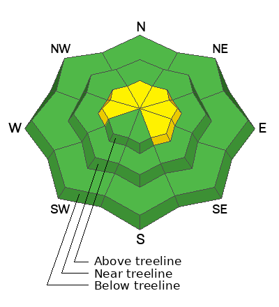
Strong southerly winds coupled with a few inches of snow bump the avalanche danger into the MODERATE category today. Human triggered avalanches are POSSIBLE, especially on steep wind drifted slopes facing the north half of the compass in windzone, above treeline.
Remember.. it's lean and potentially mean out there 'cause even a small slide could drag you through a mine field of season ending stumps, logs, or rocks. But don't let your heart be troubled... meadow skipping in wind sheltered terrain is the ticket, where good riding is found on low-angle slopes.
Low
Moderate
Considerable
High
Extreme
Learn how to read the forecast here
Special Announcements
Gear up for the season or score great deals on gifts for loved ones this holiday season while supporting the UAC’s efforts. Your participation directly funds the state's avalanche forecasting, awareness, and education programs. Check out the auction found here!
Weather and Snow
Nowcast-
Overnight, clouds thickened along the eastern front, ushering in spotty snow showers and a trace, to even a couple traces of snow in the high country. Temperatures cooled somewhat in the past few hours and register in the teens across the board. After a brief respite late Thursday, southerly winds bumped into the 20's and 30's at the turn of the new day and continue in that spirit at o'dark thirty this morning.
Forecast-
A quick hitting storm delivers a weak cold front along with a couple inches of snow. Expect snow showers to fill in and become more steady later this morning. Nothing to get overly excited about... just 1"-3" stacking up by days end. Winds shift to the west and northwest about midday and should remain pretty well-behaved, clocking in at 15-25 mph near the high peaks.
Futurecast-
Another storm system tracks into Utah Saturday afternoon and continues through Sunday. It's a right side up kinda storm with warmer, more dense snow starting the party and colder, low density snow for the encore. I'm cautiously optimistic we'll stack up 4"-8" before clearing out on Monday.
Current Conditions-
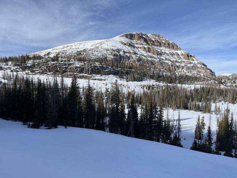
Life imitates nature. Bald Mountain living up to its namesake... and yeah, it's a little sensitive about that.... especially in mid December :(
Recent Avalanches
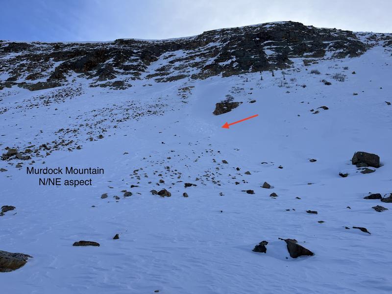
Ted reported this recent little avalanche in Murdock Bowl, a shallow wind drift that dribbled off a steep slope and then gouged into weak, sugary snow as it descended the slope below. Ted also noted... "Where I dug and traveled today it was bottomless weak faceted snow with fist density snow making up the top third of the pack and the rest was large grains of sugary faceted snow. I was basically walking on the ground!" He added... "Things could get interesting when it does snow."
More information on avalanches and current conditions from the range are found HERE.
Ad
Avalanche Problem #1
Wind Drifted Snow
Type
Location
Likelihood
Size
Description
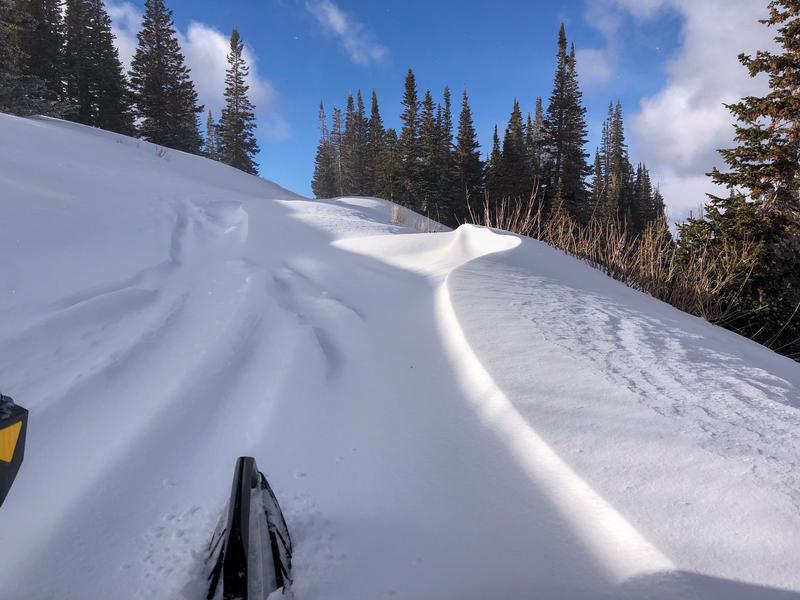
Today, I'll be on the lookout for and avoiding wind sculpted snow, especially if it appears fat and rounded or sounds hollow like a drum. Remember... the snowpack is a gong show and even a shallow wind drift could catch you off you're guard. That said, I’m steering clear of steep, leeward slopes in upper elevation terrain where even a small pocket of wind-drift snow resting on top of facets could react to my additional weight, knock me off my feet, and take me for an unexpected ride.
Avalanche Problem #2
Persistent Weak Layer
Type
Location
Likelihood
Size
Description
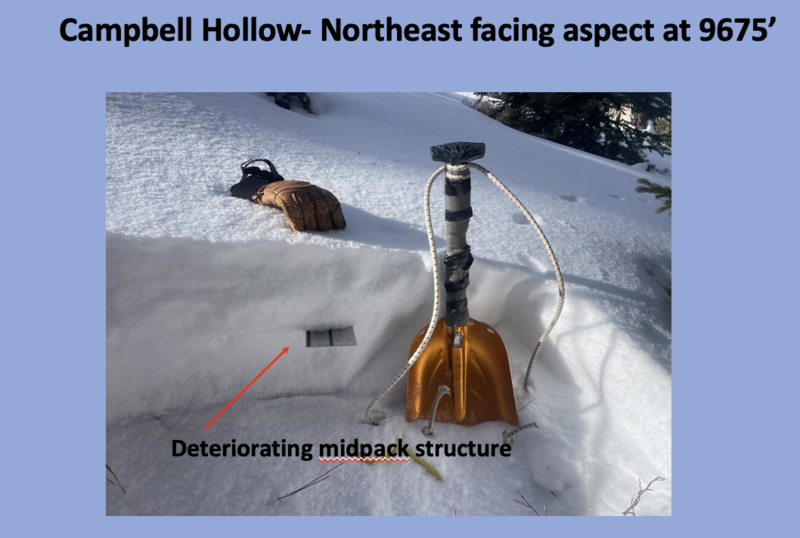
Simple snowpit profiles above from my travels Wednesday in Mill Hollow show a little structure in the snowpack, but not exactly the kind of foundation we wanna build our condo complex or our winter snowpack on.
Early season snow near the ground has grown weak and sugary, but fortunately, this persistent weak layer (PWL) has remained largely dormant because it's missing a key ingredient... a cohesive slab. With more snow, water, and wind on the way this weekend I suspect our days of easy livin' and straightforward yacht-rock avy danger are short-lived.
General Announcements
Additional Information
The Uinta weather station network was upgraded this summer and all that real-time info is found here. Simply click on the "Western Uinta" tab and then the "Weather Stations" tab to find all your weather needs.
We are always looking for snow and avalanche observations or just general riding conditions. So... if you see something, say something. You can reach our team directly by contacting: Craig at [email protected], 801-231-2170, or Andrew at [email protected], or 860-460-8142.
General Information
This forecast is from the U.S.D.A. Forest Service, which is solely responsible for its content. This forecast describes general avalanche conditions and local variations always occur. This forecast was issued on Friday, December 13th at 0330 AM and expires 24 hours after it was issued. We will update the forecast by 0700 AM tomorrow. But, in the meantime reach out to us with questions, or if you see anything in your travels.