


Observation Date
12/12/2024
Observer Name
Gagne
Region
Salt Lake » Little Cottonwood Canyon » Wolverine
Location Name or Route
Upper LCC - Wolverine
Comments
I don't think the snowfall and wind overnight Thursday into Friday will be enough to affect the PWL on the northerly aspects. But, if we get upwards of 0.25" of water weight, the few inches of dense snow may be enough to trigger some avalanches on slopes > 30° on northerly aspects.
The Saturday evening and Sunday storm has the potential for 0.5" - 1" of water, and this will certainly be enough to create avalanches on the northerly aspects.
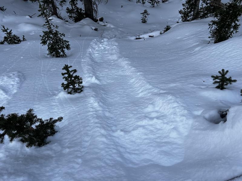
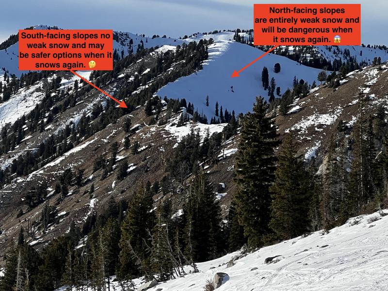
Photos:
- Sluffing in the weak, faceted snow at the surface on a steep test slope
- A contrast of northerly aspects where the PWL lives and southerly aspects which currently hold almost no snow. When it does snow again, northerly aspects will be dangerous given how weak the snowpack is on those aspects. Southerly aspects have no weak snow, and the biggest concern on these aspects will be rocks, bushes, stumps, etc.
Today's Observed Danger Rating
Low
Tomorrows Estimated Danger Rating
Low
Coordinates