Observation Date
11/29/2024
Observer Name
Bruce Tremper
Region
Salt Lake » Park City Ridgeline » Monitors » West Monitor
Location Name or Route
West Monitor
Weather
Sky
Clear
Wind Direction
West
Wind Speed
Light
Snow Characteristics
New Snow Depth
12"
New Snow Density
Low
Snow Surface Conditions
Powder
Snow Characteristics Comments
Snow skiing quite well and not hitting obstacles on elevations above about 9,000' in sun sheltered locations. Sunny aspects getting a bit of a sun crust. Snow still shallower than we would all like so you have to be careful of submerged surprises. We did not run into even one other person today, perhaps all scared away by yesterday's avalanche.
Red Flags
Red Flags
Recent Avalanches
Poor Snowpack Structure
Red Flags Comments
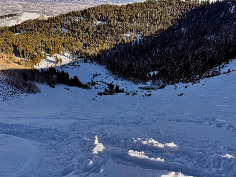
We went up to look at the West Monitor slide from yesterday. But the crown face was below a rollover on the upper quarter of the slidepath and there was just too much hangfire above it, making it too sporty for me. So I was not able to do a crown line profile of it. What surprised me most was that most of South Monitor, the adjacent, and mostly identical slidepath to the south, was mostly tracked up, yet no one triggered an avalanche there. Just subtle differences in the pre-existing snowpack or wind loading can be very important. Photo included.
Avalanche Problem #1
Problem
Persistent Weak Layer
Snow Profile Comments
South Monitor was completely tracked up but no one triggered an avalanche there, while West Monitor, an identical slidepath next to it, produced a fairly large, skier-triggered avalanche yesterday.
Today's Observed Danger Rating
Moderate
Tomorrows Estimated Danger Rating
Moderate
Coordinates


