We traveled along the PC ridgeline to look at the
human triggered avalanche in West Monitor that occurred earlier this morning. This was one of
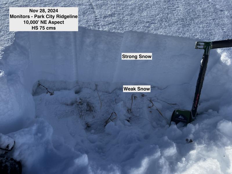
three human-triggered avalanches in the Salt Lake mountains on Thursday that failed on the PWL aspect. This avalanche was on a northeast aspect at 9,900' and I dug a pit adjacent to the slide where there was a 10 cm layer of weak facets near the ground, with a 60 cm stronger slab on top. The photo below shows this poor structure of strong over weak snow.
We had no collapsing today, and this is a sign the snowpack is adjusting to the recent load. But dealing with a persistent weak layer (PWL) is tricky as you may see "signs" of stability including tracks on a slope and no collapsing, but you only need to dig down 45-60 cms to find this poor structure. For now, I will continue to avoid slopes facing west/north/east at the mid and upper elevations.


