Check out our Holiday Auction - Sign Up for the Utah Snow and Avalanche Workshop (USAW)

Forecast for the Uintas Area Mountains

Andrew Nassetta
Issued by Andrew Nassetta on
Thursday morning, November 28, 2024
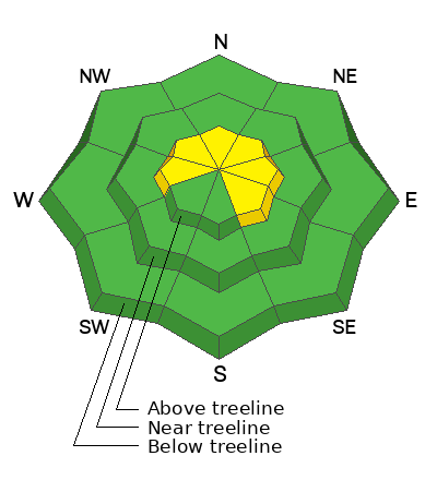
Avalanche danger is MODERATE above treeline on steep, wind loaded slopes facing west through southeast. It is POSSIBLE that today’s avalanches can be triggered by a human and break 1-3’ deep.
Areas where the snowpack is shallow, less than a couple feet, display a lot of red flags like shooting cracks and audible collapses. In areas where the snowpack is deeper, or a stiff wind drift is in place, you may see less obvious signs of instability.
Low
Moderate
Considerable
High
Extreme
Learn how to read the forecast here
Weather and Snow
Nowcast
Overnight, light to moderate WNW winds were steady with gusts in the mid-20s. Temperatures are in the single digits Fahrenheit at 9,000’ this morning with trailhead temperatures sitting not much warmer.
Forecast
Broken skies will lead to clearing and a beautiful afternoon as the sun takes over. Temperatures hit 20℉ by midday up high with a consistent, light breeze from the west.
Futurecast
Time to get familiar with this settling ridge of high-pressure. Mild daytime temperatures, sunny skies, and cold, clear nights will persist for the foreseeable future.
Snowpack & Travel
Today we have the “ingredients” for avalanches. My travels yesterday took me hunting for info on the current location of our PWL, the difference in snow depths, and obvious signs of this hazard to look for. I made a few notes that are helpful to keep in mind when evaluating the hazard:
  • Snow depths are 40-90cm across the range and vary from zone to zone.
  • Thinner areas produced more red flags than places where the snowpack is deep.
  • In areas where wind has added to the stiffness of the slab, we are seeing avalanches. In sheltered areas where the snow has not been affected by the wind, we are not seeing avalanches.
Recent Avalanches
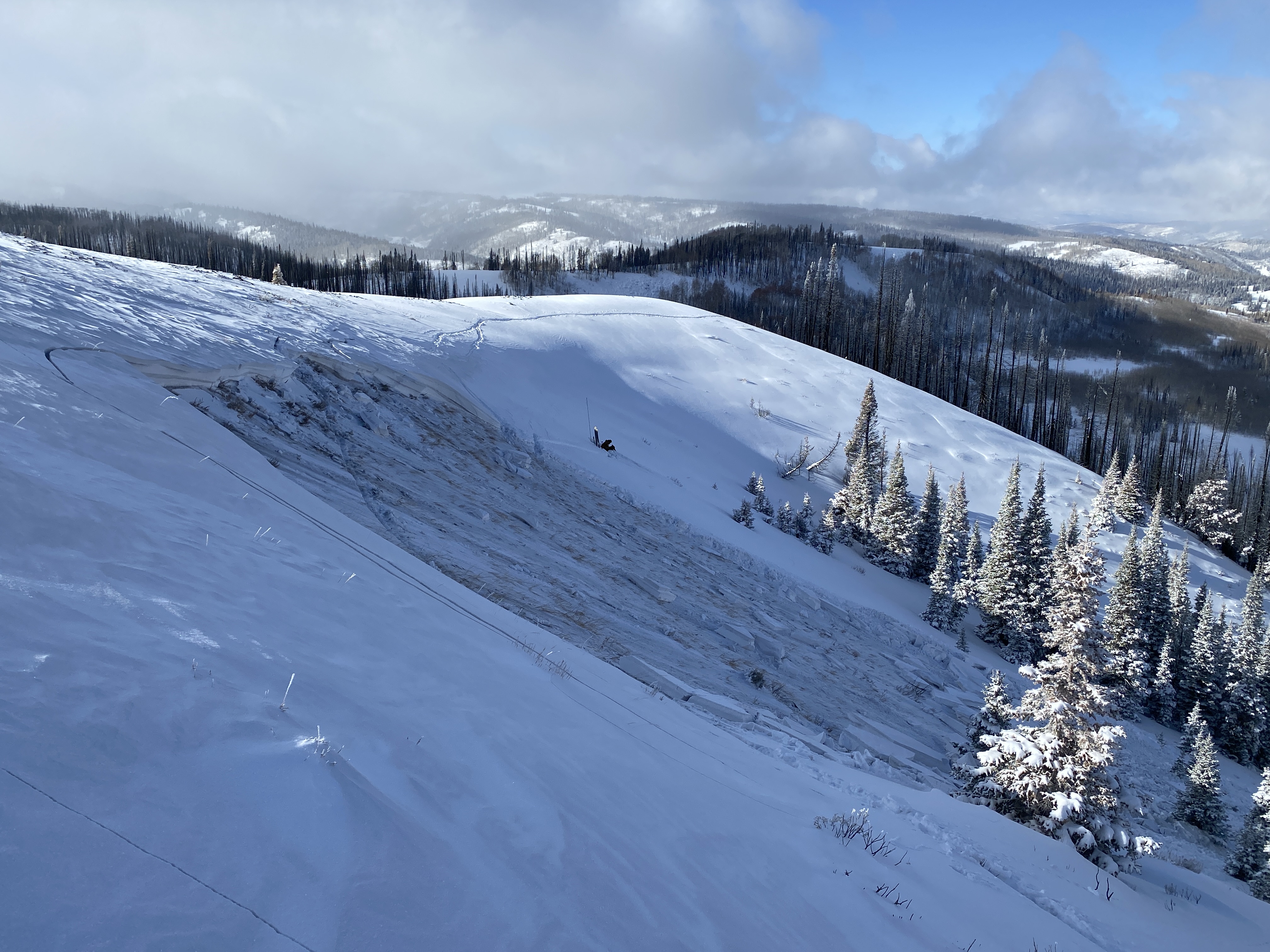
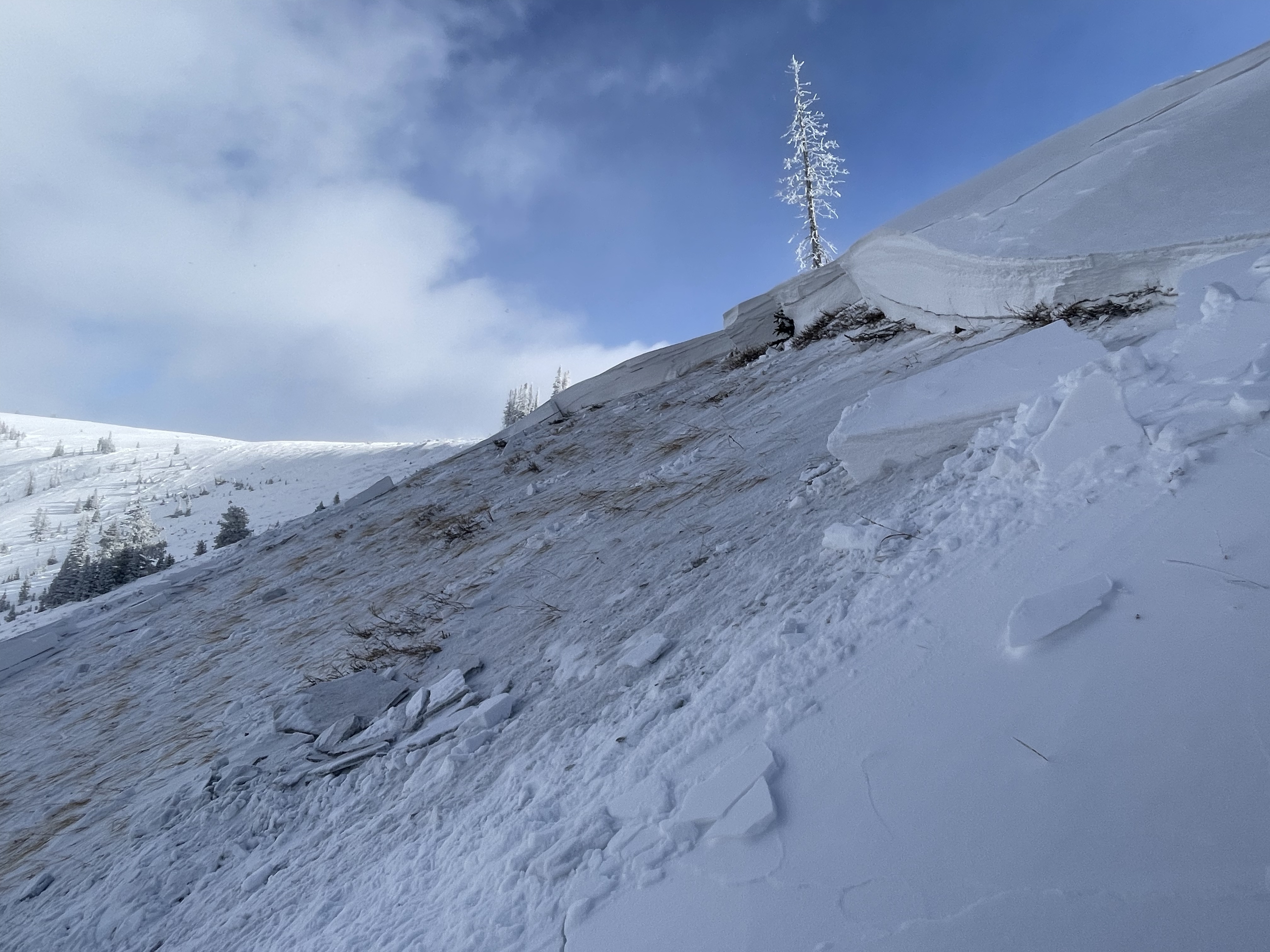
Yesterday, avalanches were remotely triggered on our persistent weak layer in areas that are heavily wind-loaded.
Today’s avalanche will continue to break wider and deeper than one might expect. As riders, we can remotely trigger these from below, above, and even from a long distance away.
For the low-down on these avalanches and more observations click here!
Ad
Avalanche Problem #1
Persistent Weak Layer
Type
Location
Likelihood
Size
Description
Old, faceted snow at the ground from late fall and early winter is our main focus right now. Over the past week, we have loaded with the PWL with its first real test of snow, water and wind – To no surprise, it failed the test.
Observed recent avalanches are being remotely triggered from a distance, as well as from below on the slope. Areas where wind-drifted snow created a hard slab that I can barely get a knife into I suspect are most reactive to the additional weight of a rider. Break out the shovel, dig down, and look for this setup of strong snow over weak. And always keep your “avalanche eyeballs” sharp and watch for obvious red flags like shooting cracks, audible collapse, and recent avalanches.
The photo above is of a north facing slope at 9,500' in the Wolf Creek Pass area.
Avalanche Problem #2
Wind Drifted Snow
Type
Location
Likelihood
Size
Description
Northwest winds moved steadily yesterday and into this morning with gusts into the 20s -- The perfect wind speed for wind loading. This hazard is specific to steep pieces of terrain greater than 30° facing west through southeast.
Look for and avoid rounded pillows and drifts that can be hard or soft. They may sound hollow like a drum and feel stiff underneath us.
General Announcements
Additional Information
The Uinta weather station network was upgraded this summer and all that real-time info is found here. Simply click on the "Western Uinta" tab and then the "Weather Stations" tab to find all your weather needs.
Save the Date
- Statewide Avalanche Awareness Week is running from December 1st-7th -- Check out the list of events and happenings across the state here!
- 17th Annual Utah Snow and Avalanche Workshop (USAW) | Saturday, December 7 | Information and tickets are available here.
We are always looking for snow and avalanche observations or just general riding conditions. So... if you see something, say something. You can reach our team directly by contacting Craig at [email protected], 801-231-2170, or Andrew at [email protected], or 860-460-8142.
General Information
This forecast is from the U.S.D.A. Forest Service, which is solely responsible for its content. This forecast describes general avalanche conditions and local variations always occur. This forecast was issued on Thursday, November 28th at 0630 AM and expires 24 hours after it was issued. We will update the forecast as conditions change, and in the meantime reach out to us with questions, or if you see anything in your travels.