UDOT PLANNED AVALANCHE CLOSURES!!

Observation: White Pine

Observation Date
11/23/2024
Observer Name
Grainger, Kelly
Region
Salt Lake » Little Cottonwood Canyon » White Pine
Location Name or Route
White Pine
Weather
Sky
Overcast
Precipitation
Light Snowfall
Wind Direction
South
Wind Speed
Moderate
Weather Comments
Overcast skies, with periods of light graupel falling although not enough to accumulate. Winds were blowing from the south strong to moderate 30 gusting to 50 MPH at nearby 11,000' ridgelines. In the drainage we were seeing swirling downslope winds blowing from the east and southeast.
Snow Characteristics
Snow Surface Conditions
Dense Loose
Wind Crust
Snow Characteristics Comments
Traveling mainly on Northwest, North, and Northeast facing slopes between 7600' and 9800' today provided a variety of snowpack depths and conditions. Solar and wind effect have produced crust, dense-loose grains, and firm textured surfaces but we did not observe any notable weakness in the upper layer as the next storm approaches.
Photo of snow coverage

Avalanche Problem #1
Problem
Persistent Weak Layer
Problem #1 Comments
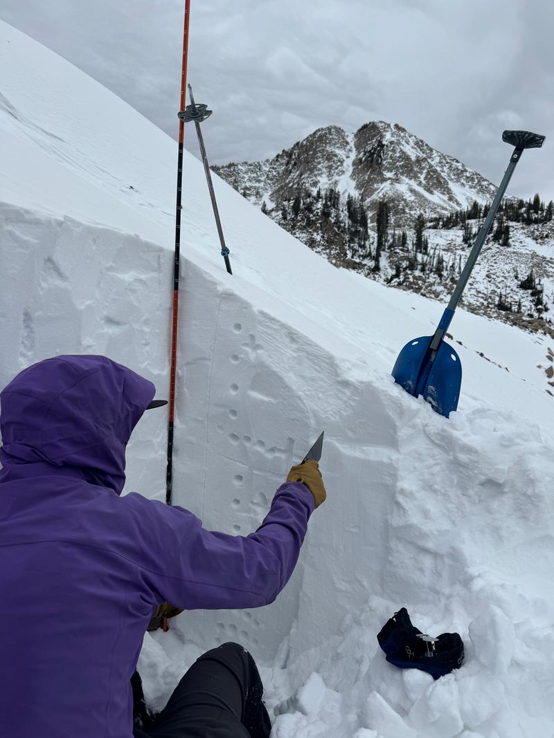
With our layer of concern, being faceted snow from late October and early November, we dug in a location with prior wind loading to test failure/propagation potential with a slab on top. Where we dug we had a height of snow (HS) of 4.5' (135cm) and we were able to get propagation on weak dry facets under a crust about 1' (36 cm) from the ground. 2 ECTPV (failure on isolation) results and one ECTP1(failure on the first tap), all failing on facets just below a deteriorating Melt/Freeze crust. While these facets are only present in certain locations, they may continue to present challenges on upper, polar (northerly facing) slopes once covered by the coming storms.
Snow Profile
Aspect
North
Elevation
9,800'
Slope Angle
37°
Comments
Today, besides looking to avoid rocks we wanted to see if we could find a place that had weak snow with a slab over the top and we were successful. This was an isolated wind loaded slope right at treeline that was steep enough to get some results.We don't think that this is representative of most of our high elevation terrain, but could be in higher elevation north facing zones that had wind loading. With the addition of new snow and water over this next week I will be wary of any locations that look wind loaded (pillowy, hollow, or drum like).
Video
Photo of a north facing wind loaded slope at 9,800'
Video
Forcaster Disclosure: I called the result on the above video an ECTP1 and my first hit was from the elbow (it was light elbow tapping) and is technically not correct in the wider world of snowpack documentation and I should have done the first 10 taps from the wrist. However, I believe that it still paints the picture of this snowpack at this particular location in White Pine on a north facing wind loaded aspect at 9,800' and next time will do the test correctly. For sure the other 2 failed on cutting. Read more about the extended column test HERE ( I know I watch this at the start of every season, and now am ready for it to snow).
Today's Observed Danger Rating
Low
Tomorrows Estimated Danger Rating
None
Coordinates