Forecast for the Uintas Area Mountains

Issued by Craig Gordon on
Saturday morning, November 2, 2024
Saturday morning, November 2, 2024
Updated Saturday November 2nd at 04:30 AM
And then... it was almost winter.
Thanks for checking in and stay tuned... we’ll issue updates as conditions warrant. Daily forecasts and danger ratings are weather dependent, though often start in early December.
But wait... there's more! Please join us at one of the many upcoming events found HERE (scroll to the left hand corner near the bottom of our homepage).

Low
Moderate
Considerable
High
Extreme
Learn how to read the forecast here
 Special Announcements
SAVE THE DATES... and take a date!
Monday, November 4 - 17th Annual Professional Snow and Avalanche Workshop (PROSAW) - Information and tickets are available here.
Saturday, December 7 - 17th Annual Utah Snow and Avalanche Workshop (USAW) - Information and tickets available here.
 Weather and Snow
Nowcast- A band of high clouds drift through the Uinta Zone early this morning, keeping a lid on overnight temperatures which register in the low to mid 20's. Along the high peaks, southerly winds flirted with gusts in the mid 20's for a few hours late last night, but decided it was too early in the relationship, and backed off into teens near the turn of the new day.
Forecast- Look for increasing clouds throughout the day with a nice little shot of snow developing overnight into Sunday. Not a season starter (maybe 6"-10"), but enough to pique our interest with a Winter Weather Advisory issued by our good friends and long time partners at the National Weather Service located right here in the City of Salt.
Futurecast- A break in the action for Monday, with another quick hitting system on tap for Tuesday

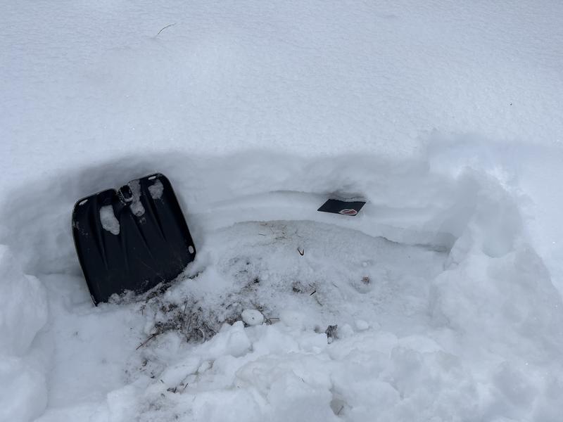
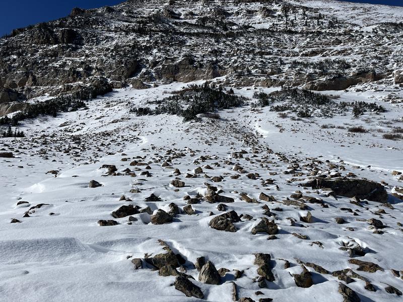
Ted Scroggin, our main man who knows the Uinta's like no other, was out and about on the tail end of this weeks storm and notes... "A short walk around the Mirror Lake and Bald Mt. area to look at conditions. The recent storm left about 6-10" depending on elevation and this new snow was falling on a few inches from the mid October storm. "

Not much much going on for the eastern front. None-the-less... just enough to walk around on with a little structure. However, 10" of settled snow does little to cover the 4' of boulder fields that make the Uinta's such a curiously, un-intriguing early season destination. Though the Bald Mountain Chamber of Commerce is working hard to change that mindset :)
 Recent Avalanches
No avy activity observed or reported
Additional Information
The Uinta weather station network was upgraded this summer and all that real-time info is found HERE. Simply click on "western Uinta" tab and then "weather stations" tab.
We are always looking for snow and avalanche observations or just general riding conditions. So... if you see something, say something. You can reach me directly at [email protected] or 801-231-2170.
Also, if you're looking for more avy education opportunities for yourself, your crew, or your club please don't hesitate to reach out to me and we'll find a presentation, class, or clinic for ya!
General Announcements
Issued on Saturday, November 2nd at 04:30, this forecast expires 24 hours after the date and time issues, but will be updated this week as conditions change!
This forecast is from the U.S.D.A. Forest Service, which is solely responsible for its content. This forecast describes general avalanche conditions and local variations always occur.


