Forecast for the Provo Area Mountains

Issued by Trent Meisenheimer on
Sunday morning, April 14, 2024
Sunday morning, April 14, 2024
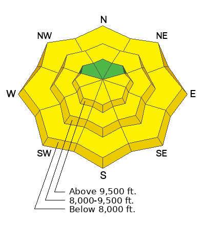
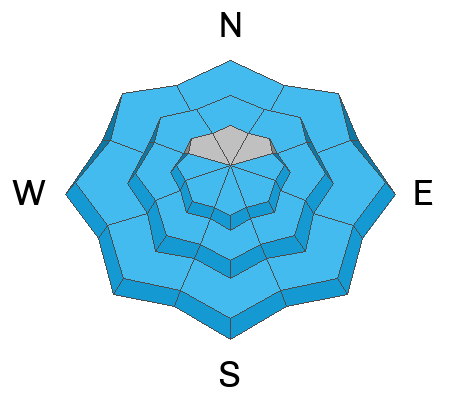
The overall avalanche danger is LOW this morning but will quickly rise to MODERATE as strong sunshine warms steep aspects facing east, south, and west for Wet Snow. Avalanche activity may involve loose-wet avalanches, wet slab avalanches, cornice fall, and lastly glide avalanches.
Timing is everything - move off of and out from under steep slopes once the snow becomes wet and unsupportable.
Slide-for-life conditions do exist on some upper-elevation terrain where the snow is hard and frozen.

Low
Moderate
Considerable
High
Extreme
Learn how to read the forecast here
 Weather and Snow
Under clear skies, mountain temperatures range from 34 to 45 degrees Fahrenheit. This morning marks the 3rd night with temperatures above freezing. The wind is from the south and blows 10 to 20 mph across many upper elevations.
This morning, we will see plenty of sunshine, with mountain temperatures rising into the 50s by the afternoon. The wind will continue to blow from the south as we have an approaching closed low system that will arrive later in the day today. We should see clouds and some snow showers possible around the dinner hour as the cold front is expected late afternoon. The heaviest snowfall will be on Monday.
I never hold my breath too much with a closed low. Since storm totals are a bit all over the place, I will go with 2-25 inches of new snow by Tuesday morning.
 Recent Avalanches
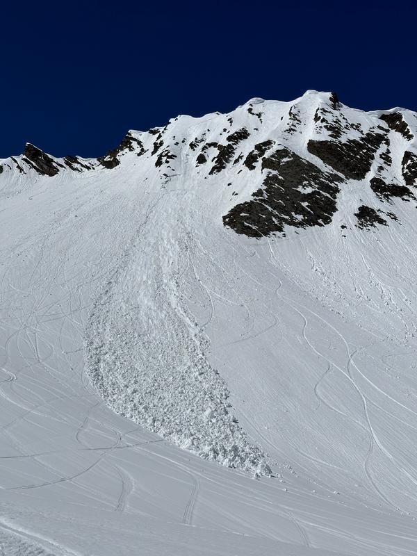
- Avalanche, Cardiac Ridge BCC. Human-triggered, 10 inches deep, 25 feet wide. Caught and carried, lost a ski, uninjured. They provided a great write-up. I'm glad everyone is okay (pic below).
- Avalanche, Cottonwood Draw, LCC. Human triggered, 6 inches deep 60 feet wide. Wet slab.

Avalanche Problem #1
Wet Snow
Type
Location

Likelihood
Size
Description
When cold, dry snow becomes wet for the first time, it almost always means wet sluffs (loose snow that fans outward as it descends). This will happen on Tuesday.
Larger wet slab avalanches can happen when melt water percolates through a layered, winter snowpack for the first time especially after 3 days of strong melting combined with no refreeze at night.
Luckily, wet avalanches usually don't last forever because over time, days or weeks of percolating meltwater, all the layers in the snow disappear, and the snow becomes homogenous and dense, turning into a stable summer-like snowpack. Typically, this cycle of instability maturing into stability occurs first on the south-facing slopes in early spring, then progresses to the east and west-facing slopes in mid-spring, and finally, by late spring, the upper elevation north facing slopes go through a wet avalanche cycle.
Finally, glide avalanches occur regularly in spring as the entire snowpack slides slowly on the ground like a glacier until they suddenly release into a full-depth avalanche. These occur periodically on steep rock slabs and occasionally on steep grassy slopes. Notorious glide avalanche locations include Stairs Gulch or the rock slabs in Broads Fork, which you should always avoid in spring. Avoid crossing under any slopes with telltale glide cracks in the snowpack. Remember, they come down randomly, even at night.
The bottom line for wet avalanches:
Get out early and get home early. Get off of - and out from underneath - any slope approaching 30 degrees or steeper when the snow becomes wet enough not to support your weight. Warning signs may include:
Get out early and get home early. Get off of - and out from underneath - any slope approaching 30 degrees or steeper when the snow becomes wet enough not to support your weight. Warning signs may include:
- Rollerballs (pinwheels) in new snow that is getting wet for the first time
- Natural or human triggered wet sluffs
- Small sluffs fanning out into larger slides or running long distances
- Cornices breaking off
- Several days of strong melting combined with no refreeze at night.
These signs mean it's time to head home or change to an aspect with cooler snow. Remember, even "smaller" slides can be dangerous in high-consequence terrain, such as above a terrain trap, trees, rocks, cliffs, or a long, large avalanche path. Plan your trip to have a safe exit back to the car.
Additional Information
Thank you all for another fantastic season. Even with a slow start, we finished with above-average snow and many great powder days. Thank you to all our supporters, regular readers, and observers. It's a team effort, and all of us at the UAC are grateful for your help.
Our regular daily avalanche forecasts end this Sunday, April 14. After that, we will issue updates with any snowfall in the Salt Lake zone. We will issue updates in other zones with significant weather events as needed. We will continue publishing any observations through the rest of April as well. Have a great spring, have fun, and stay safe!
General Announcements
This information does not apply to developed ski areas or highways where avalanche control is normally done. This forecast is from the U.S.D.A. Forest Service, which is solely responsible for its content. This forecast describes general avalanche conditions and local variations always occur.


