UDOT PLANNED AVALANCHE CLOSURES!!

Forecast for the Skyline Area Mountains

Brett Kobernik
Issued by Brett Kobernik on
Friday morning, March 8, 2024
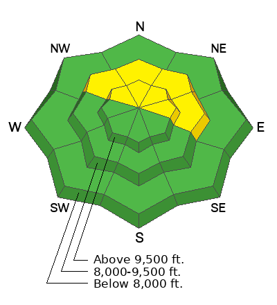
The avalanche danger rating for the Skyline is MODERATE.
Human triggered avalanches are possible but not very likely.
Places you may trigger something are on very steep slopes that face northwest through east especially right along and below ridgelines where recent deposits of wind drifted snow are present.
Low
Moderate
Considerable
High
Extreme
Learn how to read the forecast here
Weather and Snow
Current Conditions: The Skyline picked up a trace to a couple of inches of new snow in the last 24 hours. Wind has been light to moderate in speed from the west northwest. Temperatures got up to around 30˚F on Thursday and are around 20˚F this morning.
Mountain Weather: Lingering clouds should break by mid day with temperatures in the low 20s and light to moderate speed wind from the northwest. Saturday looks clear with high temperatures around 30˚F or a bit warmer. The next significant storm looks like it'll move through mid week next week.
Recent Avalanches
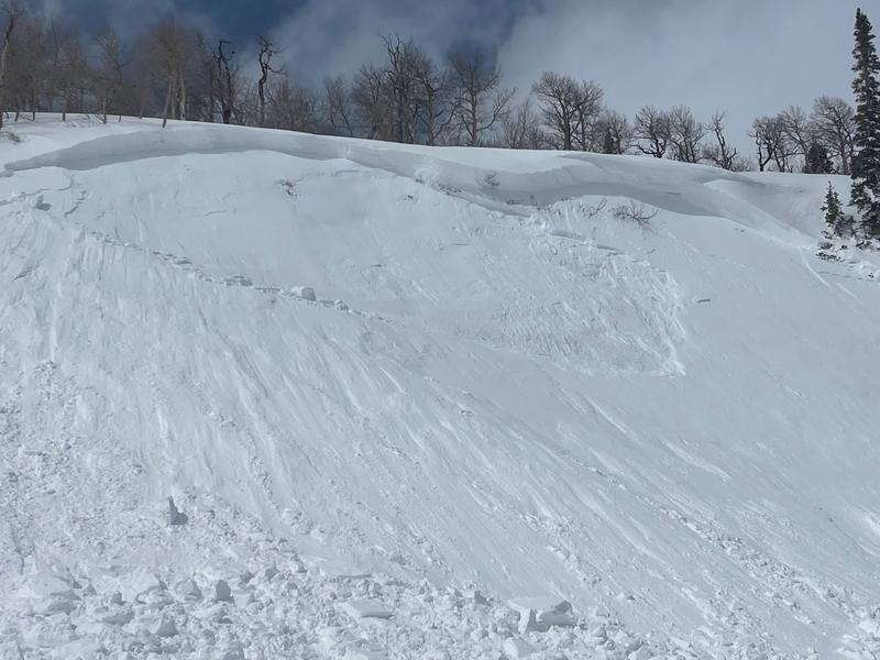
There was one snowmobile triggered slide reported on Thursday. It was a small pocket somewhere in The Cove along a wind loaded ridgeline.
Ad
Avalanche Problem #1
Wind Drifted Snow
Type
Location
Likelihood
Size
Description
The snowmobile triggered slide in The Cove on Thursday demonstrates the type of issue you might find again today. North through east facing steep terrain is the most likely place to find trouble. These wind loaded slopes will continue to stabilize and the chances of triggering something become less likely. Use caution and consider the consequences if you trigger even a small slide that might push you into trees or bury you in a terrain trap.
General Announcements
This forecast is from the U.S.D.A. Forest Service, which is solely responsible for its content. This forecast describes general avalanche conditions and local variations always occur.