Sign Up for the Utah Snow and Avalanche Workshop (USAW) on December 7th!

Forecast for the Skyline Area Mountains

Brett Kobernik
Issued by Brett Kobernik on
Friday morning, March 1, 2024
The avalanche danger rating for the Skyline is MODERATE today.
Small human triggered avalanches are possible today but not all that likely.
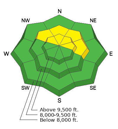
Recently formed wind drifts and wind slabs may still be sensitive to people provoking them today.
Low
Moderate
Considerable
High
Extreme
Learn how to read the forecast here
Weather and Snow
Current Conditions: It was a little breezy from the southwest along the higher terrain over the last 24 hours. Down off the ridges, the wind wasn't doing too much. Temperatures got into the mid 30s on Thursday and dropped back into the upper 20s overnight. Riding conditions remain decent in the more sheltered terrain.
Mountain Weather: We'll see some sun and some clouds filtering through today with high temperatures well into the mid 30s again. It'll feel a little breezy along the ridges. Wind will be from the southwest. A decent looking storm will move through starting Saturday afternoon and lasting through Sunday. Water amounts with this storm look pretty good and we could end up with a foot of snow by Monday.
Recent Avalanches
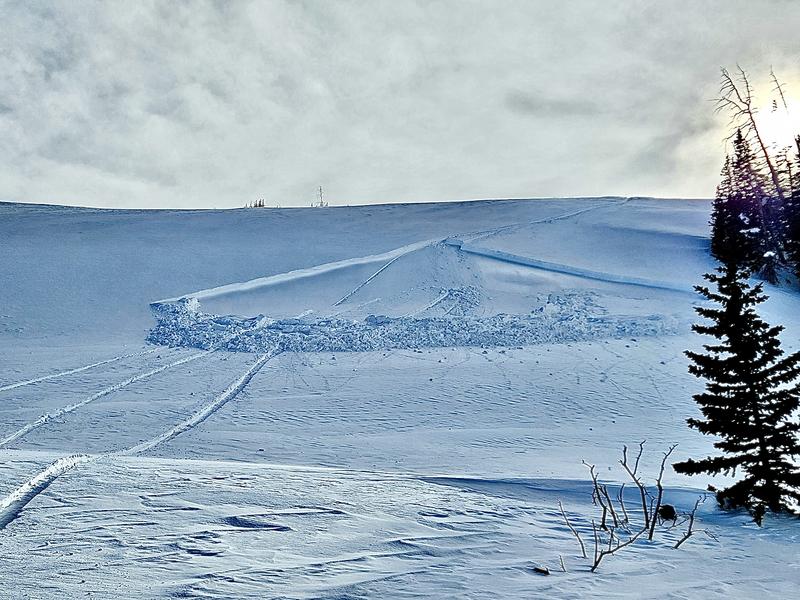
There were a couple of snowmachine triggered wind slabs reported on Thursday. These were pretty small and no one was caught or injured. It demonstrates how the recent wind slabs are not completely stable yet. Photo below, The Cove, Beau Lund:
Ad
Avalanche Problem #1
Wind Drifted Snow
Type
Location
Likelihood
Size
Description
The wind slabs that formed this week may still be sensitive to the weight of a person or a machine today. These will continue to get more stubborn and there is less of a chance of triggering one today compared to just yesterday. However, be aware that you could crack something out. These aren't huge slides but if you're caught off guard or are in terrain with some consequences, you could get caught and injured.
The most likely places to trigger one of these are on very steep north through east facing slopes near ridges and terrain features but keep your eye out for pockets on northwest facing terrain as well.
General Announcements
This forecast is from the U.S.D.A. Forest Service, which is solely responsible for its content. This forecast describes general avalanche conditions and local variations always occur.