Sign Up for the Utah Snow and Avalanche Workshop (USAW) on December 7th!

Observation: Gold Basin

Observation Date
2/4/2024
Observer Name
Nauman, Darling, Howell, Ament
Region
Moab » Gold Basin
Location Name or Route
Gold Miners, Talking Mountain Cirque
Weather
Sky
Few
Wind Direction
West
Wind Speed
Light
Weather Comments
Today was pure bluebird magic with minimal wind and ample powder.
Snow Characteristics
Snow Surface Conditions
Powder
Melt-Freeze Crust
Snow Characteristics Comments
The new snow from the last cycle was still skiing very nice today. We skied solar aspects and only encountered a couple zipper crusts on the most solar exposures. Tomorrow there will be much more crust on solars, but still some safe powder to be found for the brave and willing.
Red Flags
Red Flags
Recent Avalanches
Wind Loading
Collapsing
Red Flags Comments
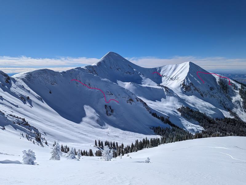
We encountered some collapsing on non-solar aspects. There were large PWL avalanches on all aspects except south in Gold Basin. For a moderate storm, there were way more large avalanches than expected on E-N-W aspects. The majority of the non-solar alpine zone of Talking Mountain slid big in this last cycle. We definitely crossed a tipping point and there is still ample hang fire to be aware of.
Avalanche Problem #1
Problem
Persistent Weak Layer
Trend
Decreasing Danger
Problem #1 Comments
Although the last warm cycle strengthened south aspects, everything else is a ticking time bomb out there right now. The good news is that the snowpack is deeper and stronger, so as things settle it will become harder to trigger out PWL, but if you do, yikes.
Avalanche Problem #2
Problem
Wind Drifted Snow
Trend
Decreasing Danger
Problem #2 Comments
Despite the relatively tame wind we've had recently (by our standards), there are substantial wind slabs cross loaded on much of the northern aspects of Gold Basin. I suspect these loaded areas were a part of what caused soo many large slabs to break on the PWLs this last cycle.
Comments
Even west aspects went big this last cycle
More huge crowns on N-E faces
Today's Observed Danger Rating
Considerable
Tomorrows Estimated Danger Rating
Considerable
Coordinates