Observer Name
Brackelsberg / Paradis
Observation Date
Thursday, January 11, 2024
Avalanche Date
Thursday, January 11, 2024
Region
Salt Lake » Parleys Canyon » Summit Park
Location Name or Route
Summit Park
Elevation
8,000'
Aspect
Northwest
Slope Angle
37°
Trigger
Skier
Trigger: additional info
Remotely Triggered
Avalanche Type
Hard Slab
Avalanche Problem
Persistent Weak Layer
Weak Layer
Facets
Depth
15"
Width
150'
Vertical
100'
Comments
[Forecaster Comment We received multiple reports of this avalanche, and at the bottom is the report from the party that remotely-triggered this avalanche.]
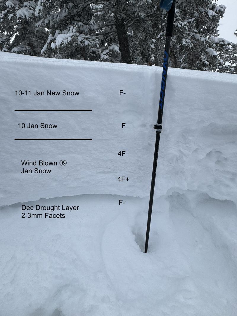
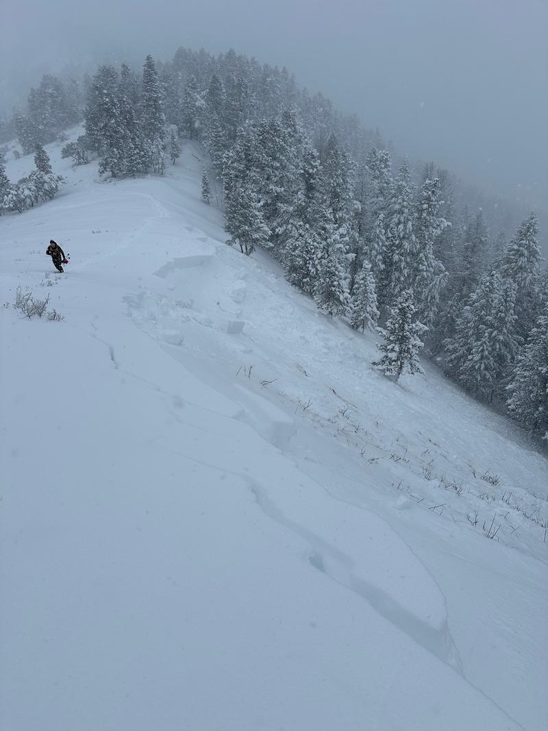
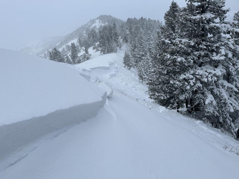
This is a common slope that wind loads and will avalanche. This is one of the largest avalanches I have seen in this area. It was about 150' wide and ranged from ~15" where we dug to about 36" at the cornice.
The profile shows the dense slab that formed from Tuesday's strong winds.
Photo 1 is looking to the north end where we dug a profile.
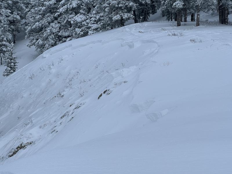
Photo 2 shows the deeper corniced section of the crown.
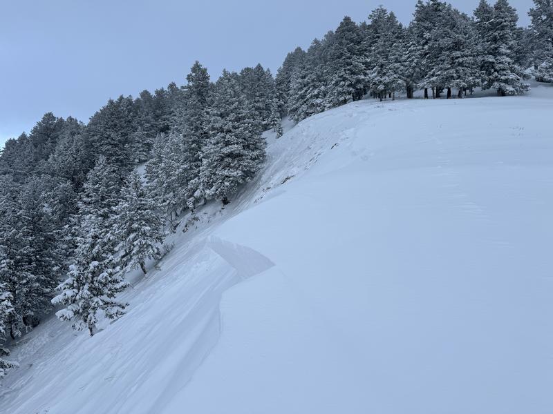
Photo 3 is looking back to the deeper corniced section.
Photo 4 shows where the slide stepped down lower on the slope.
The slide ran to the ground and down into the trees below.
[From the party that remotely-triggered this avalanche]
Our party was travelling up to Summit Park peak when our lead skier decided to check out known instability area. Sensing that the area could be remotely triggered he began to walk towards the bottom of a wind loaded ridgeline while still far back from any danger. We were the first in the area and breaking a new trail to the peak, so there was no danger of anyone in the runout zone. Further it is on a slope that is rarely skied or traversed underneath. The slope reacted as he thought and remotely triggered a slide 800 feet up the ridgeline from us. At the time we were 10' back from the ridgeline and still far below in the flats. Extremely sensitive. The slide was 18-24" in depth and propogated 150' wide. We did see signs that it stepped down to the ground around 20' down the slope.


Coordinates


