


Observation Date
1/7/2024
Observer Name
Gagne/Frey
Region
Salt Lake » Mill Creek Canyon » Porter Fork » Main Porter
Location Name or Route
Main Forter Fork
Comments
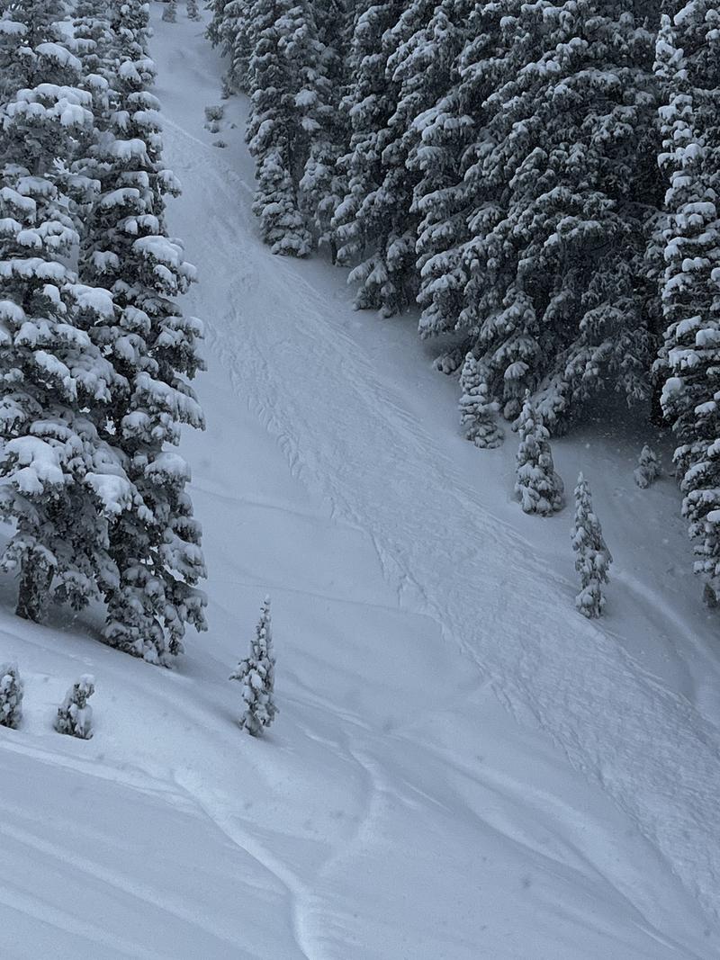
Main Porter Fork can do quite well in a northwest flow and there were periods of 1-2" of snow per hour. Storm totals since Friday are 30-60 cms. The biggest thing we noticed today is the new snow is all fist-hard, low-density and lacking a slab, so avalanche activity was mostly sluffing within the storm snow or at the interface with the PWL at the old snow surface. We did see what was likely a natural soft slab avalanche on a northwest aspect at 9,600' on a slope that was likely cross-loaded from either the southwest or northwest winds (no photo due to poor visibility).
Some ways a slab can form include:
- wind-drifting;
- the low-density snow sinters/bonds.
Given how weak the old snow surface is, I think the Millcreek area is right on the edge of the tipping point. At some point, we will see more avalanches failing on the PWL, such as a slab (from wind-drifting for example) or additional snow this coming week. Although we had no other collapsing or cracking, on one wind-loaded slope at 9,400 Porter Fork Pass, we did get a collapse with cracks propagating. This is a clear sign the PWL just needs a little bit more of a load on top.
Given the amount of new snow and the weak surface it fell on, we traveled cautiously and conservatively today.
Visibility was poor so no photos other than this sluff on a steep, north-facing slope at 9,200'
Today's Observed Danger Rating
Considerable
Tomorrows Estimated Danger Rating
Considerable
Coordinates