Join us for the 17th Annual Professional Snow and Avalanche Workshop (PROSAW) on November 4 - Purchase tickets here!

Forecast for the Logan Area Mountains

Toby Weed
Issued by Toby Weed on
Wednesday morning, January 3, 2024
The avalanche danger is LOW in the backcountry today. A change in the weather pattern is imminent, and a series of storms beginning this weekend and into next week will cause the avalanche danger to increase significantly.
Now is a really good time to recheck your avalanche rescue equipment, put fresh batteries in your transceiver, and practice companion rescue techniques with your backcountry partners.
Low
Moderate
Considerable
High
Extreme
Learn how to read the forecast here
Special Announcements
Sign up for forecast region-specific text message alerts. You will receive messages about changing avalanche conditions, watches, and warnings...HERE
Weather and Snow
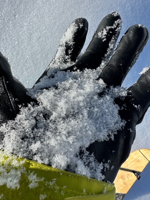
We’re finding a mixed bag of conditions, with mostly supportable crusts and bare slopes in sunny terrain and wind-jacked snow surfaces on exposed slopes. Weak surface snow, consisting of recrystallized or faceted snow and glistening feathers of surface hoar plagues most shady slopes at all elevations. Despite it’s implication of future avalanche concerns, this weak snow offers fun and fast riding and turning conditions. Although the Bear River Range has a higher percentage of normal SWE than other mountain ranges across the west, shallow, early-season conditions exist, and hitting rocks or down trees is a significant consideration.
With 91% of normal SWE (snow water equivalent), the Tony Grove Snotel at 8400' reports 39” of total snow and 24° F. It’s 22° F, and there is 32 inches of total snow at the new Card Canyon weather station.
Winds increased overnight and are blowing from the south around 20 mph at the 9700' CSI Logan Peak weather station. South winds remain fairly light on Paris Peak, and it’s 19° F.

A change in the weather pattern is coming. A storm will bring snow to the mountains of southern Utah on Thursday and Friday, with some light snow likely in the northern mountains. 2 to 5 inches could accumulate at upper elevations in the Logan Zone Friday and Friday night. Confidence is growing that a series of potentially significant winter storms will impact the mountains of northern Utah and southeastern Idaho beginning later this weekend and continuing into next week... If this forecast pans out, we can expect alluring powder conditions and, potentially, a severe increase in avalanche danger, with very weak surface snow widespread across the zone.
Recent Avalanches
No avalanches were reported recently in the Logan Zone.
Check out local observations and avalanches HERE.
Ad
Avalanche Problem #1
Normal Caution
Type
Location
Likelihood
Size
Description
In isolated areas, it might be possible to trigger small slab avalanches of wind-drifted snow close to ridgelines or dry, loose avalanches on steep, shady slopes as the snow surface weakens.
Weak, sugary, or faceted surface snow is widespread across the zone, and it will likely become a nasty, persistent weak layer when it is buried by a series of storms beginning this weekend.
I was dismayed yesterday by how widespread the weak snow is, on and near the current snow surface. See my observation from the Tony Grove Area HERE.
Here is a handful of loose, sugary faceted snow grains. This very weak snow is widespread in shady terrain at all elevations.

Always follow safe travel protocols on or under slopes steeper than 30°.
  • Be sure everyone in your party has working avalanche rescue equipment, including a transceiver, probe, and shovel. Practice with this equipment regularly, and include and instruct new partners.
  • Cross avalanche paths and runout zones one person at a time, with the rest of the party watching from a safe place.
  • Reevaluate and be willing to change your plans if you encounter any signs of instability, like recent avalanches, audible collapses (whumpfs), or cracking in drifted snow.
Additional Information

Two new weather stations are found in the Logan Zone this season. The Paris Peak Weather Station (available HERE) and the Card Canyon Weather Station (available HERE)
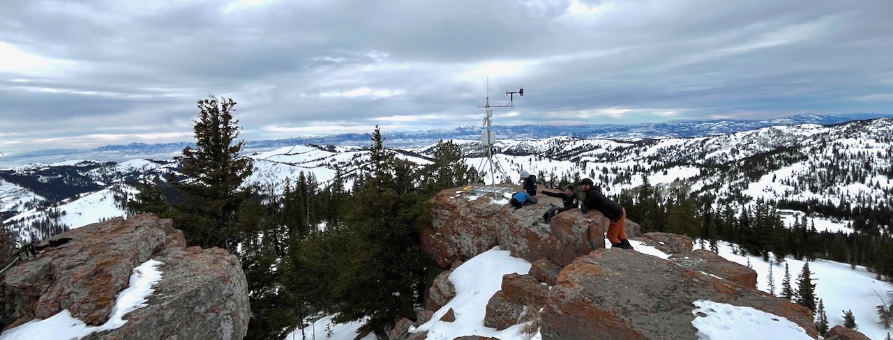
We checked on our new Paris Peak weather station on Saturday. It's looking good and working well, giving us real-time weather, including relevant ridgetop wind information. For more information on what we found in the Bloomington Canyon Area last weekend, check out our observation HERE.
General Announcements
  • For all questions on forecasts, education, KBYG, events, online purchases, or fundraising: call 801-365-5522.
  • To report an avalanche or submit an observation from the backcountry: go HERE
  • Read Mark's blog about electromagnetic interference of avalanche transceivers HERE.
    We will update this forecast by 7:30 AM on Friday.

    This forecast is from the U.S.D.A. Forest Service, which is solely responsible for its content. This forecast describes general avalanche conditions, and local variations always occur.